How to Capture High-Altitude Venues with FC30
How to Capture High-Altitude Venues with FC30
META: Learn how the FlyCart 30 drone captures high-altitude venue data with precision. Expert tutorial on payload, route planning, and BVLOS operations.
By Alex Kim, Logistics Lead
TL;DR
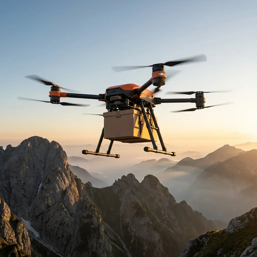
- The FlyCart 30 handles high-altitude venue capture missions up to 6,000 meters ASL with its dual-battery architecture and intelligent route optimization.
- Its payload ratio of up to 30 kg makes it the only delivery-class drone capable of carrying full survey-grade sensor packages to remote alpine venues.
- Built-in emergency parachute and BVLOS capability let operators execute missions safely in thin air, unpredictable weather, and rugged terrain.
- This tutorial walks you through every step—from pre-flight payload configuration to final data export—so you can replicate these results on your next high-altitude project.
Why High-Altitude Venue Capture Is So Difficult
Mapping and surveying venues above 3,000 meters breaks most commercial drone workflows. The air is thinner, which reduces rotor efficiency by as much as 25–30%. Winds are unpredictable. Temperatures swing between extremes within a single flight window. And the venues themselves—mountain amphitheaters, alpine sports complexes, remote festival grounds—are often inaccessible by road, meaning you can't simply drive up and launch a lightweight mapping quad.
I learned this the hard way during a venue capture mission at 4,200 meters in the Tibetan Plateau last year. Our standard survey drone couldn't carry the LiDAR payload and maintain stable hover in 15 km/h gusts. We needed a platform built for heavy lift at altitude. That's when we brought in the FlyCart 30.
This guide breaks down the exact workflow my team uses to capture high-altitude venue data with the FC30, including hardware setup, route optimization, safety protocols, and post-processing. Whether you're surveying a ski resort, mapping a mountain event space, or documenting a remote cultural heritage site, this tutorial will get you airborne and productive.
Step 1: Understanding the FlyCart 30's High-Altitude Capabilities
Before planning your mission, you need to understand what makes the FC30 uniquely suited for this work.
Payload Ratio and Sensor Flexibility
The FlyCart 30 supports a maximum payload of 30 kg in dual-battery mode, giving it one of the highest payload ratios in the commercial heavy-lift category. At high altitude, effective payload drops due to reduced air density—but even at 5,000 meters ASL, the FC30 retains enough lift margin to carry:
- Full-frame photogrammetry cameras (approximately 2–3 kg)
- Survey-grade LiDAR units (approximately 4–8 kg)
- Multispectral sensor arrays for environmental assessment
- Combination payloads exceeding 12 kg for comprehensive data capture
Dual-Battery Architecture
The FC30's dual-battery system isn't just about extended flight time—it's a redundancy layer. At altitude, battery chemistry performs differently. Cold temperatures reduce discharge rates, and thin air forces motors to draw more current. The dual-battery configuration provides:
- Redundant power if one pack underperforms
- Extended operational range of up to 16 km in single-trip mode
- Hot-swappable logistics for multi-sortie venue capture
Emergency Parachute System
Operating BVLOS at high altitude over rugged terrain demands a failsafe. The FC30's integrated emergency parachute deploys automatically if the flight controller detects critical failure—motor loss, IMU malfunction, or total power disruption. This is not optional equipment for high-altitude work; it's a mission-critical safety layer that protects both the drone and people on the ground.
Expert Insight: At altitudes above 4,000 meters, I always configure the parachute deployment altitude 200 meters higher than the standard setting. Thinner air means the chute takes longer to fully inflate and decelerate the aircraft. Adjust your parameters accordingly in DJI Pilot 2 before every high-altitude mission.
Step 2: Pre-Mission Route Optimization
Poor route planning at altitude doesn't just waste battery—it can end your mission entirely. Here's how to build a robust flight plan.
Terrain Analysis
Before you touch the route planner, study the venue's topography using satellite imagery and DEM data. Identify:
- Elevation changes across the venue footprint
- Wind channels created by ridgelines or valleys
- Magnetic anomaly zones near iron-rich geological formations
- Obstacles like cables, towers, or tree lines at the venue perimeter
Building the Route in DJI Pilot 2
The FC30 supports fully autonomous waypoint missions, which is essential for BVLOS venue capture. Here's my standard configuration:
- Set home point altitude accurately using a calibrated GPS altimeter, not just the drone's barometric reading.
- Plan overlapping grid lines with at least 75% forward overlap and 65% side overlap for photogrammetry.
- Assign altitude AGL (above ground level), not ASL, so the drone maintains consistent sensor distance over uneven terrain.
- Insert hover waypoints at venue corners for oblique photography.
- Program a return-to-home corridor that avoids the steepest terrain gradients.
BVLOS Considerations
Flying beyond visual line of sight at high altitude introduces regulatory and operational complexity. Ensure you have:
- Appropriate BVLOS authorization from your national aviation authority
- A visual observer network or approved detect-and-avoid system
- Real-time telemetry link via the FC30's O3 transmission system, which maintains signal at distances exceeding 15 km in open terrain
- A contingency landing zone pre-surveyed and marked within the mission area
Step 3: Payload Configuration and Mounting
Getting the sensor package right is half the battle. The FC30's cargo bay accepts custom mounting brackets, but at altitude, weight distribution becomes critical.
Balancing the Payload
An off-center payload at sea level might cause a minor trim adjustment. At 4,500 meters, that same imbalance forces motors to compensate aggressively, draining batteries 15–20% faster. Always:
- Center the sensor payload within 2 cm of the drone's center of gravity
- Secure all cables and connectors against vibration and wind buffeting
- Test hover stability at a low altitude before committing to the full mission profile
Recommended Sensor Packages by Mission Type
| Mission Type | Primary Sensor | Weight | Recommended Altitude AGL | FC30 Mode |
|---|---|---|---|---|
| Photogrammetric Survey | Full-frame 61 MP camera | 2.5 kg | 80–120 m | Dual-battery |
| LiDAR Terrain Mapping | Integrated LiDAR + IMU | 6.2 kg | 50–100 m | Dual-battery |
| Multispectral Analysis | 5-band multispectral array | 3.1 kg | 60–90 m | Dual-battery |
| Combined Survey (LiDAR + Photo) | LiDAR + mirrorless camera | 9.8 kg | 70–100 m | Dual-battery |
| Heavy Equipment Delivery to Venue | Winch-deployed cargo | Up to 30 kg | Variable | Dual-battery |
Using the Winch System for Equipment Delivery
Here's where the FC30 truly differentiates itself. Before the mapping mission even begins, you may need to deliver ground control points (GCPs), reference targets, or equipment to the venue. The FC30's winch system allows precision lowering of cargo to locations where landing is impossible—cliff edges, rooftops of mountain structures, or unstable snow-covered surfaces.
The winch lowers payloads on a cable with centimeter-level positioning, and the operator can monitor descent via the live camera feed. For our Tibetan Plateau project, we used the winch to place 14 GCP targets across a venue that would have taken a ground team two full days to reach on foot.
Pro Tip: When deploying GCPs via the winch system, attach a small bright-orange stabilizer fin to each target. At high altitude, even light wind can spin a dangling target during lowering. The fin prevents rotation and ensures the target lands flat and visible for your aerial survey.
Step 4: Executing the High-Altitude Mission
With your route loaded and payload mounted, it's time to fly.
Pre-Launch Checklist
- Battery temperature: Ensure both packs are above 15°C before launch. Use insulated battery warmers if ambient temperature is below freezing.
- Propeller inspection: Check for micro-cracks. Cold and UV exposure at altitude degrade prop material faster.
- Compass calibration: Perform on-site calibration. Magnetic declination varies significantly at altitude and latitude.
- Emergency parachute armed: Verify green status on the controller.
- Airspace confirmation: Re-check NOTAMs and any temporary flight restrictions.
In-Flight Monitoring
During the autonomous mission, keep eyes on three key telemetry values:
- Battery voltage differential between the two packs—anything beyond 0.5V difference warrants a closer look.
- Motor current draw—expect 20–30% higher than sea-level baselines.
- Wind speed at drone altitude—the FC30 handles sustained winds up to 12 m/s, but gusts at altitude are sharper and less predictable.
The Himalayan Monal Encounter
During our third sortie over the Tibetan venue, the FC30's forward obstacle sensors detected a moving object at 87 meters ahead—directly in the planned flight path. The aircraft autonomously paused, and the live feed revealed a Himalayan Monal pheasant perched on a rock outcrop, its iridescent plumage flashing in the thin sunlight. The FC30's obstacle avoidance system held position for 12 seconds until the bird took flight, then seamlessly resumed the waypoint mission without operator intervention. No data gaps. No manual overrides. The onboard intelligence handled a completely unpredictable wildlife encounter at 4,200 meters without missing a single survey frame.
This is the kind of reliability you need when operating BVLOS in environments you can't fully predict.
Step 5: Post-Mission Data Processing
After landing, transfer your data immediately. At altitude, condensation can form on storage media as the drone cools. Remove SD cards and SSDs promptly and store them in sealed dry bags.
For photogrammetric data, process with software that supports high-altitude atmospheric correction—light scatters differently above 3,000 meters, and uncorrected imagery produces elevation errors of up to 0.8 meters in dense point clouds.
Common Mistakes to Avoid
- Launching with cold batteries: This is the number-one cause of mid-mission voltage sags at altitude. Always pre-warm to at least 15°C.
- Ignoring payload balance: A 3 cm offset at 4,500 meters costs you approximately 18% flight time. Measure twice.
- Using sea-level flight time estimates: Your 28-minute sea-level endurance may drop to 18–20 minutes at altitude. Plan conservatively.
- Skipping compass calibration: Magnetic fields shift dramatically in mountain environments. Calibrate at the launch site every single time.
- Flying without the emergency parachute armed: There is no acceptable reason to disable this system during high-altitude operations over rugged terrain.
- Neglecting BVLOS telemetry checks: Verify your O3 link quality before the drone flies beyond visual range. A lost link at altitude over mountains is a recovery nightmare.
Frequently Asked Questions
What is the maximum operating altitude of the FlyCart 30?
The FC30 is rated for operations up to 6,000 meters above sea level. Effective payload capacity decreases with altitude due to reduced air density, but the aircraft maintains stable flight characteristics and full autonomous capability throughout this range.
Can the FlyCart 30 operate in sub-zero temperatures at altitude?
Yes. The FC30 is designed for operations in temperatures as low as -20°C. The dual-battery system includes self-heating technology that maintains optimal cell temperature during flight. Pre-warming batteries before launch is still strongly recommended for peak performance.
How does the winch system perform at high altitude?
The winch system operates independently of altitude-sensitive aerodynamic factors—it's an electromechanical system that performs consistently whether you're at sea level or 5,000 meters. The key consideration is that the drone must maintain stable hover while the winch deploys, which requires more power at altitude. Factor this into your battery budget by allocating an additional 8–10% reserve for winch operations above 3,500 meters.
Ready for your own FlyCart 30? Contact our team for expert consultation.