FlyCart 30 Coastal Deliveries in Dusty Conditions
FlyCart 30 Coastal Deliveries in Dusty Conditions: How to Keep Images Clear and Missions Reliable
META: A practical FlyCart 30 tutorial for coastal and dusty delivery operations, covering image haze, payload stability, route planning, winch use, BVLOS awareness, and field-ready visibility checks.
When teams talk about FlyCart 30 performance on coastal routes, most of the conversation goes straight to payload, range, batteries, and drop accuracy. Those are the obvious variables. The less glamorous issue is visibility—specifically, why onboard images and inspection shots can come back looking flat, gray, and slightly dirty even when the aircraft itself flew the route correctly.
That matters more than many operators admit. In a dusty shoreline environment, poor image clarity is not just an aesthetic problem. It affects landing zone confirmation, obstacle awareness, sling-load monitoring, and post-mission documentation. If your photos or video frames look like they are covered by a thin veil, the root cause is often environmental, optical, and operational at the same time.
A recent photography-focused report from 2026-03-23 highlighted a familiar problem: images taken in haze, overcast weather, rain, or through glass often look dull and lacking in transparency. It also broke “transparency” in an image into three practical elements: vivid color, clear spatial layering, and sharp subject outlines. That framework translates surprisingly well to FlyCart 30 field work, especially for operators delivering along coastlines where dust, salt, humidity, and low-contrast skies can all stack against the camera.
This is not a generic camera lesson. It is a mission tutorial for FlyCart 30 crews who need cleaner visuals and better operational decisions in dirty air.
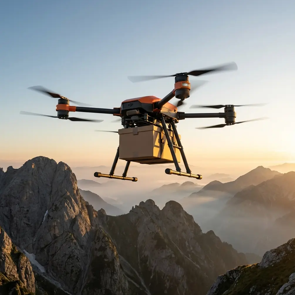
Why this matters on FlyCart 30 missions
FlyCart 30 is built for real transport work, not for cinematic photography. Still, every delivery crew depends on visual information. Before release, during descent, and after drop-off, the aircraft’s camera feed helps answer basic but mission-critical questions:
- Is the route corridor still usable?
- Has dust reduced contrast enough to hide wires, poles, or terrain edges?
- Is the winch drop zone actually clear?
- Did the package settle correctly after lowering?
- Is the coastline wind kicking up enough debris to justify a route change?
When the image turns gray and muddy, those answers become slower and less reliable. The photography article’s three-part definition of image transparency is useful here because each part maps to a flight task.
Vivid color helps separate ground markers, clothing, warning paint, and landing tarps from the background. Clear spatial layering helps the pilot or logistics lead judge distance between foreground obstacles and the drop site. Sharp outlines help identify wires, railings, roof edges, and suspended payload position. Lose those three qualities, and the mission becomes more fatiguing even if the aircraft remains technically within limits.
Why coastal dust creates that “fogged” look
The source article specifically points to bad weather, haze, rain, and shooting through windows as common reasons images look gray and uninspiring. In a coastal delivery setting, FlyCart 30 crews face a similar cocktail:
- Fine dust from service roads and staging areas
- Sea salt suspended in humid air
- Flat cloud cover that reduces scene contrast
- Moisture on protective surfaces
- Occasional viewing through vehicle glass during setup or checks
This is why operators sometimes say the image looks “washed” even when the camera is functioning normally. The atmosphere is scattering light. Edges soften. Blacks lift toward gray. Distance compresses. A rooftop target that should stand out starts blending into the shoreline.
For FlyCart 30, this has a direct operational effect on route optimization. If visual confirmation becomes unreliable on the planned corridor, the shortest route may no longer be the safest route. A slightly longer path over cleaner air or away from dust plumes can produce more stable decision-making during the delivery segment.
The three-part field test for image clarity
The photography report described three ingredients of a transparent-looking image: color, depth separation, and crisp contours. I use the same three-part test before approving a FlyCart 30 coastal run.
1. Check color separation
If markers, cones, vests, tarp edges, or package labels all look muted, the camera is already telling you the atmosphere is eating contrast. This is often the first sign that airborne dust or moisture is stronger than it appears from ground level.
Operational significance: weak color separation makes it harder to confirm the exact release point, especially if the site uses simple visual markers rather than active beacons.
2. Check spatial layering
Look at foreground, midground, and background objects in the feed. Can you immediately distinguish the near edge of a roof from the shoreline behind it? Can you tell whether brush sits before or behind the intended lowering zone?
Operational significance: poor layering hurts depth judgment. That is especially relevant when using the FlyCart 30 winch system, because the payload may appear closer to the ground than it really is—or the opposite.
3. Check edge definition
Poles, wires, fence tops, railings, and package outlines should appear clean. If lines look soft and smeared, the air or lens condition is reducing your ability to detect fine hazards.
Operational significance: edge loss increases the chance of missing small but dangerous obstructions during low-altitude cargo placement.
That three-part evaluation takes less than a minute and is far more useful than asking whether the image “looks good.”
A practical FlyCart 30 workflow for dusty coastlines
As a logistics lead, I do not treat image quality as a camera department issue. I build it into the delivery workflow.
Step 1: Inspect the optical path before power-up
The source article mentions shooting through glass as one cause of a gray, lifeless result. In the field, operators recreate the same problem by checking the camera through dusty vehicle windows, protective covers, or contaminated lens surfaces. Do not trust a quick glance from inside the truck.
Walk out. Inspect the lens area directly. If the aircraft has been staged near a dirt road or surf zone, assume contamination until proven otherwise.
A small third-party accessory has made a noticeable difference for some teams: a high-quality anti-static lens cleaning kit with sealed wipes and a blower. It sounds trivial. It is not. Dust that barely registers to the naked eye can flatten contrast enough to complicate a drop. Accessories that keep the optical surface clean can improve usable situational awareness without changing the aircraft itself.
Step 2: Read the air, not just the forecast
You may be cleared to fly and still be operating in poor visual texture. Overcast skies and suspended dust can degrade image transparency long before conditions look severe.
Before launch, point the camera toward a scene with layered detail—nearby railing, mid-distance structure, and far horizon. If all three collapse into similar gray tones, prepare to change route or altitude.
This is where BVLOS planning deserves discipline. Beyond visual line of sight work already depends on robust procedures. If the environmental conditions are reducing image clarity, route assumptions that looked fine on paper may need to be revised for greater separation from shoreline spray or vehicle dust corridors.
Step 3: Reassess payload ratio against the route
Dusty coastal air often comes with gusts. Gusts kick up particles. Heavier payloads can still be within spec, but they may force a route or descent profile that spends longer in the dirtiest layer of air.
Payload ratio is not only about lift capacity. It affects how aggressively you can adjust route geometry, how quickly you can clear a turbulent shoreline band, and how precisely you can position for a controlled winch drop. If the mission feed is already losing color and edge definition, a conservative payload ratio can buy back control margin.
Step 4: Use the winch system deliberately
On coastline deliveries, the winch system is one of the FlyCart 30’s strongest operational advantages. It lets the aircraft stay above unstable ground conditions and avoid direct touchdown in dust or debris. But the value of the winch depends on what you can actually see.
If the feed appears flat or muddy, do not rush the lowering sequence. Pause and verify references. Watch the payload outline against the ground. If the package edges are hard to distinguish, you are operating with less margin than the telemetry alone suggests.
This is one reason I prefer standardized ground mats or high-contrast target panels at recurring sites. They restore some of the visual separation that haze and dust take away.
Step 5: Let battery strategy support visibility strategy
Dual-battery systems are usually discussed in terms of endurance and redundancy. That is fair, but they also support smarter decision-making in dirty environments. Extra energy margin can allow a reroute around a dusty bluff, a hold to wait for a vehicle plume to clear, or a second approach rather than forcing the first one.
The same logic applies to emergency systems. An emergency parachute is not a substitute for judgment, but in demanding cargo corridors it is part of the risk envelope that supports conservative operational choices. Teams fly better when they are not mentally cornered.
What image haze really does to delivery quality
The original report described poor images as gray, stuffy, and visually dirty. That description sounds subjective until you see how it affects a logistics operation.
A hazy feed tends to produce three forms of degradation:
- Slower interpretation
- Higher cognitive load
- Less confidence in release decisions
That combination increases mission friction. The aircraft may still complete the task, but the crew burns more attention doing it. Over time, that leads to inconsistency. Some drops become too cautious. Others become too fast. Neither is ideal.
For FlyCart 30 operators handling shoreline deliveries, the goal is not “beautiful footage.” The goal is clear enough visual information to support repeatable cargo placement and route discipline.
Route optimization when the air is visually dirty
A lot of route optimization models chase efficiency in distance and time. In coastal dust, I recommend adding a simpler question: where does the camera see best?
That can shift the preferred corridor in surprising ways. A route that avoids a road shoulder, quarry edge, or exposed beach crossing may yield cleaner air even if it adds distance. When the image retains stronger color separation, clearer depth, and sharper outlines, the pilot and payload operator can work faster and with fewer corrections.
That matters especially on recurring medical, maintenance, or remote camp deliveries. Once you identify a corridor with better visual quality, it often becomes the operationally superior route even if it is not the shortest one.
If your team is refining those procedures, it can help to compare notes with operators who run similar environments; I often recommend using a direct operations chat for fast field coordination instead of waiting for a full debrief cycle.
Simple habits that improve FlyCart 30 mission visuals
These habits are not glamorous, but they work:
- Stage away from active dust sources whenever possible.
- Avoid doing image checks through vehicle glass.
- Clean optical surfaces before every coastal launch, not only when they look dirty.
- Use fixed visual references at drop zones.
- Build route alternatives for low-contrast days.
- Leave enough battery margin to reject a poor first approach.
- Reevaluate payload ratio when gusts and suspended dust rise together.
Each one supports the same objective: preserving enough scene transparency to make the onboard image operationally useful.
The bigger lesson from a small photography article
The most valuable insight from the source material is not the complaint about hazy photos. It is the definition of what a clear image actually is. The article reduces “transparency” to three visible traits: stronger color, clearer spatial hierarchy, and sharper outlines. That is a practical checklist for FlyCart 30 crews.
In dusty coastal delivery work, those three traits tell you whether your camera feed is helping the mission or quietly undermining it. They also remind operators that visual quality is environmental intelligence, not vanity.
A FlyCart 30 can be equipped for serious logistics with careful route planning, disciplined BVLOS procedures, winch-based delivery techniques, and conservative battery management. But if the team ignores how dust, haze, rain, humidity, or contaminated surfaces flatten the image, they are leaving performance on the table.
Better visuals do not just make the record cleaner. They make the mission easier to interpret, easier to repeat, and easier to scale.
Ready for your own FlyCart 30? Contact our team for expert consultation.