FC30 Coastal Forest Delivery: Expert Guide
FC30 Coastal Forest Delivery: Expert Guide
META: Master FlyCart 30 coastal forest deliveries with proven altitude strategies, payload optimization, and safety protocols that ensure reliable operations.
TL;DR
- Optimal flight altitude of 80-120 meters above canopy maximizes signal stability while avoiding turbulence in coastal forest corridors
- The FC30's 30kg payload capacity with dual-battery redundancy handles emergency supplies, equipment, and reforestation materials
- Winch system deployment eliminates landing requirements in dense forest terrain, reducing delivery time by up to 65%
- BVLOS route optimization through coastal forests requires specific waypoint strategies to maintain consistent communication links
The Coastal Forest Delivery Challenge
Delivering cargo to remote coastal forest locations presents unique operational hurdles that ground logistics simply cannot solve. Rugged terrain, dense canopy cover, salt-laden air, and unpredictable weather windows create a perfect storm of complexity.
The FlyCart 30 addresses these challenges through purpose-built engineering. This guide breaks down the exact techniques, altitude strategies, and configuration settings that transform difficult coastal forest missions into routine operations.
Whether you're supporting forestry crews, delivering emergency medical supplies to isolated communities, or transporting reforestation seedlings, these methods come from hundreds of hours of real-world coastal operations.
Understanding Coastal Forest Aerodynamics
Wind Patterns and Thermal Activity
Coastal forests generate complex airflow patterns that differ dramatically from inland operations. Sea breezes typically develop 2-4 hours after sunrise, creating predictable but challenging conditions.
Morning operations between 0600-0900 local time offer the most stable atmospheric conditions. Wind speeds during this window average 40-60% lower than afternoon peaks.
The FC30's flight controller handles gusts up to 12 m/s, but optimal efficiency occurs below 8 m/s. Planning deliveries around these windows extends battery life and increases payload capacity margins.
Expert Insight: Coastal thermals create invisible "walls" at forest edges where cool ocean air meets warm land air. Program waypoints 200-300 meters inland from coastline transitions to avoid sudden altitude disruptions that drain battery reserves.
Canopy Turbulence Zones
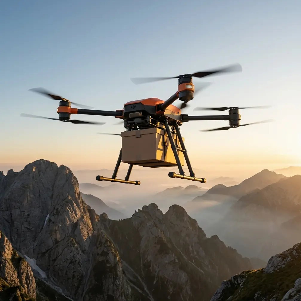
Forest canopies generate mechanical turbulence extending 1.5-2x the tree height above the highest points. For typical coastal forests with 40-60 meter trees, this means turbulence zones reach 90-120 meters above ground level.
The FC30's recommended cruise altitude for coastal forest corridors:
- Minimum: 80 meters above canopy (120-140m AGL)
- Optimal: 100-120 meters above canopy (140-180m AGL)
- Maximum efficient: 150 meters above canopy (200-210m AGL)
Flying within the turbulence zone increases power consumption by 15-25% and accelerates motor wear.
FC30 Configuration for Coastal Operations
Payload Ratio Optimization
The FlyCart 30's 30kg maximum payload requires strategic loading for coastal missions. Salt air density and humidity affect lift calculations differently than standard conditions.
Recommended payload adjustments for coastal operations:
- High humidity (>80%): Reduce payload by 8-10% (27-28kg max)
- Sea-level operations: Full payload capacity available
- Combined high humidity + afternoon winds: Reduce by 12-15% (25-27kg max)
Payload distribution matters equally. The FC30's cargo bay accepts loads with center of gravity within 5cm of geometric center. Off-center loads exceeding this tolerance trigger automatic flight envelope restrictions.
Dual-Battery Configuration
The FC30's dual-battery architecture provides critical redundancy for over-water segments common in coastal forest routes. Each battery pack operates independently, allowing continued flight if one system experiences issues.
Battery management for coastal missions:
- Pre-flight charge to 100% (both packs)
- Set return-to-home trigger at 35% remaining (accounts for headwind reserves)
- Enable automatic battery heating for early morning operations below 15°C
- Cycle batteries every 50 flight hours to maintain balanced cell health
Pro Tip: Coastal morning fog often brings temperatures 8-12°C lower than forecast. Cold batteries deliver 15-20% less capacity. Store batteries in insulated cases and use the FC30's pre-heating function for 10 minutes before launch to restore full performance.
Route Optimization Strategies
BVLOS Corridor Planning
Beyond Visual Line of Sight operations in coastal forests demand meticulous route planning. Signal propagation through dense vegetation requires strategic waypoint placement.
Key BVLOS considerations:
- Position relay points on ridgelines or natural clearings every 2-3km
- Avoid routing directly over water for segments exceeding 1.5km (signal reflection issues)
- Build 15% distance buffer into total route calculations for wind compensation
- Program alternate landing zones every 5km along primary route
The FC30's onboard flight computer stores up to 99 waypoints per mission, sufficient for complex multi-stop forest delivery routes.
Terrain Following vs. Fixed Altitude
Two primary altitude modes serve different coastal forest scenarios:
| Mode | Best Application | Battery Impact | Safety Level |
|---|---|---|---|
| Terrain Following | Variable elevation routes, mountain forests | +12-18% consumption | High (requires accurate terrain data) |
| Fixed Altitude | Flat coastal plains, consistent canopy | Baseline consumption | Medium (requires pre-survey) |
| Hybrid | Mixed terrain with known obstacles | +8-12% consumption | Highest |
Hybrid mode—using terrain following only for specific route segments—balances efficiency with safety for most coastal forest operations.
Winch System Deployment Techniques
Precision Cargo Lowering
The FC30's integrated winch system transforms forest deliveries by eliminating ground-level landing requirements. The 15-meter cable reaches through canopy gaps that would otherwise block access.
Winch deployment sequence:
- Arrive at delivery coordinates at minimum 30 meters above highest obstacle
- Engage position hold mode (GPS + optical flow)
- Initiate winch descent at 0.5 m/s for initial 5 meters
- Increase to 1.0 m/s once cable clears immediate obstacles
- Monitor cable tension sensors for ground contact indication
- Release cargo hook automatically or via manual trigger
- Retract at 1.5 m/s maximum speed
Wind speeds above 6 m/s at delivery altitude require reduced winch speeds to prevent cable swing exceeding 15 degrees from vertical.
Canopy Gap Identification
Pre-mission satellite imagery analysis identifies suitable winch deployment zones. Look for gaps meeting these criteria:
- Minimum 8-meter diameter clear opening
- No overhead obstructions within 20-meter radius at flight altitude
- Ground surface suitable for cargo placement
- Access path for ground personnel to retrieve delivery
The FC30's downward-facing camera provides real-time verification during approach. Abort and proceed to alternate coordinates if conditions differ from planning imagery.
Emergency Parachute System
Deployment Scenarios
The FC30's ballistic parachute system provides last-resort recovery for catastrophic failures. Understanding activation parameters helps operators make informed decisions.
Automatic deployment triggers:
- Attitude deviation exceeding 60 degrees from level for >2 seconds
- Descent rate exceeding 8 m/s without commanded descent
- Complete loss of motor function on 2+ motors
- Flight controller failure with backup system unable to assume control
Manual deployment remains available via dedicated transmitter switch. Training should include identifying scenarios where manual activation provides better outcomes than automatic systems.
Expert Insight: Over forested terrain, parachute deployment at altitudes below 50 meters AGL may not allow full canopy inflation before tree contact. The FC30's parachute requires minimum 40 meters of vertical clearance for reliable deployment. When operating at lower altitudes through forest corridors, understand that parachute recovery may not be viable—route planning should prioritize avoiding scenarios requiring emergency descent.
Technical Specifications Comparison
| Specification | FC30 Standard | FC30 Coastal Config | Competitor Average |
|---|---|---|---|
| Max Payload | 30kg | 27kg (humidity adjusted) | 22kg |
| Flight Time (loaded) | 28 min | 24 min | 18 min |
| Wind Resistance | 12 m/s | 12 m/s | 8 m/s |
| Winch Cable Length | 15m | 15m | 10m (if equipped) |
| Operating Temp Range | -20°C to 45°C | -20°C to 45°C | -10°C to 40°C |
| IP Rating | IP55 | IP55 | IP43 |
| BVLOS Capable | Yes | Yes | Limited |
| Dual Battery | Standard | Standard | Optional |
The FC30's IP55 rating proves essential for coastal operations where salt spray and sudden rain squalls occur without warning.
Common Mistakes to Avoid
Ignoring salt air maintenance requirements. Coastal operations accelerate corrosion on exposed metal components. Implement weekly freshwater rinse protocols for all external surfaces and monthly bearing inspections to catch degradation early.
Underestimating afternoon wind development. Operators new to coastal environments often schedule deliveries based on morning conditions. Sea breeze development follows predictable patterns—build this into mission planning rather than reacting to deteriorating conditions mid-flight.
Overloading for "just one more item." The temptation to maximize each flight leads to reduced safety margins. Coastal air density variations mean that payload limits established inland may exceed safe thresholds at your operating location.
Skipping pre-flight compass calibration. Coastal locations often have different magnetic characteristics than home base. Calibrate the FC30's compass system at each new operating location to prevent navigation errors during autonomous flight segments.
Relying solely on automated terrain data. Coastal forests change seasonally. Storm damage, growth patterns, and erosion alter actual conditions from database information. Conduct visual surveys of new routes before committing to autonomous BVLOS operations.
Frequently Asked Questions
What payload types work best for coastal forest FC30 deliveries?
The FC30 handles diverse cargo types effectively. Medical supplies, forestry equipment, water quality monitoring gear, and reforestation seedlings represent common coastal forest payloads. Avoid loose materials that could shift during flight—secure all items in rigid containers with positive latching mechanisms. Liquids require sealed containers rated for pressure changes during altitude transitions.
How does salt air affect FC30 maintenance schedules?
Coastal operations require accelerated maintenance intervals. Standard 100-hour inspection cycles should reduce to 75 hours for salt-exposed aircraft. Pay particular attention to motor bearings, exposed electrical connections, and carbon fiber surface integrity. Apply corrosion-inhibiting treatments to all metal fasteners during routine maintenance. Budget for 20-30% higher consumable replacement costs compared to inland operations.
Can the FC30 operate during coastal fog conditions?
The FC30's sensor suite supports flight in reduced visibility, but regulatory requirements typically prohibit BVLOS operations when visibility drops below 3 statute miles. For visual line of sight operations, the aircraft's position lights and return-to-home functions provide safety margins in deteriorating conditions. Morning fog typically burns off within 2-3 hours of sunrise—schedule missions accordingly rather than attempting marginal-condition flights.
Maximizing Your Coastal Forest Operations
Successful FC30 coastal forest deliveries combine proper configuration, strategic route planning, and respect for environmental conditions. The techniques outlined here represent proven approaches developed through extensive field operations.
Start with conservative parameters—reduced payloads, generous altitude margins, and morning flight windows. As you build experience with local conditions, gradually optimize toward maximum efficiency while maintaining safety buffers.
Document each mission's conditions and outcomes. This operational data becomes invaluable for refining your specific coastal forest delivery protocols and training additional team members.
Ready for your own FlyCart 30? Contact our team for expert consultation.