FlyCart 30 Delivering Tips for Venues in Low Light
FlyCart 30 Delivering Tips for Venues in Low Light: What Mountain Weather Teaches Logistics Teams
META: Practical FlyCart 30 guidance for venue delivery in low light, with lessons drawn from cloud-heavy mountain conditions, route planning, payload control, winch operations, and safety systems.
Low-light delivery sounds manageable until the terrain starts playing tricks on depth perception.
I learned that the hard way while planning supply drops for venues tucked into elevated scenic sites, heritage compounds, and event spaces with uneven access roads. On paper, the mission profile looked simple: move small but time-sensitive loads from a staging area to a venue after sunset or during heavy overcast. In reality, low contrast, moisture, shifting wind, and visual clutter turn a short route into a precision job.
That is why a seemingly unrelated aerial scene from Kongtong Mountain in Pingliang, Gansu deserves attention from anyone evaluating the FlyCart 30. During the recent National Day holiday period, the area saw continuous rainfall. After the rain, the mountain developed dramatic flowing cloud and sea-of-cloud conditions. Peaks and old buildings appeared and disappeared in the mist. Beautiful for photography. Demanding for logistics.
Those details matter because they describe exactly the kind of visual environment that exposes whether a delivery platform is truly venue-ready in marginal light.
The real problem with venue delivery is not distance
Most venue operators first ask about range. Logistics teams usually ask something else: can the aircraft complete the route consistently when the destination is visually messy?
A venue near tree lines, stepped courtyards, temple-style roofs, ridgelines, or cliffside access roads creates a layered background. Add drizzle, post-rain fog, or cloud drift and the environment starts to resemble the Kongtong Mountain scene: mountains and architecture fading in and out, outlines softened, depth cues reduced.
In those conditions, a cargo drone is not being judged on brochure claims. It is being judged on whether it can:
- hold a stable route when visual references weaken
- manage payload behavior during descent
- place cargo accurately without forcing a risky touchdown
- preserve enough power margin for contingencies
- maintain safe operations if weather shifts faster than expected
That is the frame in which the FlyCart 30 becomes interesting.
Why the Kongtong Mountain weather pattern is operationally relevant
The reference image set from Kongtong Mountain is more than scenic content. It shows a post-rain environment where cloud layers and terrain interact dynamically. The fact pattern is specific: continuous rain during a major holiday window, followed by strong flowing cloud effects, with mountain ridges and ancient buildings partially obscured in mist.
For venue delivery teams, two operational signals stand out.
First, intermittent obscuration changes how routes should be built.
If buildings and ridgelines are only partially visible, a pilot cannot rely on casual line-of-sight interpretation of the environment. That pushes more value onto preplanned routes, terrain-aware path design, and disciplined altitude buffers. In practical FlyCart 30 operations, route optimization is not just about efficiency. It is about removing ambiguity when the landscape stops looking stable.
Second, architecture hidden in cloud is a clearance problem, not just a visibility problem.
Historic roofs, elevated eaves, decorative structures, towers, and tree canopies can sit inside the same visual layer in low light or mist. A cargo aircraft serving a venue in that setting benefits from delivery methods that reduce the need to commit to a full landing near obstacles. This is where the winch system becomes more than a convenience.
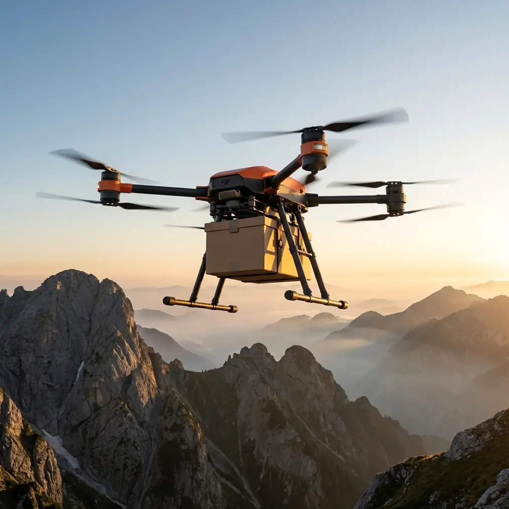
The FlyCart 30 advantage at venues: delivery without forcing the aircraft into the hardest space
For many venues, the ideal drop point is not the ideal landing point.
That distinction gets sharper after dusk or in low cloud. A courtyard may be accessible for lowering a package but too tight for a comfortable touchdown. A service lane may be clear enough for human pickup but bordered by trees, cables, roofing features, or guest infrastructure that create rotor-management headaches. In that scenario, the FlyCart 30’s winch system is one of the most practical tools in the platform.
A controlled suspended delivery lets the aircraft remain in a more favorable hover position while lowering cargo into the final receiving zone. Operationally, that reduces the pressure to “thread the needle” into cramped venue geometry. It also helps preserve cleaner separation from structures that can become hard to judge in low-light haze.
For venue teams, this changes the conversation from “Can the drone land there?” to “Can the drone service that point safely and repeatably?” That is a much better question.
Payload ratio is not just about carrying more
People often treat payload ratio as a simple measure of lifting capacity. In venue logistics, it is really about mission flexibility.
If your aircraft can carry a meaningful load relative to its size and energy profile, you gain options. You can consolidate runs. You can stage supplies smarter. You can avoid sending one aircraft out repeatedly in weather windows that are closing. And when low light compresses operating confidence, fewer sorties can mean lower cumulative exposure.
The FlyCart 30 discussion should therefore include payload planning discipline, not just payload headline numbers. For venues, the best operators separate loads into three buckets:
Critical small-volume cargo
Medical supplies, communication gear, event control hardware, batteries, or repair components.Time-sensitive operational cargo
Catering essentials, registration equipment, lighting accessories, radio packs, weather covers.Bulk items that should not be flown in marginal light
Nonurgent stock, decorative materials, and anything with awkward aerodynamic behavior.
This is where payload ratio matters in a grounded way. You want the aircraft doing the highest-value movement per sortie, especially when low light and moisture raise the cost of every unnecessary trip.
Dual-battery planning is a venue reliability issue
I would argue that dual-battery thinking is underappreciated in venue operations.
Low-light delivery tends to happen when schedules slip, weather shifts, or venues are busiest. The drone may need to hold longer, reroute around obstacles, or abort and retry after the receiving team loses visual on the drop zone. Those are not edge cases. They are normal friction points.
A dual-battery setup supports resilience in exactly these moments. Not because it invites aggressive flying, but because it gives the operation more breathing room for disciplined decision-making. The significance is operational, not theoretical: when cloud thickens over elevated terrain and the route starts demanding deviations, energy reserve becomes a planning tool.
That matters even more in post-rain environments like the one reported at Kongtong Mountain. Continuous rainfall followed by layered cloud usually means variable air density effects, moisture on surfaces, and localized wind behavior near ridges and structures. You do not want a power plan built around best-case assumptions.
BVLOS only works when the planning culture is mature
Venue operators are increasingly curious about BVLOS workflows, and with good reason. Some sites are separated from staging zones by terrain, tree cover, private access roads, or guest-heavy zones where ground transport is slow and disruptive.
But BVLOS is not a shortcut. It amplifies the importance of route discipline, airspace awareness, emergency logic, and communication with the receiving end.
The Kongtong Mountain conditions offer a useful thought model here. If mountains and heritage buildings can vanish into drifting cloud, then route design cannot depend on a human casually “keeping an eye on it” from one vantage point. The route has to stand on its own. That means:
- conservative corridor selection
- known alternates
- altitude choices with obstacle margins
- clear handoff procedures at the venue
- predefined abort triggers for visibility degradation
A FlyCart 30 operation built for venues should treat BVLOS as a systems question, not a checkbox.
The wildlife moment that changed our sensor assumptions
One evening route review still sticks with me.
We were serving a hillside event venue with mixed tree cover and a narrow service clearing. Light was fading fast after a damp afternoon. During the inbound leg, the aircraft’s sensor suite flagged movement near the planned descent corridor. It turned out to be a barn owl crossing low and unexpectedly from the tree line toward the open space above the receiving zone.
That matters because wildlife interactions in low light are often brief, silent, and hard for a ground team to call out in time. The aircraft did not “solve” the problem by magic. What it did do was give us enough environmental awareness to pause the descent, hold position, reassess the final path, and complete the drop without crowding the corridor the owl had just used.
This is the kind of event that gets ignored in generic drone articles, but it is exactly the sort of detail venue teams should think about. Sensors are not there only for structures. They are part of operating gracefully in spaces shared with birds, trees, cables, rooflines, and people.
Emergency parachute thinking belongs in venue SOPs
At venues, the issue is not only whether the aircraft is safe in the air. It is whether your risk posture remains acceptable over spaces where staff, contractors, or visitors may be nearby.
That is why the emergency parachute discussion should not be treated as a technical footnote. It is a core part of standard operating procedure design. If the mission runs over mixed terrain, partial guest-access zones, or complex building footprints, a last-resort controlled mitigation layer has direct operational significance.
The same atmospheric conditions described at Kongtong Mountain—rain, cloud, obscured structures—are precisely the kind that remind operators to define failure management before launch rather than during a problem.
Route optimization for low-light venue delivery
If I were setting up a FlyCart 30 playbook for venues, I would build route optimization around six practical checks.
1. Design for the weather after the weather
The Kongtong report highlights what happens after continuous rain: cloud flow, mist, and partial obscuration. Many teams plan for active rain but underestimate the complexity of the hour after it stops.
2. Avoid scenic lines
The most direct path near ridges, rooftops, or elevated architectural features is often the least forgiving path in low light.
3. Separate landing logic from delivery logic
If the venue can receive by winch, do not force a landing profile simply because it looks shorter on the map.
4. Preserve return margin
Dual-battery capacity should support conservative reserve policy, especially when the venue side may need extra time to secure the load zone.
5. Brief the receiving team like flight crew
A venue runner with a radio and a vague pin on a phone is not enough. Mark the exact handoff zone, fallback zone, and no-go perimeter.
6. Build a wildlife pause into final approach logic
Bird activity around trees, roof edges, and lit spaces increases at the times many venue deliveries happen. Your descent corridor needs a hold procedure.
A note for venue managers evaluating the platform
If you are looking at the FlyCart 30 for resort properties, mountain event sites, heritage destinations, golf facilities, amphitheaters, or remote hospitality spaces, do not let the discussion get trapped at headline lift specs.
Ask how the aircraft performs when the venue looks more like Kongtong Mountain after rain: cloud drifting through structures, terrain losing contrast, buildings half-hidden in mist, and the receiving point still needing service. That is the use case that reveals whether your operation is actually ready.
The strongest FlyCart 30 deployments are usually not the flashiest. They are the ones where payload ratio, winch delivery, BVLOS discipline, dual-battery planning, route optimization, sensor awareness, and emergency parachute procedures all support one simple outcome: cargo arrives without turning the venue into a flight test.
If you are mapping out that kind of workflow and want to compare operating setups with someone who thinks in logistics terms, you can start the conversation here: message our cargo drone team.
The lesson from Kongtong Mountain is straightforward. A landscape can be stunning and operationally unforgiving at the same time. Continuous rain, flowing cloud, and old buildings fading in and out of mist may read like a travel feature, but to a delivery planner they describe a test environment. And low-light venue logistics is full of test environments disguised as short flights.
The FlyCart 30 makes sense when it is used with that reality in mind.
Ready for your own FlyCart 30? Contact our team for expert consultation.