FlyCart 30 Field Report: What Suining’s New Fire Recon
FlyCart 30 Field Report: What Suining’s New Fire Recon Drones Reveal About Real-World Aerial Operations
META: A field-report style analysis of Suining’s newly deployed fire reconnaissance drones and what their under-10-minute response workflow means for FlyCart 30 operators filming dusty construction sites, planning BVLOS routes, and improving antenna placement.
Suining’s first publicly demonstrated “airborne reconnaissance drones” were not introduced as a gadget story. They appeared in a firefighting scenario. A dispatch command came in after smoke was spotted. The aircraft launched automatically from its rooftop dock, followed a preset route, built a 3D model, helped identify trapped people, and sent live video back to command. The entire sequence took less than 10 minutes.
That timeline matters.
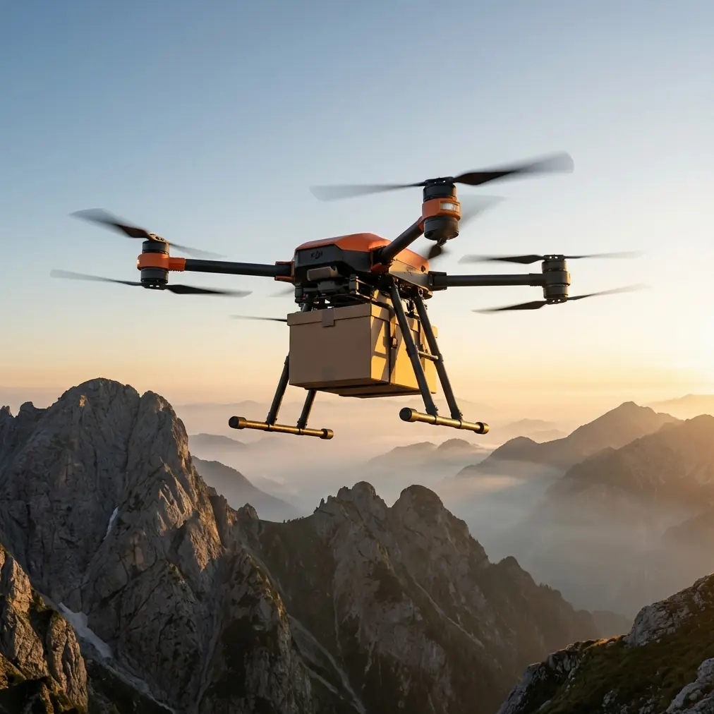
For anyone working with the FlyCart 30 around large, dusty construction sites, the significance is not just speed. It is workflow discipline. The Suining demonstration shows what happens when drone operations stop being ad hoc and start being systemized: aircraft on standby, a defined launch point, route logic prepared in advance, and a command chain that can act on incoming visual data immediately.
As someone who looks at UAV operations from the logistics side, I read this story less as a firefighting headline and more as a signal of where serious drone deployment is going. The aircraft itself gets attention, but the real advantage comes from the operating model around it. That is exactly the lens FlyCart 30 crews should use when planning construction-site filming or mixed cargo-and-visual missions in harsh ground conditions.
The Suining deployment is really a story about response architecture
The public facts are straightforward. On March 24, above the Suining Economic Development Zone fire rescue brigade compound, a fire reconnaissance drone received a mission and rose automatically. It flew along a preset route toward the target zone. During that sortie, it handled 3D modeling, target search, and real-time image transmission. According to the report, the end-to-end process took under 10 minutes and marked the local fire service’s entry into an “air-ground integrated” emergency response model.
There is another operational detail worth paying attention to: the drone sat inside an automated rooftop “smart landing pad.” The system opened on command, the aircraft launched, and it returned automatically after completing the mission. That means the deployment was not centered on a pilot standing in an open lot making one-off decisions. It was built around repeatability.
That same logic translates well to FlyCart 30 field use.
Construction sites, especially dusty ones, create the kind of friction that exposes weak planning. Visibility shifts fast. The ground team is busy. Temporary structures interfere with line of sight. Vehicles move unpredictably. Radio conditions can degrade when cranes, steel, and site offices crowd the work area. If your aerial workflow depends on improvisation every time the aircraft goes up, you lose time where time matters most.
Suining’s example points to a better model: define the launch area, define the route architecture, define how visual information returns to the decision-maker, and reduce the number of manual steps between alert and airborne execution.
Why this matters specifically for FlyCart 30 users
The reference story is about reconnaissance, not heavy lift. But FlyCart 30 operators should still pay attention because construction-site operations rarely stay in one box. A crew may start with imaging work, then pivot to transporting tools, sample materials, medical kits, survey devices, or emergency parts between separated points on site. In that kind of environment, the value of a transport platform is shaped by the same things that made the Suining deployment compelling: fast launch readiness, route reliability, and useful data return.
That is where terms like payload ratio and route optimization stop sounding theoretical.
A good payload ratio is only valuable if the route can be flown consistently in the actual RF and environmental conditions of the site. A capable winch system is only useful if the aircraft can hover stably over dusty or obstructed landing zones without creating unnecessary ground disturbance or forcing crews into dangerous pickup positions. BVLOS planning is only productive if communications remain stable and the command team understands where the antenna geometry starts working against them.
The Suining report gives us a useful benchmark for operational thinking. Under 10 minutes from launch to model generation, target lock, and image transmission is not simply “fast.” It means the workflow was engineered to compress dead time. That is the real lesson for FlyCart 30 deployment in construction filming environments.
Dust changes the mission more than many teams admit
Dust is often treated as a background annoyance. It should be treated as a primary planning variable.
On a construction site, dust affects image quality, landing confidence, maintenance intervals, and often the quality of human decisions made under pressure. If you are filming progress updates, facade installation, excavation zones, or structural lifts with a FlyCart 30 nearby as part of a broader UAV workflow, you need a clean separation between visual mission design and transport mission design.
The more mature approach is to designate aerial corridors and task windows. In practical terms, that means not flying your visual capture pass directly through the same disturbed air and particulate plume created by heavy machinery or a recent downwash-heavy operation. It also means using route optimization to avoid repeated transits over the dirtiest zones when the mission objective can be met from cleaner angles or higher standoff points.
The fire service example from Suining reinforces this idea. The aircraft did not wander into the task area. It flew a preset path toward a defined objective. That matters because route consistency improves more than timing. It improves the quality of the imagery coming back, which in turn improves the decisions based on that imagery.
If you are using FlyCart 30 in an environment where filming construction progress is part of a larger operational picture, the smartest move is to think like a command center, not like a hobby pilot.
Antenna positioning is the quiet factor behind maximum range
Most range discussions focus too heavily on aircraft specs and too lightly on field geometry.
If you want maximum practical range and cleaner control links on a dusty construction site, antenna position deserves a site walk before the first mission. This is one of those small habits that separates smooth operations from frustrating ones.
Here is the principle: place the control point where the antenna sees the route, not where the crew finds shade.
That sounds obvious until you see how often teams set up behind stacked materials, parked equipment, temporary site offices, or a berm that blocks the lower portion of the aircraft’s flight path. A few degrees of obstruction at the wrong point in the route can become the weak link in an otherwise well-planned mission.
For FlyCart 30 work, I recommend thinking in three layers:
First, elevate the antenna environment whenever possible. A slightly higher control position with a cleaner visual path to the aircraft usually beats a comfortable low point surrounded by equipment.
Second, orient the control setup toward the longest critical leg of the route, not toward takeoff. Many crews optimize for the first 30 seconds, then accept weaker link quality where it matters most: at the far edge of the jobsite or behind structural clutter.
Third, protect the Fresnel zone in practical terms. You do not need a textbook discussion on site. You need to know that cranes, rebar stacks, containers, concrete cores, and even dense moving machinery can make a “clear enough” link behave worse than expected.
Suining’s use of a rooftop smart pad is instructive here. Elevated launch infrastructure helps with more than convenience. It improves departure geometry and can reduce immediate signal obstruction near the home point. On a construction project, you may not have a permanent rooftop dock, but you can still borrow the principle by choosing a launch and control position with cleaner outbound line of sight.
If your team wants a second set of eyes on antenna layout and route planning, I usually suggest sending the site map and a few phone photos before deployment through this field planning chat.
“Air-ground integration” is not jargon when crews actually use it
One phrase in the Suining report deserves attention: “air-ground integrated” response. That expression can sound abstract until you break down what happened.
The aircraft launched after a smoke report. It followed a route already suited to the mission. It generated 3D situational data. It identified likely victims. It returned live visuals to a central command function. In other words, the drone was not flying for the sake of flying. It was inserted directly into a ground decision cycle.
Construction-site UAV teams should think the same way.
If the FlyCart 30 is supporting filming, transport, inspection, or internal logistics, every sortie should answer one operational question: What ground action becomes faster, safer, or more accurate because this aircraft flew?
Sometimes the answer is obvious. A part gets delivered to the upper structure without sending workers through a congested path. A survey payload reaches a remote corner of the site. A visual pass reveals an access issue before a crane move. Other times, the answer is weaker because the flight was never integrated into site decision-making in the first place.
The Suining model worked because dispatch, aircraft, route, and data return all belonged to one chain. That is the benchmark.
Safety planning should match the mission, not decorate it
When users talk about advanced UAV operations, safety features often get mentioned as a checklist item. That misses the point. On a site with dust, lifting activity, and partial visual obstruction, safety systems need to be matched to actual mission profiles.
For FlyCart 30 crews, that means thinking hard about emergency parachute logic, dual-battery condition discipline, and the thresholds that trigger an abort versus a reroute. It also means pre-briefing the team on winch-drop zones if the aircraft is being used in mixed logistics and filming support roles.
A dual-battery setup is not just redundancy on paper. It changes how conservatively you can plan returns when route lengths vary or hovering time expands because the ground team is delayed. An emergency parachute is not there to make operators feel modern. It becomes meaningful when the route crosses areas where a controlled emergency descent would materially reduce risk. And a winch system is not just about avoiding touchdown. On dusty sites, it can keep the aircraft out of unstable ground effect near loose material, improve delivery precision, and reduce contamination risk around the landing area.
These features matter most when the mission framework is already disciplined. The Suining deployment showed that discipline. Automatic launch, preset routing, live feedback, automatic return. Each of those choices reduces avoidable workload and leaves more bandwidth for actual decision-making.
The deeper signal from this news
There was another drone-related item in the reference set about a Chengdu-built hydrogen UAV linked to a 50 kg class aircraft and a 30-hour continuous flight record. That is a different category of platform, but it reinforces the same broader pattern: Chinese UAV development is pushing beyond isolated aircraft performance and into mission endurance, systems integration, and operational specialization.
Suining’s under-10-minute recon workflow sits on the shorter, tactical end of that spectrum. Long-endurance hydrogen systems sit on the strategic end. Between them is the everyday field reality where FlyCart 30 operators work: missions that are not experimental, not theatrical, and not forgiving of sloppy planning.
That is why this Suining story deserves attention from people who may never run a fire brigade mission. It shows how quickly UAV operations mature once they are built around process instead of spectacle.
What FlyCart 30 teams should take away this week
If I were briefing a site team after reading the Suining report, I would keep it simple.
Prebuild routes before the urgent call comes in. Choose control and antenna positions based on line of sight, not convenience. Separate dusty logistics corridors from visual capture corridors. Use the winch where the ground zone is poor. Treat dual-battery and emergency parachute planning as mission design inputs, not brochure features. And make sure live video or flight data lands with the person who can act on it immediately.
The headline detail from Suining was “less than 10 minutes.” The deeper lesson is that those 10 minutes were possible because dozens of smaller decisions had already been made correctly.
That is exactly how effective FlyCart 30 operations are built.
Ready for your own FlyCart 30? Contact our team for expert consultation.