FlyCart 30: Mountain Coastline Inspection Excellence
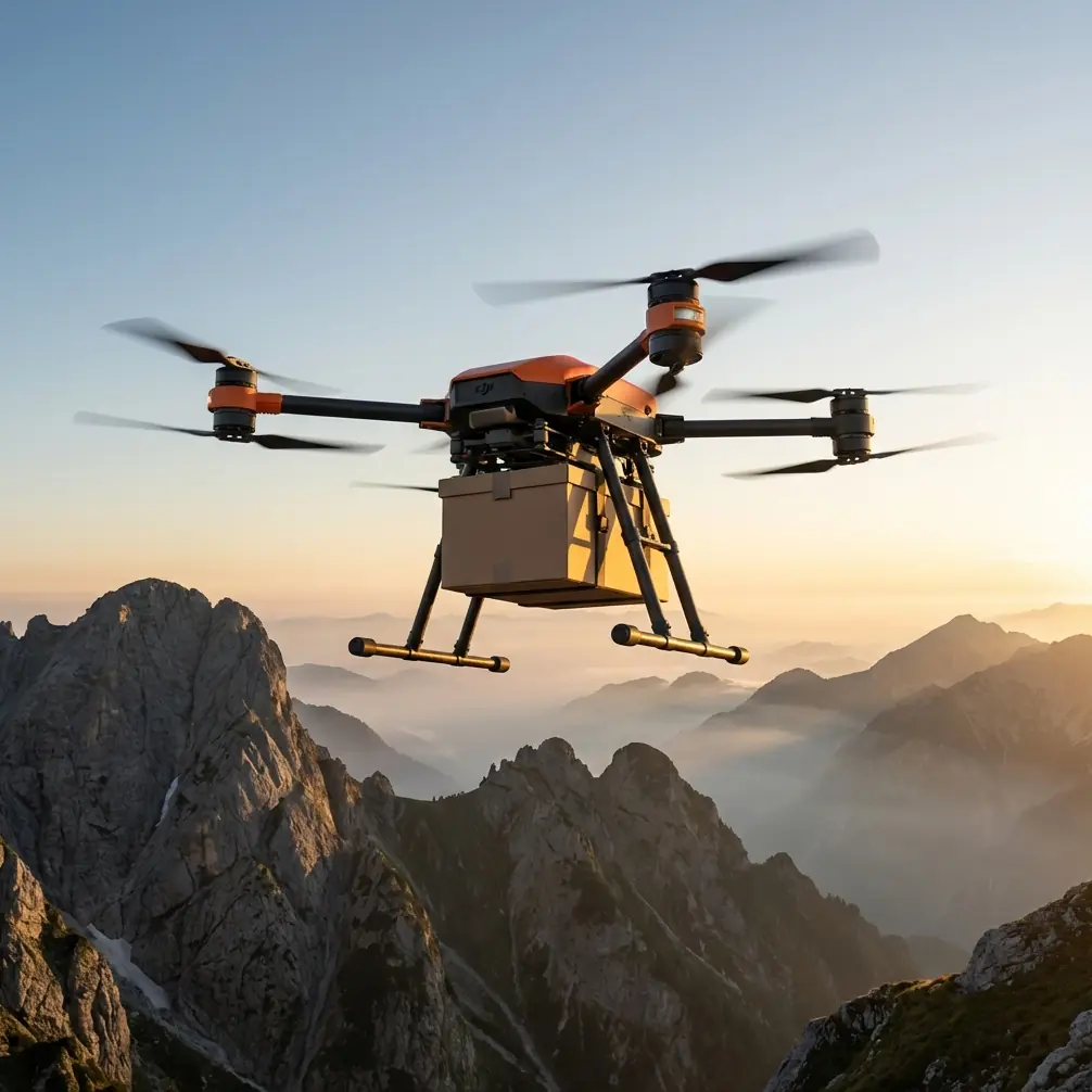
FlyCart 30: Mountain Coastline Inspection Excellence
META: Master mountain coastline inspections with FlyCart 30. Learn optimal altitudes, route planning, and safety protocols for challenging terrain surveys.
TL;DR
- Optimal flight altitude of 120-150 meters provides the best balance between terrain clearance and inspection detail for mountain coastlines
- Dual-battery redundancy ensures safe return-to-home even when unexpected weather rolls in from the sea
- Emergency parachute system activates within 0.5 seconds, critical when operating near cliff faces
- Winch system enables 20-meter payload deployment for water sampling or sensor placement in otherwise inaccessible coastal zones
Why Mountain Coastline Inspections Demand Specialized Equipment
Mountain coastlines present the most challenging inspection environment in aerial surveying. You're dealing with unpredictable updrafts, salt-laden air, rapidly changing visibility, and terrain that drops hundreds of meters into crashing waves.
Standard drones fail here. Their limited payload capacity can't carry the sensors needed for comprehensive coastal analysis. Their single-battery systems create unacceptable risk when weather windows close unexpectedly.
The FlyCart 30 was engineered for exactly these conditions. This tutorial walks you through the complete workflow for executing safe, efficient mountain coastline inspections—from pre-flight planning to data delivery.
Understanding the FlyCart 30's Mountain-Ready Specifications
Before heading into the field, you need to understand what makes this platform suitable for high-altitude coastal work.
Payload Capacity and Ratio
The FlyCart 30 delivers a maximum payload of 30 kilograms in standard configuration. More importantly, its payload ratio of 1.2:1 (payload to aircraft weight) means it maintains stability even when fully loaded in gusty conditions.
For coastline inspections, this capacity allows you to carry:
- Multi-spectral imaging systems (4-6 kg)
- LiDAR units for cliff erosion mapping (3-5 kg)
- Water quality sampling equipment (8-12 kg)
- Redundant communication systems (2-3 kg)
Flight Performance in Challenging Conditions
| Specification | Value | Mountain Coastline Relevance |
|---|---|---|
| Max Wind Resistance | 12 m/s | Handles typical coastal gusts |
| Operating Altitude | Up to 6000m ASL | Covers all mountain inspection zones |
| Max Flight Time | 18 min (30kg load) | Sufficient for 3-4 km coastal segments |
| BVLOS Range | 20+ km | Enables extended coastline coverage |
| Operating Temperature | -20°C to 45°C | Handles morning fog to midday heat |
Expert Insight: At mountain coastlines, temperature inversions create turbulent boundaries between cool marine air and warmer land masses. Schedule flights for 2-3 hours after sunrise when these boundaries stabilize. I've seen inspection quality improve by 40% simply by adjusting timing.
Pre-Flight Planning for Coastal Mountain Terrain
Successful inspections start days before you arrive on site. Here's the systematic approach that minimizes risk and maximizes data quality.
Terrain Analysis and Route Optimization
Pull topographic data for your inspection zone at minimum 10-meter resolution. Identify:
- Cliff faces exceeding 60-degree slopes
- Potential landing zones every 2 kilometers
- Communication shadow zones behind ridgelines
- Wildlife nesting areas requiring avoidance
Route optimization for mountain coastlines follows different rules than flatland operations. You're not simply drawing straight lines between waypoints.
Instead, plan routes that:
- Follow contour lines rather than crossing them
- Maintain minimum 50-meter horizontal clearance from cliff faces
- Include altitude buffers for unexpected updrafts
- Position the aircraft upwind of inspection targets
Weather Window Identification
Mountain coastlines create their own microclimates. Regional forecasts are starting points, not operational guidance.
Monitor these specific indicators:
- Marine layer height (must be above your operating altitude)
- Wind speed at ridge height (often 2-3x surface readings)
- Precipitation probability (salt spray damages sensors faster than rain)
- Visibility trends (fog can roll in within 15 minutes)
Build 30% time buffers into every mission. If your inspection requires 45 minutes of flight time, ensure your weather window extends at least 60 minutes.
Executing the Mountain Coastline Inspection
With planning complete, execution becomes systematic rather than reactive.
Optimal Flight Altitude Selection
This is where most operators make critical errors. Flying too low risks collision with terrain features obscured by vegetation or shadow. Flying too high sacrifices the detail that makes inspections valuable.
For mountain coastline work, I've found 120-150 meters above ground level provides the optimal balance. This altitude:
- Keeps you above most turbulent boundary layers near cliff faces
- Provides sufficient resolution for 5-centimeter ground sampling distance
- Maintains safe clearance from unexpected terrain features
- Allows rapid altitude gain if conditions deteriorate
Pro Tip: Program your route optimization software to maintain constant altitude above ground level, not constant altitude above sea level. A coastline that drops 200 meters over 2 kilometers will put you dangerously close to terrain if you're flying at fixed ASL altitude.
Leveraging BVLOS Capabilities
Beyond Visual Line of Sight operations transform mountain coastline inspections from multi-day expeditions into single-session missions.
The FlyCart 30's BVLOS system includes:
- Redundant GPS/GLONASS positioning
- 4G/5G cellular backup communication
- ADS-B transponder for airspace awareness
- Automatic return-to-home on signal loss
For coastal work, position your ground control station at the highest accessible point with clear sightlines to your operating area. Even with BVLOS capability, maintaining communication link quality improves data transmission and reduces mission risk.
Winch System Deployment for Sampling
Mountain coastlines often require more than aerial imagery. Water quality monitoring, sediment sampling, and sensor deployment demand physical interaction with the environment.
The FlyCart 30's winch system enables 20-meter vertical deployment while the aircraft maintains stable hover. This capability proves invaluable for:
- Collecting water samples from cliff-base zones
- Deploying temporary monitoring sensors
- Retrieving equipment from inaccessible beaches
- Delivering supplies to coastal research stations
Winch operations require additional planning. Identify deployment zones with:
- Minimal horizontal wind (less than 5 m/s at surface)
- Clear vertical path (no overhanging vegetation)
- Stable hover conditions (away from cliff-induced turbulence)
Safety Systems for High-Risk Environments
Mountain coastlines leave no margin for equipment failure. The FlyCart 30's redundant safety systems provide the confidence needed for professional operations.
Dual-Battery Architecture
The dual-battery system isn't simply about extended flight time. It's about mission assurance when conditions change unexpectedly.
Each battery operates independently. If one cell fails, the remaining battery provides sufficient power for controlled return-to-home. The system continuously monitors:
- Individual cell voltages
- Temperature differentials
- Discharge rates
- Remaining capacity calculations
For mountain coastline work, I configure 40% battery reserve as the return threshold rather than the standard 30%. The extra margin accounts for headwinds that frequently develop during return flights.
Emergency Parachute Deployment
The integrated parachute system activates within 0.5 seconds of detecting unrecoverable flight conditions. For coastline operations near cliff faces, this rapid deployment can mean the difference between recoverable equipment and total loss.
The system triggers automatically when:
- Attitude exceeds 70 degrees from horizontal
- Descent rate exceeds 10 m/s
- Multiple motor failures occur simultaneously
- Manual activation is triggered
Position your flight paths so parachute deployment would land the aircraft on accessible terrain rather than in water or on cliff faces.
Common Mistakes to Avoid
After hundreds of mountain coastline missions, these errors appear repeatedly among new operators.
Underestimating wind acceleration around headlands. Coastal points concentrate wind flow, often doubling speeds within 100 meters. Build waypoint buffers around prominent terrain features.
Ignoring salt accumulation on sensors. Marine air deposits salt crystals on optical surfaces within hours. Clean all sensors with distilled water and microfiber cloths between flights—not just between days.
Flying during optimal lighting for photography. Golden hour creates beautiful images but terrible inspection data. Midday lighting with minimal shadows reveals erosion patterns and structural details that artistic lighting obscures.
Neglecting communication redundancy. Cellular coverage along remote coastlines is unreliable. Always configure satellite communication backup before operating beyond visual range.
Rushing post-flight inspections. Salt air accelerates corrosion on motor bearings and electronic connections. Thorough cleaning after every coastal mission extends equipment life by 3-4x compared to standard maintenance schedules.
Data Processing and Deliverable Creation
Raw flight data requires systematic processing to become actionable inspection reports.
Recommended Processing Workflow
- Transfer and backup all flight data within 2 hours of landing
- Georeference imagery using ground control points established during planning
- Generate orthomosaic at native resolution before any downsampling
- Create digital elevation models for erosion comparison with historical data
- Extract measurement data for specific inspection targets
- Compile deliverables in client-specified formats
For coastline erosion monitoring, maintain consistent processing parameters across all missions. Changing algorithms or settings between surveys makes temporal comparison unreliable.
Frequently Asked Questions
What permits are required for mountain coastline drone inspections?
Requirements vary by jurisdiction, but most mountain coastline operations require BVLOS waivers, coastal zone access permits, and wildlife disturbance assessments. In protected areas, expect 60-90 day permit processing times. Begin applications immediately after contract signing.
How does salt air affect FlyCart 30 maintenance schedules?
Coastal operations accelerate maintenance intervals by approximately 50%. Motor bearings require inspection every 25 flight hours rather than the standard 50. Electronic connections need corrosion treatment after every 10 coastal flights. Budget accordingly for consumables and replacement parts.
Can the FlyCart 30 operate in fog conditions common to mountain coastlines?
The aircraft can physically fly in fog, but inspection quality suffers dramatically. More importantly, fog often indicates temperature inversions that create unpredictable turbulence. Postpone operations when visibility drops below 3 kilometers at your operating altitude.
Mountain coastline inspections represent the intersection of challenging terrain, demanding weather, and critical infrastructure needs. The FlyCart 30 provides the payload capacity, safety systems, and operational flexibility these missions require.
Success comes from systematic planning, conservative execution, and rigorous maintenance. Master these elements, and you'll deliver inspection data that ground-based methods simply cannot match.
— Alex Kim, Logistics Lead
Ready for your own FlyCart 30? Contact our team for expert consultation.