How We Adapted the FlyCart 30 for Urban Forest Inspection Wi
How We Adapted the FlyCart 30 for Urban Forest Inspection Without Guesswork
META: A practical case study on using FlyCart 30 for urban forest inspection, with camera-setting logic, payload planning, winch workflow, and operational lessons from the field.
When people talk about the FlyCart 30, the conversation usually drifts straight to transport. That misses part of the story.
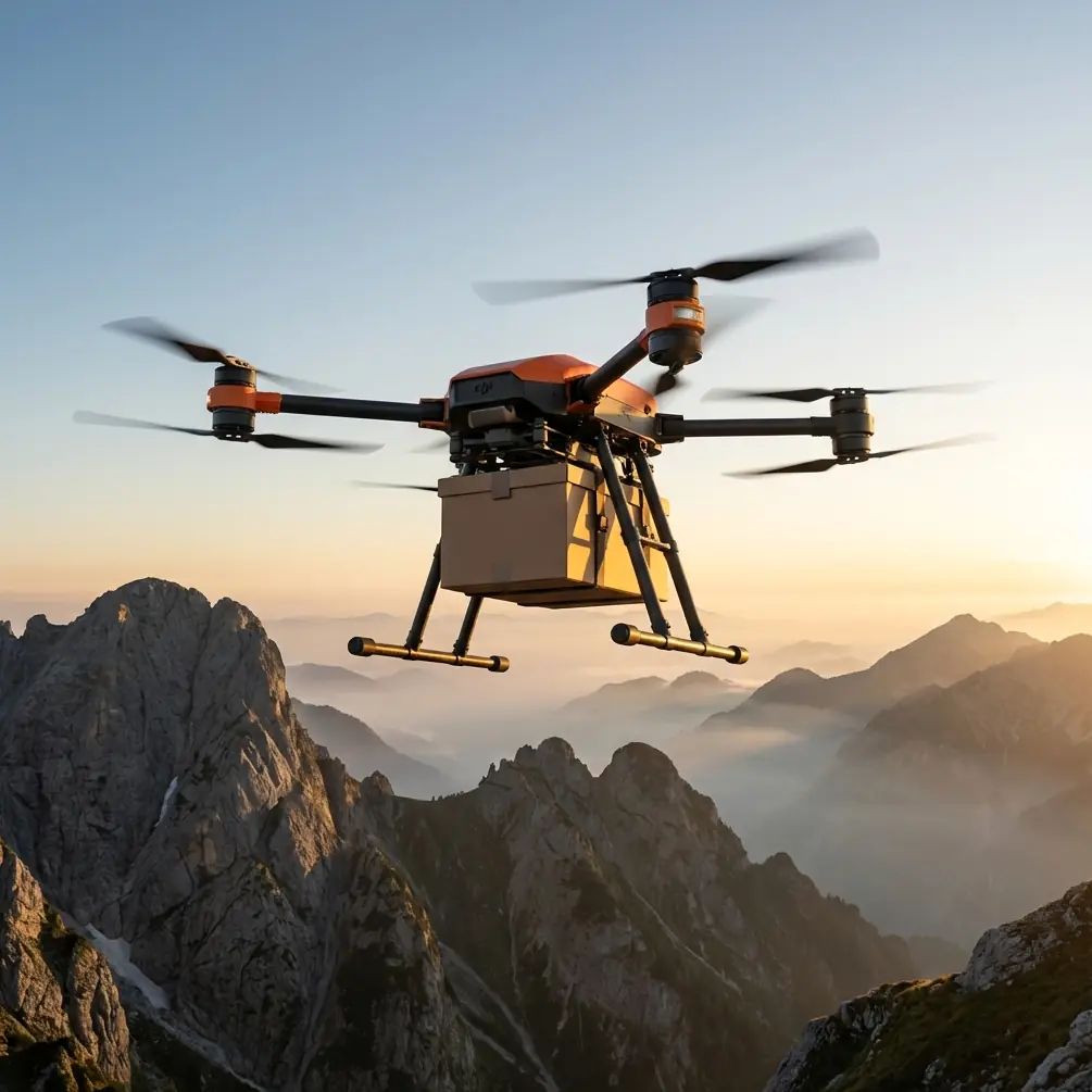
In our team’s case, the FC30 became useful in a different way: urban forest inspection. Not deep wilderness surveying and not routine parcel delivery. I mean the awkward edge zones where tree corridors run alongside roads, utility easements, park boundaries, retaining slopes, and low-density built-up areas. These jobs look simple on paper. They rarely are.
I’m Alex Kim, and on the logistics side, my concern was never just whether the aircraft could fly the route. The real question was whether the entire workflow could produce usable inspection imagery without wasting battery cycles, repeat sorties, and daylight. That pushed us into an unusual intersection of logistics planning and camera discipline.
The surprising breakthrough did not come from airframe specs alone. It came from applying a very basic photography principle in a structured way: stop guessing manual settings, and adjust them in the right order.
Why urban forest inspection is harder than it sounds
Urban forest work has a peculiar rhythm. You may launch in a clear opening, transit above mixed terrain, then inspect tree canopies shadowed by buildings, reflective glass, wet roads, or open lawn. Light changes fast. Wind channels between structures. Branch motion can ruin images that looked fine on the live view. The result is familiar to anyone who has reviewed inspection footage after landing: some frames are too bright, some too dark, and the most valuable ones are just soft enough to be annoying.
With a platform like the FlyCart 30, that problem matters more than people expect. This aircraft is built to carry capability. The payload ratio discussion is not academic when you are balancing sensor choices, mounting hardware, and mission endurance. Every additional tool on the aircraft needs to justify itself operationally. If your imaging process is inconsistent, the aircraft’s capacity is not helping you. It is just carrying inefficiency.
That was our turning point. We stopped treating image capture as a side task and started handling it with the same discipline we use for route optimization.
The camera lesson that changed our inspection success rate
A recent photography explainer made a point that sounds simple, but it maps perfectly to field inspection: manual mode becomes much easier when you set parameters in a specific order instead of randomly chasing exposure.
That idea matters in drone operations because random adjustments cost time. Hover time, orbit time, reposition time. If the pilot and payload operator are both guessing, the mission drags.
The two details that became especially useful for our FC30 inspection runs were these:
- Aperture controls incoming light, and a smaller F-number means a larger opening.
- Shutter speed changes both brightness and motion rendering: faster shutter speeds darken the image but freeze motion, while slower shutter speeds brighten the image and can create blur or stylized motion effects.
On a consumer photo walk, that is beginner advice. On an urban forest inspection mission, it becomes operational doctrine.
Aperture is not just about brightness
In our tree inspections, aperture affects more than exposure. A larger aperture gives a brighter image, yes, but it also increases background blur. The source article links that look to portrait photography, where the subject pops against a softened background. Nice effect, wrong priority for most inspection work.
When we inspect branch structure, canopy density near structures, or limb encroachment over pathways, we usually want more of the scene to remain legible. Context matters. A blurred background may look pleasing, but it can hide whether a suspect branch is close to a signpost, fence line, facade edge, or service corridor. That is why our payload team learned to treat shallow depth of field cautiously.
This single adjustment reduced one common failure mode: beautiful images that were poor inspection records.
Shutter speed determines whether the image is useful at all
The source reference also points out that faster shutter speeds can freeze moving subjects, while slower settings brighten the image and can create effects like silky waterfalls or car light trails.
That second effect has zero value in our work. Tree inspection is not landscape art.
Branches move. Leaves tremble. Small crown motion becomes much more obvious when viewed on a large screen after the mission. So the practical takeaway was immediate: when inspecting urban forest zones, especially near street wind channels or after weather shifts, shutter speed deserves priority because motion blur can destroy evidence quality even when exposure looks acceptable on the controller.
In other words, for our FC30 missions, a slightly darker frame is often recoverable. A blurred branch junction is not.
Building an FC30 workflow around that logic
The FlyCart 30 gave us enough operational flexibility to formalize the process. Its dual-battery architecture was a major part of that. Not because we wanted to stay airborne forever, but because stable mission planning depends on reserve confidence. Urban forest inspection often includes lateral repositioning, altitude changes, and extra passes over flagged trees. You need margin.
That margin let us standardize a three-step method for image capture:
Set the aperture first for scene intent
If the job requires structural clarity across a larger portion of the frame, we avoid relying on a wide-open look just to gain brightness. We decide what level of scene separation is acceptable before touching anything else.Set shutter speed based on branch movement
If the canopy is active, shutter speed moves up. The source material’s core point holds true in practice: faster shutter speeds darken the image, but they are better for freezing motion. For us, that trade is usually worth making.Then resolve exposure through the rest of the stack
Once the scene intent and motion control are set, the operator can fine-tune the remaining exposure variables instead of spiraling through guesswork.
This changed sortie efficiency more than expected. Our payload operator spent less time “fixing” images in the air, and our pilots flew cleaner inspection paths because they were not hovering aimlessly while camera settings drifted.
Where the winch system unexpectedly helped inspection work
Most people associate the FC30 winch system with delivery operations. We used it differently.
Certain urban forest sites do not give you a comfortable landing zone for swapping accessories, placing markers, or retrieving small field tools. The winch became useful for controlled lowering of lightweight third-party accessories into tight spaces where a ground team needed them without forcing a landing nearby.
The accessory that ended up making the biggest difference for us was a compact third-party visual reference panel kit used by the ground crew to improve repeatability in image comparison over multiple visits. It was not glamorous. Just practical. We could lower it into position near a target tree cluster, confirm placement, and then capture more consistent reference imagery from the air.
That kind of enhancement is easy to overlook when evaluating an aircraft only by headline payload numbers. But in real operations, the ability to support the inspection process around the flight can matter as much as the flight itself.
BVLOS thinking, even when the mission is local
I want to be careful here. Urban forest inspection is governed by local rules, site constraints, and airspace requirements. But from a planning standpoint, BVLOS-style discipline improved our VLOS work.
By that I mean we borrowed the mindset: define route segments clearly, identify communication checkpoints, establish contingency logic, and minimize unnecessary deviations. The FC30 is capable enough that sloppy planning becomes the main bottleneck.
We used route optimization principles to structure urban forest runs into short, deliberate sectors:
- transit corridor
- inspection hover zone
- secondary angle pass
- exit path
That sector logic paired well with the camera-order method. Once the operator knew the lighting pattern for a sector, settings became far more predictable. Less guessing. Fewer retakes. Better battery economy.
Safety systems matter more in mixed urban-green environments
The emergency parachute discussion often gets treated like a spec-sheet checkbox. In our world, it is part of risk posture.
Urban forest inspection sits in an awkward operational envelope. You are not always over dense canopy, and you are not always clear of pedestrian or built-up zones either. Any aircraft in that setting benefits from layered mitigation thinking. The FC30’s safety-oriented architecture, including emergency recovery provisions, matters because route design often has to account for roads, sidewalks, fences, and sporadic public presence at the edge of parkland.
That does not remove responsibility from the operator. It raises the standard. A capable aircraft should lead to more disciplined planning, not less.
What actually improved after these changes
The biggest improvement was not image aesthetics. It was decision quality.
Once we stopped guessing camera settings and started using a fixed adjustment sequence grounded in aperture and shutter behavior, our inspection outputs became more reliable. Teams reviewing the imagery could more confidently evaluate:
- branch movement zones near structures
- canopy gaps and asymmetry
- line-of-sight obstruction around access routes
- changes between previous and current site visits
That reliability had downstream value. Fewer repeat deployments. Better maintenance prioritization. Cleaner records for clients managing urban green assets across multiple sites.
The FC30’s role in this was broader than lift capacity. Yes, payload ratio still matters because every accessory, sensor, and mount affects endurance and handling. But the real lesson is that a powerful platform only pays off when the operational method is equally mature.
A field note for teams starting similar work
If you are using the FlyCart 30 for urban forest inspection, resist the urge to overcomplicate the first phase. Start with a repeatable image logic.
Remember the two practical rules drawn from the source material:
- a smaller F-number means a larger aperture and a brighter image, but also stronger background blur
- faster shutter speeds make the image darker while helping freeze movement; slower shutter speeds brighten the frame but can introduce motion effects
Those are not abstract photography tips. They directly affect whether your tree assessment images are credible.
If your team wants to compare accessory setups or talk through an FC30 inspection workflow, we’ve had useful peer exchanges through this field contact channel: message our operations desk
That kind of conversation is often more valuable than another generic feature rundown, because the right setup depends on how your sites behave in real light, real wind, and real access conditions.
The FlyCart 30 is better when treated like a system, not a drone
That is the main lesson from our project.
The FC30 helped because it combined carrying capability, mission flexibility, safety-oriented design, and workflow adaptability. The dual-battery setup supported reserve planning. The winch system expanded how we managed ground support tasks. Route optimization reduced wasted movements. A third-party accessory improved consistency. And a basic but disciplined manual camera method cut down on the one thing that quietly damages inspection value more than most teams admit: guesswork.
Urban forest inspection is full of subtle failure points. Light shifts under canopy edges. Wind changes between buildings. Subjects move just enough to ruin clarity. When operators understand what aperture is doing to scene separation and what shutter speed is doing to motion, the aircraft’s capability starts translating into actual field results.
That is where the FlyCart 30 becomes more than a transport platform. It becomes a serious aerial work system for inspection teams that care about evidence quality, repeatability, and mission efficiency.
Ready for your own FlyCart 30? Contact our team for expert consultation.