How I’d Use the FlyCart 30 for Solar Farm Inspection in Moun
How I’d Use the FlyCart 30 for Solar Farm Inspection in Mountain Terrain
META: A field-driven tutorial on using the DJI FlyCart 30 for mountain solar farm inspection, covering route planning, winch workflows, dual-battery endurance, payload ratio, and safety systems.
Mountain solar sites look clean on a map. In the field, they are a logistics problem disguised as an energy asset.
I learned that the hard way on a ridge installation where access roads turned into rock shelves, pickup trucks could only reach part of the array, and every forgotten tool translated into another uphill trip. The inspection itself was not the real bottleneck. Moving spares, meters, replacement sensors, and line gear between separated strings was what consumed the day. That is exactly where the FlyCart 30 changes the shape of the work.
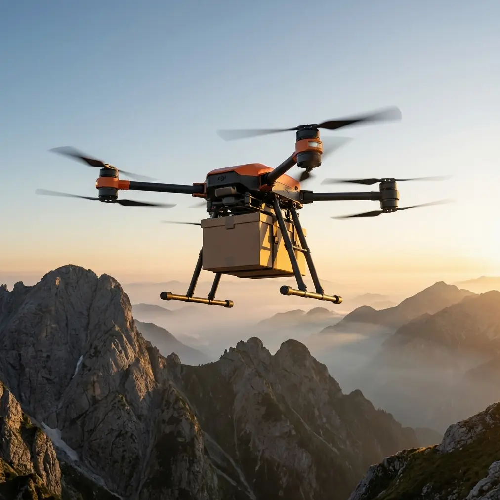
This is not a generic drone story. The FlyCart 30 is built around cargo movement, and for mountain solar inspection that matters more than people often admit. When your crews are checking combiner boxes, inverter pads, cable runs, and perimeter sections spread across elevation changes, transport friction quietly drives cost, fatigue, and inspection delays. A platform with a dedicated winch system, dual-battery architecture, and an emergency parachute does more than save walking time. It lets you design the inspection day differently.
Below is the workflow I would use if I were setting up FlyCart 30 support for a mountain solar farm inspection team.
Start with the real constraint: terrain, not flight time
At flat utility-scale sites, distance is usually the planning variable. In mountain projects, vertical separation and access quality matter just as much. One section may be only a few hundred meters away, yet functionally isolated because crews need to descend around drainage cuts or climb service paths that vehicles cannot safely use.
So the first step is not asking, “How far can the aircraft fly?” The better question is, “Which inspection tasks are being slowed down by terrain penalties?”
With the FlyCart 30, I’d map the site into three categories:
Vehicle-accessible zones
These are areas where the drone is optional. Trucks or UTVs can support routine checks efficiently.Walk-access-only zones
These become the primary FC30 support areas. Any repeated movement of tools, test equipment, spare fuses, connectors, or small replacement parts is a candidate for drone delivery.Vertical drop or steep-slope zones
This is where the winch system becomes operationally significant. Instead of landing on uneven or dusty ground near modules, you can lower equipment precisely to a technician or staging point.
That last point is easy to underestimate. On solar sites in mountain terrain, clean landings are not always practical. Panels, racking, cable trays, loose gravel, and narrow terraces create poor touchdown options. A winch-equipped cargo drone solves a different problem than a conventional aircraft. It reduces the need to find a landing surface at all.
Build the inspection around payload ratio, not maximum lift alone
People love quoting peak payload figures, but payload ratio is what actually determines whether a cargo flight helps or slows your operation.
For mountain solar inspection, the useful payload is rarely a single heavy object. More often it is a combination of medium-weight, high-need items: handheld testers, thermal inspection accessories, weatherproof tool kits, replacement communications hardware, grounding components, labeling supplies, and emergency maintenance parts. The question is not “Can the FC30 lift it?” The question is “Can it lift enough of the day’s likely demand in one movement to eliminate repeated crew travel?”
That is why I plan inspection loads as kits rather than one-off items. For example:
- A DC troubleshooting kit
- A communications repair kit
- An inverter pad diagnostic kit
- A weather response kit for exposed sections
- A small-string maintenance kit for repeated connector or fuse issues
This improves the payload ratio because each flight supports a full task cluster, not a single missing item. If a crew hikes to a remote array section and realizes it needs three additional tools and two replacement components, the old workflow creates three bad options: walk back, wait for a ground runner, or defer the work. The FC30 turns that into a single dispatch.
That is where cargo drones earn their place on inspection days. They do not replace inspection expertise. They remove the dead time around it.
Use the winch system to keep technicians moving
The FlyCart 30’s winch system is one of the most valuable features for mountain solar environments because it changes how handoffs happen in awkward terrain.
On a steep site, landing can be the slowest and riskiest part of the mission. Even when a terrace exists, rotor wash can kick up dust, grit, or loose material near exposed electrical equipment. Lowering gear from a stable hover can be cleaner and faster.
My preferred workflow would look like this:
- Launch from a known safe logistics point near a service road or field base.
- Fly to a pre-marked drop zone above the technician’s work area.
- Hold altitude clear of modules, racking, and slope-side obstacles.
- Lower the equipment by winch to a controlled pickup point.
- Recover the line and return or reposition.
Operationally, this matters for more than convenience. It reduces:
- landing-zone scouting time,
- contact risk on uneven ground,
- unnecessary technician movement across slopes,
- and delays near energized equipment areas.
For mountain inspections, the best drone delivery is often the one that never needs to touch down.
Dual-battery design matters more in the mountains than on paper
Battery architecture is one of those details people skim past until the site gets difficult.
On a mountain solar farm, wind exposure changes between ridges and valleys. Temperature can shift quickly. Climb segments are rarely symmetrical with return legs. If your drone support plan assumes ideal conditions, your inspection schedule starts slipping by midday.
This is why the FlyCart 30’s dual-battery setup deserves attention. From an operations standpoint, dual-battery systems support continuity and resilience. They help stabilize mission planning when environmental conditions are less forgiving than the map suggests.
For an inspection team, that translates into practical benefits:
- More reliable rotation planning between flights
- Fewer schedule disruptions when supporting remote crews
- Better confidence in route assignment across uneven elevation profiles
It also helps with staging discipline. Instead of treating the drone as a novelty asset that gets used only when everything aligns perfectly, you can build it into the normal support pattern for the day. That is the difference between occasional convenience and real operational integration.
Route optimization is where most teams leave efficiency on the table
If I were implementing FC30 support for mountain solar inspection, I would spend more time on route logic than on flight demonstrations.
The common mistake is dispatching the aircraft reactively: a crew calls, needs something, and the drone launches. That works, but it underuses the platform. A better model is pre-emptive route optimization.
Here is the tutorial version of that process:
1. Group inspection tasks by terrain penalty
Do not group by electrical category alone. A combiner-box check and a communications repeater check may belong in the same drone-support block if both sit on the same inaccessible terrace.
2. Pre-stage kits at the launch area
Every likely support package should be boxed, tagged, and ready before the first crew deployment.
3. Assign time windows, not just destinations
If Team A reaches the upper string corridor at 09:40 and Team B reaches the western inverter pad at 10:00, you can schedule cargo support in a sequence rather than improvising every handoff.
4. Use return legs intelligently
The outbound leg should not be your only planning focus. Return flights can recover faulty components, field samples, damaged sensors, or depleted equipment.
5. Protect a weather reserve
Mountain conditions punish tight margins. Keep a route buffer so the drone is supporting the mission, not forcing the mission to adapt to it.
This is where BVLOS becomes strategically relevant. On large or segmented solar sites, beyond visual line of sight operations can extend the usefulness of a logistics drone dramatically, especially when terrain blocks direct ground visibility between work zones. Of course, BVLOS depends on local regulation, approvals, and operating procedures. But from a site design perspective, the FC30 becomes much more powerful when route planning is based on the actual geography of the asset rather than line-of-sight convenience from a single launch point.
Safety systems are not a brochure detail on mountain sites
When you are flying over sloped ground, service paths, and technicians working near infrastructure, safety features stop being abstract.
The emergency parachute is one of those details that carries real operational weight. In mountain environments, an aircraft issue does not just mean a rough landing in an open field. It may mean a descent near racking, rocky inclines, drainage channels, or active work areas. Any built-in mitigation that improves the outcome of a critical failure deserves serious consideration.
For me, the significance is twofold:
- It supports safer deployment over areas where forced-landing options are limited.
- It improves risk planning when operations must support crews in otherwise awkward sections of the site.
That does not eliminate the need for disciplined SOPs. It reinforces them. Safety systems are most valuable when they are paired with route boundaries, exclusion zones, crew communication protocols, and conservative weather thresholds.
A realistic day-one workflow for mountain solar inspection
If you handed me a FlyCart 30 and asked how to use it well on a mountain solar site from day one, I would keep the first deployment narrow and measurable.
Phase 1: Support only remote technicians
Do not try to make the drone serve the entire property immediately. Focus on the crews who lose the most time to walking and terrain.
Phase 2: Limit cargo types
Start with inspection kits, small replacement parts, and recovery of removed components. Avoid overcomplicating the manifest.
Phase 3: Standardize handoff points
Choose repeatable hover-drop locations where the winch can be used safely and consistently.
Phase 4: Track field metrics
Measure technician waiting time, foot travel avoided, task completion speed, and number of deferred jobs prevented.
Phase 5: Expand only after proving the route plan
Once the route logic is stable, then extend to broader site support.
This is the part many operations teams skip. They focus on aircraft capability before they prove workflow value. On mountain solar projects, workflow value is everything.
The past challenge that convinced me
The turning point for me came after a long inspection day where a crew found an issue in a remote section late in the afternoon. Nothing exotic. They needed a replacement component and a specific test tool left at the lower staging area. The round trip on foot ate enough time that the repair slipped, daylight narrowed, and the team had to revisit the section the next day.
That was not a technical failure. It was a logistics failure.
A platform like the FlyCart 30 directly addresses that kind of loss. Not through hype, and not by pretending a cargo drone replaces field judgment. It fixes the gap between identifying work and physically supporting the team that needs to do it. If you want to compare workflow ideas for your own terrain, this is the most practical way to start the conversation: message our flight operations desk.
What the FlyCart 30 actually changes for solar inspection teams
For mountain solar inspection, the value proposition is simple but not shallow.
The FC30 helps crews stay where their expertise matters most. It shortens the distance between diagnosis and action. Its winch system is especially useful where landing zones are poor. The dual-battery setup supports steadier mission planning in uneven conditions. The emergency parachute improves the safety picture when the terrain offers few forgiving outcomes. And if your operation can support BVLOS procedures, route optimization becomes far more meaningful across broken topography.
That is why I would not frame the FlyCart 30 as just a delivery drone for solar work. On mountain sites, it is better understood as a field logistics tool that compresses response time across elevation and access barriers.
When that happens, inspection quality improves in a quiet way. Teams carry less, wait less, backtrack less, and postpone fewer tasks. The array gets more attention. The terrain gets less control over the day.
That is the real operational advantage.
Ready for your own FlyCart 30? Contact our team for expert consultation.