FlyCart 30 in Remote Venue Inspection: A Field Report
FlyCart 30 in Remote Venue Inspection: A Field Report on What the Camera Doesn’t Finish
META: A field report on using FlyCart 30 for remote venue inspection, with practical notes on battery management, route planning, winch use, BVLOS considerations, and why post-processing matters.
I’ve seen a recurring mistake in remote venue inspection work: teams judge the mission by what they see on the controller screen and assume the image pipeline ends there.
It doesn’t.
That sounds obvious to photographers, but in UAV operations it still gets missed. The camera output from a drone, even on a well-planned inspection flight, is not always the final deliverable. It is closer to a digital negative. The difference matters, especially when you are inspecting remote venues where decisions are being made from visual evidence: roof condition, access routes, staging areas, facade wear, structural attachments, drainage patterns, crowd-flow infrastructure, or temporary installation readiness.
The reference point here comes from a recent piece on image editing that made a blunt but accurate claim: many people fool themselves into thinking a camera’s straight-out-of-camera file needs no editing. The article argues that what the camera produces is not a finished photo, but a “digital negative,” holding original data with light, color, and contrast still unoptimized. In the same scene, with the same subject, the difference between the unprocessed file and a carefully refined final image can be dramatic.
For FlyCart 30 operators doing remote venue inspection, that principle is operational, not artistic.
Why this matters for FlyCart 30 specifically
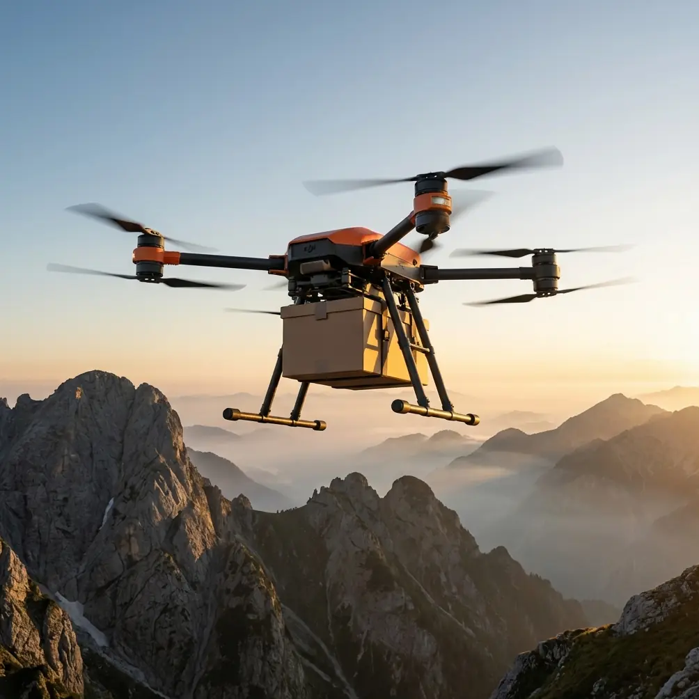
FlyCart 30 gets discussed mostly through its transport role: payload ratio, winch-based delivery, dual-battery architecture, route efficiency, and the broader promise of moving equipment into difficult terrain. All of that is relevant. But when you deploy the platform to inspect remote venues, the aircraft often becomes more than a transport tool. It becomes part of a logistics-and-visibility workflow.
That workflow has two outputs:
- Physical access support — moving sensors, lines, radios, first-aid kits, lightweight tools, or communications equipment into places crews cannot easily reach.
- Visual intelligence — collecting imagery that informs site readiness and task sequencing.
The second output is where teams often underperform. They fly a strong mission, then treat raw imagery as finished evidence.
That is the same misconception highlighted in the source material. A straight-out capture may faithfully record the moment, but still fail to present the information in the clearest way. The source text describes an original file with flat light, visible background clutter, chaotic clothing patterns, slightly dull skin tone, and no emotional focus. In inspection terms, the equivalent is familiar: glare on roof panels, weak local contrast on cracked concrete, cluttered background around anchoring points, washed midtones on retaining walls, and distracting terrain details that bury the actual issue.
A raw file can be technically honest and operationally incomplete at the same time.
Remote venue inspection is usually a visibility problem disguised as a flight problem
When a venue sits far from paved access, with uneven terrain or limited infrastructure, the instinct is to focus only on aircraft capability. Can the platform get there? Can it carry what we need? Can it winch equipment down safely? Can we maintain link quality? Can we do this under a BVLOS framework where applicable?
Those are real questions. But once the aircraft reaches the site, the next challenge is interpretation. If the image set is poorly exposed, low in contrast, or visually noisy, the inspection slows down. People start second-guessing what they see. Follow-up flights increase. Ground crews wait longer. Route optimization on the air side gets partially canceled by inefficiency on the data side.
That is why the “digital negative” concept from the source is so useful here. It gives operators a cleaner mental model: the flight collects source material; the deliverable is finished after review and processing.
This is not about stylizing infrastructure photos. It is about extracting operational clarity.
What I look for on a FlyCart 30 venue mission
My role leans logistics-first, so I tend to structure these missions around sequence rather than pure flight performance. On a remote venue inspection with FlyCart 30, I usually break it into four linked stages.
1. Access logic before launch
Before anyone touches the aircraft, I want the venue divided into decision zones: arrival corridor, equipment drop zone, elevated structures, service perimeter, and fallback landing or hover points. If the site is large, route optimization starts here, not in the air. There is no value in flying elegant lines over areas nobody needs reviewed.
If the aircraft is also supporting a winch operation, that division becomes even more important. The winch system is not just a convenience. It can remove the need for a landing in uncertain ground conditions. For remote venues with muddy edges, loose gravel, partial obstructions, or temporary event infrastructure, a controlled suspended drop can preserve safety margins and save setup time.
Operational significance: the winch system changes inspection geometry. You can inspect first, place gear second, and keep the aircraft out of unstable touchdown areas.
2. Battery planning that reflects the real mission, not the brochure mission
Here is the field tip I wish more teams followed.
On FlyCart 30, the dual-battery setup gives flexibility and resilience, but it can also tempt crews into thinking only in terms of maximum available endurance. That is the wrong mindset for remote inspection. I treat battery planning as a quality-control issue, not just a range issue.
My rule is simple: if the mission has both transport and imaging value, reserve your cleanest, most stable battery window for the image collection segment that matters most. Don’t burn through that segment after aggressive repositioning, repeated climbs, or unnecessary hover time over the wrong part of the venue.
Why? Because battery state influences pilot behavior. As reserves tighten, teams rush. They abbreviate angles. They accept flatter framing. They skip a confirming pass. Then they land with “usable” footage that still needs another trip.
A dual-battery architecture is operationally significant because it helps stabilize mission continuity, but only if you use it to protect inspection quality instead of merely stretching the clock.
My practical habit in the field: I mark the inspection-critical pass in the mission plan and mentally assign it a protected energy budget. If conditions deteriorate before that pass, I cut peripheral tasks. Don’t spend inspection clarity on nonessential maneuvering.
The image problem most crews don’t diagnose correctly
The source article says the unprocessed image may preserve all original data while still leaving light, color, and contrast in an unoptimized state. That is exactly the issue with venue inspection imagery in difficult environments.
Many crews think a weak image means the flight was bad. Often the flight was fine. The file just hasn’t been finished.
A remote venue can have all the classic visual problems at once:
- bright roofing next to shaded service alleys
- reflective metal truss work
- dusty or low-contrast surfaces
- irregular terrain that hides drainage lines
- visual clutter from cables, fencing, temporary materials, and vegetation
Straight capture records those elements faithfully, but it does not automatically rank them by importance. That is the job of post-processing and review.
If a source file is treated as a digital negative, you can recover separation between surfaces, improve shadow readability, rebalance contrast, and guide attention toward the inspection target. That shortens downstream decision-making. Engineers, site managers, and logistics coordinators stop debating the image and start discussing the site.
BVLOS and route discipline only help if your outputs are review-ready
BVLOS conversations tend to revolve around compliance, telemetry, communication reliability, and contingency handling. All necessary. But the hidden risk in long-range remote work is not always a lost link or weather shift. Sometimes it is a successful flight that returns with mediocre evidence.
That sounds less dramatic, but it creates operational drag. A return mission to confirm one overlooked roof seam or one obscured access point is expensive in time, coordination, and battery cycles.
So when planning a FlyCart 30 route for venue inspection, I prefer fewer high-value passes over excessive coverage. Route optimization is not just minimizing distance. It is maximizing decision-grade visibility per unit of battery and crew attention.
If you want a simple checkpoint, use this one: after each major segment, ask whether the current image set would let an off-site stakeholder make a confident call without asking for another angle. If the answer is no, fix it while the aircraft is still in position.
Emergency systems are part of inspection planning too
The emergency parachute feature tends to get mentioned in safety summaries and then mentally shelved. That’s a mistake on remote venue work.
Its significance is strategic. When you are assessing venues with uncertain terrain, sparse road access, and possibly no practical immediate recovery route, every contingency affects how aggressively you design the mission. Emergency systems don’t remove risk, but they help frame what kind of corridor and hover decisions are reasonable.
In practice, this means I’m more conservative around structures with narrow vertical margins and more deliberate in choosing observation positions that preserve optionality. The safest mission is not the one that merely reaches the venue. It is the one that leaves enough margin for a clear inspection pass, a stable reposition, and a controlled response if conditions change.
A remote venue case pattern I see often
Let’s say the assignment is to inspect an event venue outside the main road network: a hillside site, open-air performance area, or temporary sports setup. The first request sounds simple: “Need photos of condition and access.”
By the time you arrive, the actual need is more layered:
- Can support equipment be moved to a hard-to-reach section?
- Are the service paths usable?
- Is there standing water near temporary structures?
- Are roof or rigging attachment points visible enough for planners?
- Can teams avoid sending staff on foot into unstable areas?
This is where FlyCart 30 earns its place. The aircraft’s logistics profile supports the mission beyond observation alone, while the inspection side benefits from disciplined image handling. But if you skip the finishing process and pass along untouched captures, you’re giving stakeholders records, not insight.
That distinction mirrors the source article almost exactly. The source says a straight file may qualify as a documentary record but still fall short of a true finished work. Translate that into venue inspection language, and the lesson becomes: a raw aerial image may document the site, yet still fail to communicate what matters most.
My preferred review workflow after landing
I keep this tighter than most creative teams because inspection clients don’t want drama; they want clarity.
Sort by decision area, not by flight time.
Organize imagery into access, structure, perimeter, drainage, and placement-relevant categories.Correct light and contrast first.
The source article is right that unoptimized light and contrast can flatten a scene. In inspection, that flattening hides defects and depth.Reduce background distraction.
The source text points out how visual clutter can dominate an image. For venue work, cluttered backgrounds around ladders, roof edges, cables, or staging materials often mask the actual condition being reviewed.Create a final set for action.
Not everything belongs in the stakeholder packet. Include the frames that support planning decisions.
If your team is still building that workflow and wants a practical operations discussion, I usually suggest starting with mission design and output standards together rather than treating editing as an afterthought. A quick way to begin that conversation is through this field coordination channel.
The real takeaway from the source material
The source wasn’t about drones. It was about photography. But the core claim applies directly to FlyCart 30 inspection work in remote venues: the camera’s first output is not the endpoint.
That one idea reshapes how you use the aircraft.
It changes battery planning because you protect the best collection window for the most valuable passes.
It changes route optimization because you fly for interpretable evidence, not just area coverage.
It changes how you use the winch system because access support and image support become one coordinated workflow.
It changes review standards because you stop confusing raw documentation with finished inspection output.
On paper, these sound like small distinctions. In the field, they separate a mission that simply flew from one that actually reduced uncertainty.
And in remote venue inspection, reducing uncertainty is the job.
Ready for your own FlyCart 30? Contact our team for expert consultation.