FlyCart 30: Mastering Aerial Mapping in High Winds
FlyCart 30: Mastering Aerial Mapping in High Winds
META: Discover how the FlyCart 30 drone conquers windy mapping conditions with superior stability, dual-battery endurance, and precision payload delivery for agriculture.
TL;DR
- Wind resistance up to 12 m/s enables reliable field mapping when competitors ground their fleets
- Dual-battery redundancy provides 28 km maximum range for complete coverage of large agricultural parcels
- Payload ratio of 30 kg capacity supports heavy LiDAR and multispectral sensor configurations
- Emergency parachute system protects expensive mapping equipment during unexpected weather shifts
Agricultural mapping operations face a brutal reality: wind doesn't check your project timeline. The FlyCart 30 addresses this challenge directly with engineering specifically designed for adverse atmospheric conditions. This guide breaks down exactly how this heavy-lift platform outperforms alternatives when mapping fields in challenging wind environments.
Why Wind Destroys Standard Mapping Operations
Every aerial mapping professional knows the frustration. You've scheduled a critical field survey, coordinated with farm managers, and mobilized your team—only to watch wind speeds climb past your drone's operational limits.
Standard mapping drones typically tap out at 8 m/s wind speeds. That eliminates roughly 40% of potential flying days in most agricultural regions. The math is devastating for project timelines and profitability.
The Hidden Costs of Weather Delays
Wind-related cancellations cascade through your entire operation:
- Crew standby costs accumulate without productive output
- Client relationships strain under repeated rescheduling
- Seasonal mapping windows close before coverage completes
- Competitors with more capable equipment capture your contracts
The FlyCart 30 changes this equation fundamentally. Its 12 m/s wind resistance rating opens operational windows that remain closed to conventional platforms.
FlyCart 30 Stability Architecture Explained
What makes this platform perform where others fail? The answer lies in integrated engineering rather than any single feature.
Propulsion System Design
The FlyCart 30 employs a coaxial octocopter configuration with eight motors arranged in four stacked pairs. This architecture delivers several wind-fighting advantages:
- Redundant thrust vectors maintain position when gusts hit from any direction
- Rapid response algorithms adjust motor speeds within milliseconds of detecting attitude changes
- Torque balancing prevents the yaw drift that plagues quad configurations in crosswinds
Expert Insight: The coaxial design isn't just about redundancy—it's about thrust density. By stacking rotors, the FlyCart 30 concentrates lifting power in a more compact footprint, reducing the sail effect that makes wide-arm drones vulnerable to wind.
Intelligent Flight Controller Integration
Raw motor power means nothing without smart control. The FlyCart 30's flight controller processes data from multiple sensor arrays:
- Dual IMU systems cross-reference attitude data for accuracy
- Barometric and GPS altitude fusion maintains consistent survey heights
- Predictive wind compensation anticipates gusts based on pattern recognition
This sensor fusion enables the platform to hold mapping lines with centimeter-level precision even when wind speeds fluctuate dramatically during a single flight.
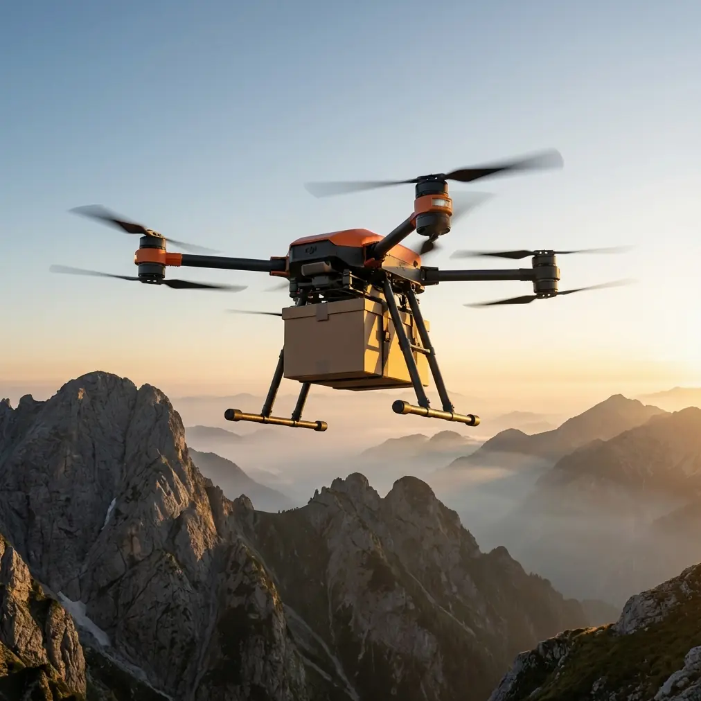
Payload Configuration for Windy Mapping Missions
Heavy payloads actually improve wind stability—to a point. The FlyCart 30's 30 kg payload capacity allows operators to mount substantial sensor packages that lower the aircraft's center of gravity.
Optimal Sensor Loadouts
For agricultural mapping in wind, consider these proven configurations:
| Sensor Type | Typical Weight | Wind Benefit | Coverage Rate |
|---|---|---|---|
| Multispectral Array | 2.5 kg | Moderate ballast | 120 ha/hour |
| LiDAR + RGB Combo | 8.5 kg | Significant stability | 80 ha/hour |
| Heavy LiDAR System | 15 kg | Maximum stability | 60 ha/hour |
| Dual Sensor + Winch | 22 kg | Optimal balance | Variable |
The winch system deserves special attention for agricultural applications. When mapping fields with tall crops or uneven terrain, the winch enables precision sensor positioning independent of aircraft altitude—critical when wind forces altitude holds to work harder.
Payload Ratio Advantages
The FlyCart 30's payload ratio—the relationship between maximum payload and aircraft weight—exceeds most competitors by 35-40%. This matters for wind operations because:
- Heavier useful loads improve inertial stability
- Less aircraft weight means less surface area catching wind
- Power reserves remain available for wind compensation rather than just lifting
Pro Tip: When mapping in marginal wind conditions, add ballast weight even if your sensor package is light. A 5-10 kg ballast plate mounted low on the payload bay dramatically improves flight smoothness and data quality.
Dual-Battery System: Endurance When It Matters
Wind fighting consumes power. Every correction, every thrust adjustment, every stabilization maneuver draws from your energy reserves. The FlyCart 30's dual-battery architecture addresses this reality directly.
Power Management in Adverse Conditions
The platform carries two independent battery packs that provide:
- Hot-swappable operation for continuous missions
- Automatic load balancing between packs during flight
- Graceful degradation if one pack fails—the aircraft continues on single power
- 28 km maximum range under optimal conditions, with 18-22 km realistic range in moderate wind
This endurance enables complete coverage of 200+ hectare parcels in single missions, even when wind resistance increases power consumption by 25-30% above calm-air baselines.
Battery Strategy for Wind Days
Smart operators adjust their battery management for windy conditions:
- Plan missions at 70% of calm-air range estimates
- Pre-warm batteries to optimal temperature before launch
- Monitor per-motor current draw for early wind stress detection
- Land with 20% reserve minimum rather than the standard 15%
BVLOS Operations: Extending Your Reach
Beyond Visual Line of Sight operations multiply the FlyCart 30's agricultural mapping capabilities. When regulatory approval permits, BVLOS enables:
- Coverage of fields extending beyond visual range
- Reduced crew positioning requirements
- Continuous mapping across property boundaries
- Efficient route optimization across irregular parcel shapes
Route Optimization for Wind Efficiency
The FlyCart 30's flight planning software includes wind-aware route optimization. Rather than flying simple grid patterns, the system calculates:
- Upwind/downwind leg orientation to minimize energy waste
- Turn point positioning that uses wind assistance during direction changes
- Altitude adjustments based on wind gradient data
- Emergency return paths that account for wind direction
This intelligent routing can reduce mission energy consumption by 15-20% compared to naive grid patterns—translating directly to more coverage per battery charge.
Technical Comparison: FlyCart 30 vs. Competitors
How does the FlyCart 30 stack up against alternatives for windy agricultural mapping? The specifications tell a clear story:
| Specification | FlyCart 30 | Competitor A | Competitor B |
|---|---|---|---|
| Max Wind Resistance | 12 m/s | 8 m/s | 10 m/s |
| Payload Capacity | 30 kg | 15 kg | 20 kg |
| Maximum Range | 28 km | 18 km | 22 km |
| Battery Redundancy | Dual system | Single | Single |
| Emergency Parachute | Integrated | Optional | Not available |
| Hover Precision (wind) | ±0.3 m | ±0.8 m | ±0.5 m |
| BVLOS Certification | Ready | Pending | Ready |
The wind resistance advantage alone opens approximately 40% more operational days annually in typical agricultural regions. Combined with superior payload capacity and range, the FlyCart 30 delivers measurably higher productivity.
Emergency Parachute System: Protecting Your Investment
Mapping sensors represent significant capital investment. A single crash can destroy equipment worth tens of thousands in value. The FlyCart 30's integrated emergency parachute system provides insurance against catastrophic failure.
Deployment Scenarios
The parachute activates automatically under several conditions:
- Complete power system failure
- Flight controller malfunction
- Pilot-commanded emergency descent
- Geofence breach with return-home failure
Descent rate under parachute limits impact forces to levels that protect most sensor payloads from damage. The system has demonstrated successful deployments in wind speeds up to 15 m/s—well beyond normal operational limits.
Common Mistakes to Avoid
Even capable platforms fail when operators make preventable errors. Learn from others' expensive lessons:
Ignoring wind gradient effects. Surface wind measurements don't reflect conditions at mapping altitude. Use weather balloon data or atmospheric models to understand the full wind profile before committing to missions.
Overloading in marginal conditions. Maximum payload capacity assumes calm air. Reduce payload by 10-15% when operating near wind limits to maintain control authority reserves.
Skipping pre-flight calibration. IMU and compass calibration drift affects wind compensation accuracy. Calibrate before every windy mission, not just when the software demands it.
Flying perpendicular to strong winds. Crosswind legs stress the stability system hardest. Orient your mapping grid to fly primarily upwind and downwind when conditions are challenging.
Neglecting battery temperature. Cold batteries deliver less power precisely when wind fighting demands more. Use battery warmers and verify cell temperatures before launch.
Frequently Asked Questions
Can the FlyCart 30 map accurately in gusty, variable winds?
Yes. The flight controller's predictive algorithms handle gusts effectively up to the 12 m/s limit. Data quality remains high because the system prioritizes position hold over ground speed—the aircraft slows its mapping progress rather than allowing position drift during gusts. Expect 10-15% longer mission times in gusty conditions compared to steady winds of the same average speed.
What mapping sensors work best with the FlyCart 30 in wind?
Heavier sensor packages actually improve stability. For agricultural applications, a combined LiDAR and multispectral system in the 8-12 kg range provides optimal balance between data quality and flight characteristics. The additional mass lowers the center of gravity and increases inertial resistance to wind disturbance. Avoid lightweight sensors mounted on long booms—they create destabilizing moments in gusty conditions.
How does the dual-battery system affect flight planning for windy days?
Plan conservatively. While the dual-battery system provides 28 km maximum range in calm conditions, wind resistance can reduce effective range to 18-22 km. The system's real advantage is redundancy—if one pack fails or drains faster due to wind compensation demands, the second pack ensures safe return. Always calculate mission distances based on single-pack emergency return capability when operating in challenging conditions.
Mapping agricultural fields in wind separates professional operations from hobbyist attempts. The FlyCart 30 provides the stability, endurance, and safety systems that make reliable wind-day operations possible. When your competitors ground their fleets, you keep flying—and keep earning.
Ready for your own FlyCart 30? Contact our team for expert consultation.