Forest Mapping Mastery with DJI FlyCart 30
Forest Mapping Mastery with DJI FlyCart 30
META: Learn expert forest mapping techniques with the FlyCart 30 drone. Discover optimal altitudes, payload strategies, and route planning for complex terrain surveys.
TL;DR
- Optimal mapping altitude of 120-150 meters balances canopy penetration with terrain safety in forested areas
- Dual-battery system enables 28-kilometer range, covering extensive forest plots in single missions
- Winch system deployment allows sensor placement beneath dense canopy without landing
- Emergency parachute integration provides critical safety margins when operating BVLOS in remote terrain
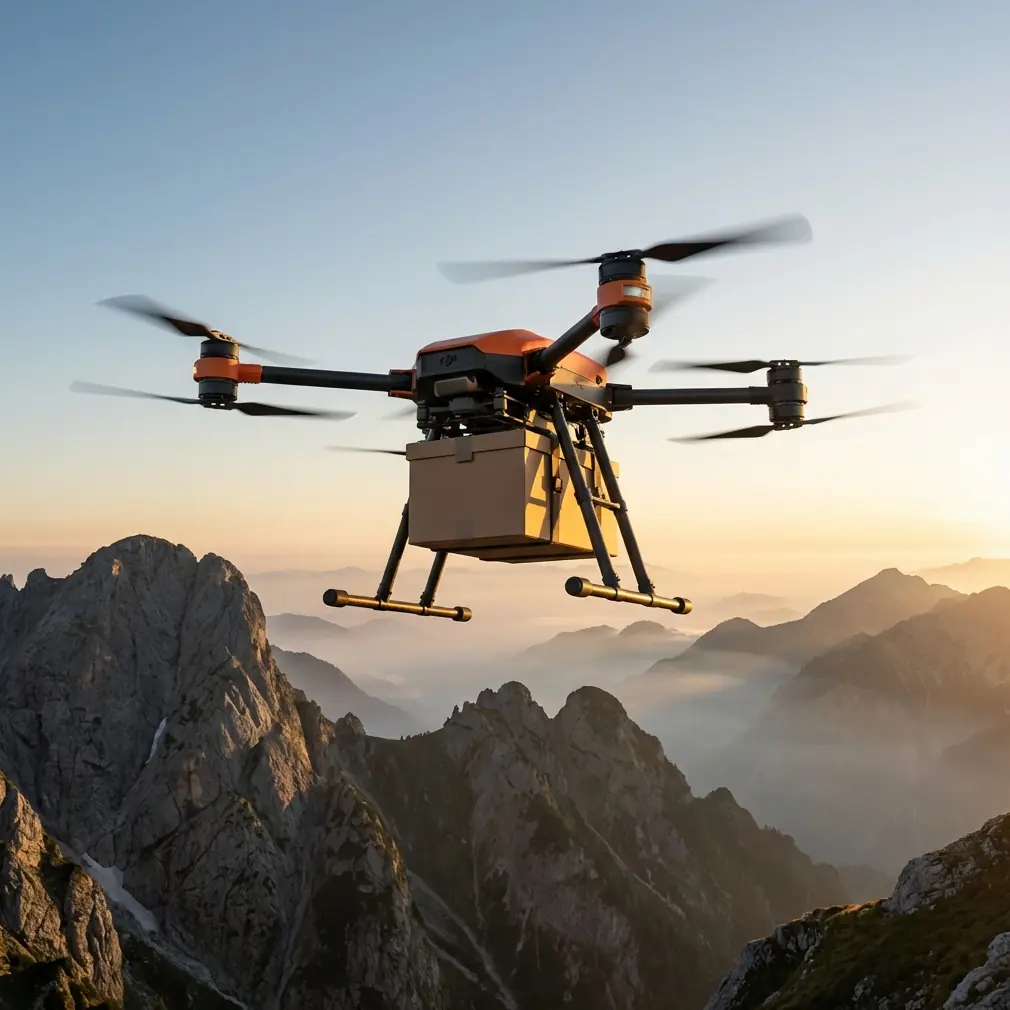
Complex forest terrain presents unique challenges that ground-based surveys simply cannot address efficiently. The DJI FlyCart 30 transforms how forestry professionals approach large-scale mapping operations, combining heavy-lift capability with precision navigation systems designed for BVLOS operations.
This tutorial breaks down the exact workflow I use when mapping forests across mountainous regions, including altitude optimization, payload configuration, and route planning strategies that maximize coverage while maintaining safety margins.
Understanding Forest Mapping Requirements
Forest mapping differs fundamentally from urban or agricultural surveys. Canopy density, terrain elevation changes, and limited GPS reception create obstacles that demand specialized approaches.
The FlyCart 30 addresses these challenges through several integrated systems:
- Dual-antenna RTK positioning maintains centimeter-level accuracy even under partial canopy cover
- Terrain-following radar adjusts altitude dynamically across elevation changes
- 40kg maximum payload capacity supports multiple sensor configurations simultaneously
- IP55 weather resistance enables operations during light precipitation common in forest environments
Payload Ratio Considerations
Effective forest mapping requires balancing sensor weight against flight duration. The FlyCart 30's payload ratio of approximately 1:1 (aircraft weight to payload capacity) provides exceptional flexibility.
For comprehensive forest surveys, I typically configure:
| Sensor Type | Weight | Purpose |
|---|---|---|
| LiDAR Unit | 8-12 kg | Canopy penetration mapping |
| Multispectral Camera | 2-3 kg | Vegetation health analysis |
| Thermal Imager | 1-2 kg | Wildlife detection |
| RTK Base Station Relay | 3-4 kg | Extended positioning coverage |
This configuration totals approximately 15-20 kg, leaving substantial margin for additional batteries or specialized equipment.
Optimal Flight Altitude Strategy
Expert Insight: Flying at 120-150 meters AGL provides the ideal balance between LiDAR canopy penetration and terrain obstacle clearance. Lower altitudes increase point density but dramatically raise collision risk in variable terrain. Higher altitudes reduce data quality without proportional safety benefits.
Altitude selection depends on three primary factors:
Canopy Height Variability Forests with uniform canopy heights (managed plantations) allow lower flight altitudes. Natural forests with emergent trees require additional clearance—typically canopy maximum height plus 30 meters.
Terrain Slope Steep terrain demands careful altitude management. The FlyCart 30's terrain-following system handles slopes up to 50 degrees, but I recommend manual waypoint altitude adjustment for slopes exceeding 35 degrees.
Sensor Requirements LiDAR systems perform optimally within specific altitude ranges. Most forestry-grade units achieve best canopy penetration between 100-180 meters AGL, with diminishing returns beyond this envelope.
Altitude Programming Workflow
- Import terrain elevation data from satellite sources
- Overlay known canopy height models
- Calculate minimum safe altitude per grid section
- Add 25-meter safety buffer for GPS uncertainty
- Program waypoints with terrain-relative altitude holds
Route Optimization for Complex Terrain
Efficient route planning reduces flight time, battery consumption, and data gaps. The FlyCart 30's 28-kilometer maximum range enables coverage of substantial forest areas, but poor route design can waste this capability.
Grid Pattern Selection
Standard parallel grid patterns work poorly in mountainous forests. Instead, use contour-following patterns that maintain consistent altitude relative to terrain features.
Key route optimization principles:
- Align flight lines perpendicular to primary slopes for consistent sensor geometry
- Plan turnaround points over clearings where GPS reception improves
- Overlap flight lines by 30% to compensate for canopy-induced positioning drift
- Schedule steepest terrain segments early when battery capacity remains highest
Pro Tip: Program hover waypoints every 2 kilometers along your route. These brief pauses allow the RTK system to recalibrate and provide data quality checkpoints. The FlyCart 30's efficient hover capability makes this practical without significant battery impact.
BVLOS Considerations
Forest mapping frequently requires Beyond Visual Line of Sight operations. The FlyCart 30 supports BVLOS through several integrated features:
- Redundant communication links maintain control beyond visual range
- Automatic return-to-home triggers on signal degradation
- Real-time telemetry provides continuous position and system status
- Emergency parachute deployment offers recovery option for critical failures
Regulatory requirements vary by jurisdiction. Ensure proper waivers and observer networks before conducting BVLOS forest operations.
Winch System Applications
The FlyCart 30's winch system opens unique possibilities for forest mapping that fixed-payload drones cannot match.
Sensor Deployment Beneath Canopy
Dense canopy blocks aerial sensors from capturing ground-level data. The winch system allows lowering sensors through canopy gaps while the aircraft maintains safe altitude above the trees.
Practical applications include:
- Ground-penetrating radar deployment for archaeological surveys
- Soil sampling equipment placement in inaccessible locations
- Weather station installation at specific forest floor positions
- Wildlife camera positioning without ground team access
Winch Operation Protocol
- Position aircraft over identified canopy gap
- Engage hover stabilization at minimum 40 meters above canopy
- Deploy winch at controlled descent rate of 0.5 m/s
- Monitor payload camera for obstacle proximity
- Complete sensor operation or placement
- Retract winch before repositioning aircraft
The winch cable extends 20 meters, sufficient for most canopy penetration requirements.
Dual-Battery Management
Extended forest mapping missions demand careful power management. The FlyCart 30's dual-battery architecture provides both redundancy and extended range.
Battery Configuration Options
| Configuration | Flight Time | Range | Best Use Case |
|---|---|---|---|
| Dual TB65 | 32 minutes | 28 km | Maximum coverage |
| Single TB65 | 18 minutes | 15 km | Quick surveys |
| Dual + Payload Reduction | 38 minutes | 32 km | Extended BVLOS |
Field Charging Strategy
Remote forest operations often lack grid power access. Plan battery rotation using:
- Vehicle-mounted inverter systems providing continuous charging
- Minimum 4 battery sets for continuous operations
- 30-minute cooling period between discharge and recharge
- Temperature monitoring to prevent charging in extreme conditions
Common Mistakes to Avoid
Underestimating Canopy GPS Interference Dense forest canopy degrades GPS signals significantly. Always verify RTK fix quality before beginning data collection, and plan routes that periodically cross clearings for signal recovery.
Ignoring Wind Patterns in Valleys Mountain forests create complex wind patterns. Morning operations typically offer calmer conditions. Avoid afternoon flights when thermal activity increases turbulence in valleys.
Overloading Payload Capacity While the FlyCart 30 handles 40kg payloads, maximum loads dramatically reduce flight time and maneuverability. Target 60-70% of maximum capacity for mapping missions requiring precise flight paths.
Skipping Pre-Flight Terrain Analysis Relying solely on onboard terrain-following without pre-mission analysis risks encountering obstacles the sensors cannot detect. Always review satellite imagery and elevation data before flight.
Neglecting Emergency Landing Zones Identify potential emergency landing sites along your route before launch. The FlyCart 30's emergency parachute requires minimum 30 meters clearance for safe deployment.
Frequently Asked Questions
What LiDAR specifications work best with the FlyCart 30 for forest mapping?
LiDAR units with multiple return capability (minimum 5 returns) provide best canopy penetration results. Pulse rates exceeding 500 kHz ensure adequate point density at typical mapping altitudes. The FlyCart 30's payload capacity accommodates most professional forestry LiDAR systems, including units with integrated IMU and GNSS receivers weighing up to 15 kg.
How does the FlyCart 30 handle sudden weather changes during forest operations?
The aircraft's IP55 rating protects against light rain and dust, allowing completion of active flight segments during weather deterioration. Onboard sensors detect wind speed increases, triggering automatic speed reduction or return-to-home protocols. For forest operations, I recommend setting weather abort thresholds at wind speeds exceeding 12 m/s or visibility below 3 kilometers.
Can the FlyCart 30 operate effectively in areas with limited cellular coverage?
The FlyCart 30 does not depend on cellular networks for primary operation. Direct radio links between controller and aircraft function independently of cellular infrastructure. For BVLOS operations requiring remote monitoring, satellite communication modules can supplement standard telemetry, though this adds payload weight and complexity.
Forest mapping with the FlyCart 30 represents a significant capability advancement over previous drone platforms. The combination of heavy-lift capacity, extended range, and integrated safety systems enables survey operations that previously required multiple aircraft or ground team deployments.
Success depends on thorough pre-mission planning, appropriate sensor selection, and conservative safety margins. The techniques outlined here provide a foundation for developing mission-specific protocols adapted to your particular forest environments and data requirements.
Ready for your own FlyCart 30? Contact our team for expert consultation.