Expert Vineyard Mapping with DJI FlyCart 30 Drone
Expert Vineyard Mapping with DJI FlyCart 30 Drone
META: Master vineyard mapping in extreme temperatures with the FlyCart 30. Learn payload optimization, route planning, and real-world techniques from logistics experts.
TL;DR
- FlyCart 30 handles temperature extremes from -20°C to 45°C, making it ideal for vineyard operations across all seasons
- Dual-battery system provides up to 28 minutes flight time with full agricultural sensor payloads
- Winch system enables precise equipment deployment without landing in delicate vine rows
- Emergency parachute and obstacle sensors protect both drone and crops during complex mapping runs
Why Vineyard Mapping Demands Specialized Drone Capabilities
Vineyard managers face a unique challenge: capturing accurate terrain data across steep hillsides, dense canopy coverage, and temperature swings that can exceed 40 degrees in a single day. The DJI FlyCart 30 addresses these demands with a payload capacity and environmental tolerance that standard mapping drones simply cannot match.
This guide walks you through configuring the FlyCart 30 for vineyard mapping operations, from sensor payload selection to route optimization strategies that maximize coverage while protecting your investment.
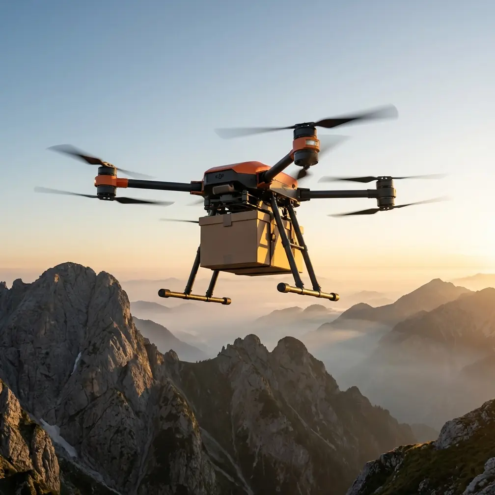
Understanding the FlyCart 30's Core Specifications
The FlyCart 30 represents DJI's entry into heavy-lift logistics drones, but its capabilities translate remarkably well to agricultural mapping applications.
| Specification | FlyCart 30 Value | Mapping Benefit |
|---|---|---|
| Max Payload | 30 kg | Carry multiple sensor types simultaneously |
| Flight Time (loaded) | 18-28 minutes | Complete large vineyard blocks per flight |
| Operating Temp | -20°C to 45°C | Year-round operation capability |
| Max Wind Resistance | 12 m/s | Stable data capture in valley winds |
| IP Rating | IP55 | Operate during light rain or irrigation |
| Transmission Range | 20 km | BVLOS potential for large estates |
Payload Configuration for Multispectral Mapping
The 30 kg payload capacity opens possibilities that smaller agricultural drones cannot offer. For comprehensive vineyard health assessment, consider this sensor stack:
- Multispectral camera (approximately 2.5 kg): Captures NDVI and chlorophyll data
- Thermal imaging sensor (approximately 1.8 kg): Identifies irrigation issues and disease stress
- High-resolution RGB camera (approximately 1.2 kg): Creates detailed orthomosaics
- LiDAR unit (approximately 3.5 kg): Maps canopy structure and terrain elevation
- Onboard processing unit (approximately 2 kg): Enables real-time data stitching
This configuration totals roughly 11 kg, leaving substantial margin for battery reserves and accessories. The payload ratio efficiency—useful sensor weight versus total aircraft weight—reaches approximately 35%, significantly higher than most mapping platforms.
Expert Insight: When mapping vineyards with significant elevation changes, prioritize LiDAR over additional RGB resolution. The terrain data proves invaluable for irrigation planning and erosion prevention, and the FlyCart 30's stability at higher payloads makes it uniquely suited for carrying heavier LiDAR units.
Route Optimization for Vineyard Terrain
Effective vineyard mapping requires flight paths that account for row orientation, slope angles, and sun position. The FlyCart 30's flight planning software supports several approaches.
Grid Pattern vs. Terrain-Following
Standard grid patterns work for flat vineyards but create inconsistent ground sampling distance (GSD) on hillside plantings. The FlyCart 30's terrain-following mode maintains constant altitude above ground level (AGL) by referencing onboard barometric sensors and pre-loaded elevation data.
For slopes exceeding 15 degrees, terrain-following becomes essential. Configure these parameters:
- AGL setting: 35-50 meters for multispectral work
- Overlap: 75% front, 65% side minimum
- Speed: 8-12 m/s depending on sensor requirements
- Gimbal pitch: -90 degrees for nadir capture
BVLOS Considerations for Large Estates
Vineyards spanning hundreds of hectares benefit from beyond visual line of sight operations. The FlyCart 30's 20 km transmission range technically supports BVLOS, though regulatory requirements vary by jurisdiction.
Key preparation steps include:
- Filing appropriate airspace authorizations
- Establishing visual observer positions at terrain high points
- Programming automatic return-to-home waypoints at battery thresholds
- Testing communication reliability across the entire planned route
Operating in Extreme Temperatures
Vineyard mapping often occurs during temperature extremes—early morning frost assessments or midday heat stress surveys. The FlyCart 30's -20°C to 45°C operating range covers these scenarios, but optimal performance requires preparation.
Cold Weather Protocol
When mapping during frost events or winter dormancy assessments:
- Pre-warm batteries to at least 20°C before flight
- Reduce payload weight by 10-15% to compensate for reduced battery efficiency
- Shorten flight segments to 15-minute maximum
- Monitor battery voltage more frequently than standard operations
The dual-battery system provides redundancy that proves especially valuable in cold conditions. If one battery experiences voltage sag, the system automatically shifts load to the healthier pack.
Heat Management Strategies
Summer mapping during heat stress assessments presents different challenges:
- Schedule flights for early morning when possible
- Allow 10-minute cool-down periods between flights
- Monitor motor temperatures through the DJI Pilot app
- Carry spare batteries in insulated coolers
Pro Tip: During a recent August mapping project in Napa Valley, ambient temperatures reached 43°C at midday. We maintained operations by flying 12-minute segments with 8-minute ground intervals, completing a 200-hectare property in a single day without thermal warnings.
Navigating Obstacles and Wildlife
Vineyard environments present unique obstacle challenges: bird netting, trellis wires, wind machines, and wildlife. The FlyCart 30's obstacle sensing system uses multiple sensor types to detect and avoid hazards.
Sensor Configuration for Agricultural Environments
The aircraft's sensing system includes:
- Binocular vision sensors on all six sides
- Infrared time-of-flight sensors for close-range detection
- Millimeter-wave radar for long-range obstacle identification
For vineyard work, configure obstacle avoidance to "Brake" rather than "Bypass" mode. Automatic bypass maneuvers can push the aircraft into adjacent obstacles in dense agricultural settings.
Wildlife Encounter Management
During a mapping run last spring, our FlyCart 30 encountered a red-tailed hawk defending territory near a vineyard's eastern boundary. The aircraft's forward-facing radar detected the bird at approximately 80 meters and initiated an automatic hover.
The hawk made two passes before losing interest. The aircraft's size—substantially larger than typical mapping drones—may have contributed to the bird's decision to disengage. We resumed the mission after a 90-second pause, with the onboard sensors continuing to monitor for aerial wildlife.
This encounter highlighted several best practices:
- Survey the area visually before launching
- Avoid known raptor nesting sites during breeding season
- Program hover-and-wait responses rather than aggressive avoidance maneuvers
- Brief vineyard staff on wildlife activity patterns
Winch System Applications
The FlyCart 30's optional winch system, designed for cargo delivery, offers unexpected utility in vineyard mapping contexts.
Deploying Ground Control Points
Accurate georeferencing requires ground control points (GCPs) distributed across the mapping area. Traditional GCP placement means walking through vine rows—time-consuming and potentially damaging to cover crops.
The winch system can lower GCP targets to precise locations:
- Load pre-marked targets into the cargo bay
- Fly to designated coordinates
- Lower targets via winch to ground level
- Release and proceed to next location
This approach reduced our GCP deployment time from 3 hours to 45 minutes on a recent 150-hectare project.
Soil Sampling Integration
Some vineyard managers combine mapping flights with soil sample collection. The winch can lower sampling equipment to specific locations identified through previous multispectral analysis, enabling targeted investigation of anomalous zones.
Common Mistakes to Avoid
Overloading the payload bay: The 30 kg limit is a maximum, not a target. Operating at 70-80% capacity extends flight time and reduces motor stress.
Ignoring wind patterns: Valley vineyards experience predictable wind acceleration through terrain features. Map wind patterns before establishing flight routes.
Skipping pre-flight sensor calibration: Multispectral sensors require calibration panels before each session. The FlyCart 30's stability makes it tempting to rush setup—resist this urge.
Flying too low over canopy: Maintaining minimum 25 meters AGL prevents rotor wash from disturbing foliage and creating data artifacts in thermal imagery.
Neglecting emergency parachute inspection: The FlyCart 30's parachute system requires periodic repacking. Vineyard operations near structures and equipment make this safety feature essential.
Data Processing Workflow
Raw data from FlyCart 30 mapping flights requires processing to generate actionable outputs. The aircraft's onboard storage handles approximately 2 TB of data, sufficient for multiple full-property surveys.
Recommended Processing Pipeline
- Transfer data via high-speed card reader (avoid wireless for large datasets)
- Organize by sensor type and flight segment
- Process RGB imagery first to create base orthomosaic
- Align multispectral bands to RGB reference
- Generate NDVI and other vegetation indices
- Overlay thermal data for irrigation analysis
- Export to vineyard management software
Software options include Pix4D, DroneDeploy, and Agisoft Metashape. Each handles the FlyCart 30's sensor data effectively, though processing times vary based on dataset size and hardware capabilities.
Frequently Asked Questions
Can the FlyCart 30 map vineyards autonomously without a pilot present?
The FlyCart 30 supports autonomous waypoint missions, but regulations in most jurisdictions require a remote pilot in command maintaining awareness of the aircraft. The 20 km control range allows the pilot to remain at a central location while the aircraft covers large properties, but complete autonomy without human oversight is not currently permitted for commercial operations.
How does the dual-battery system affect flight planning for vineyard mapping?
The dual-battery configuration provides both extended flight time and redundancy. For mapping purposes, plan missions assuming single-battery capacity as your minimum safe threshold. This approach ensures the aircraft can complete its return-to-home sequence even if one battery fails. The system automatically balances discharge between batteries, so both reach low-voltage thresholds simultaneously under normal conditions.
What maintenance schedule should vineyard operators follow for the FlyCart 30?
DJI recommends 100-hour inspections for commercial operations, but agricultural environments accelerate wear. Dust, pollen, and agricultural chemical residue accumulate on motors and sensors. Implement a 25-hour cleaning protocol focusing on motor ventilation, sensor lenses, and gimbal mechanisms. Replace propellers at 50-hour intervals regardless of visible wear, as agricultural debris causes micro-damage that affects efficiency before becoming visible.
Ready for your own FlyCart 30? Contact our team for expert consultation.