FlyCart 30 for Coastal Forest Monitoring
FlyCart 30 for Coastal Forest Monitoring: A Practical Field Tutorial on Payload, Power, and Image Discipline
META: Learn how FlyCart 30 operations can be adapted for coastal forest monitoring, with practical guidance on payload ratio, dual-battery management, winch use, BVLOS planning, and why disciplined image capture matters in the field.
Coastal forest monitoring looks simple on a map. In practice, it is one of the more unforgiving drone missions you can run with a FlyCart 30.
Salt air works into connectors. Wind shifts fast at canopy edges. Landing zones are rarely clean. Access roads flood, then disappear. The mission itself is usually not a single task either. A team may need to move sensors, retrieve sample kits, drop small tools at remote plots, and document conditions with enough clarity that a forestry manager can make decisions days later without stepping on site.
That is where the FlyCart 30 becomes interesting. Not as a generic transport platform, but as a working aircraft for coastal operations where logistics and observation overlap. I approach this as a field logistics problem first and an aircraft problem second. If the aircraft supports the workflow, the mission scales. If it does not, the best spec sheet in the world will not save a long day in the mangroves.
This tutorial is built around one core idea: coastal monitoring with the FlyCart 30 improves when you treat payload handling, battery discipline, route design, and image capture as one system rather than four separate checklists.
Why this matters now
Two recent developments outside the aircraft itself sharpen that point.
First, one industry update highlights a major propulsion manufacturing expansion in Coventry, where ePropelled opened a new Global Innovation Centre designed to support output of more than one million propulsion systems annually by 2027. That matters operationally because heavy-duty UAV work is moving deeper into industrial scale. For operators using platforms like the FlyCart 30, component ecosystems, propulsion maturity, and long-term support capacity are becoming real planning factors rather than background industry noise.
Second, an unrelated but useful photography note makes a point many drone teams still ignore: strong images are a fusion of technique and art, and effective capture depends on concentrating fully on a fleeting moment. That may sound philosophical, but in forest monitoring it has direct operational value. If your aerial documentation is poorly timed, poorly framed, or captured in bad light, the logistics mission may succeed while the data mission fails.
The FlyCart 30 sits right at that intersection. It moves what field teams need, but it also creates opportunities to gather visual evidence when conditions are changing by the minute.
Start with the real coastal mission profile
For coastal forest monitoring, I usually divide FlyCart 30 jobs into three categories:
- transport of lightweight but mission-critical items
- winch-assisted delivery or retrieval where landing is unsafe
- support for repeatable observation workflows across dispersed points
That distinction matters because payload ratio changes everything.
A common mistake is loading the aircraft as if every flight should maximize carrying capacity. In coastal monitoring, that is rarely the smartest move. A better standard is to match payload ratio to mission uncertainty. If wind is unstable, terrain is obstructed, and your route includes multiple hover segments for winch drops, leaving margin is not conservative in a bad way. It is what keeps the operation predictable.
For forest work near the coast, I tell teams to think in “delivery efficiency per battery cycle,” not “kilograms per sortie.” A moderate load with cleaner power reserves often beats a heavier configuration that forces rushed decision-making on the return leg.
My field rule for dual-battery management
The most useful battery lesson I have learned with work-class UAVs is simple: do not let the second battery become a psychological excuse.
On paper, a dual-battery setup creates confidence. In the field, that confidence can turn sloppy. Teams stretch a route because they know there is redundancy. They accept more hover time over canopy. They delay a return because the battery graph still looks acceptable.
That is where coastal missions start to punish you.
My tip is to assign different jobs to each half of your battery confidence. The first portion is for the mission you planned. The second is for everything the coast adds without permission: a gust front at the tree line, a slower winch retrieval, a blocked return corridor, or a second approach after a pilot waves off a descent.
In briefing language, I phrase it like this: “Battery reserve belongs to the environment, not to us.”
That framing changes pilot behavior immediately. It also makes route optimization more honest. If the route only works by consuming the reserve you meant for surprises, the route is wrong.
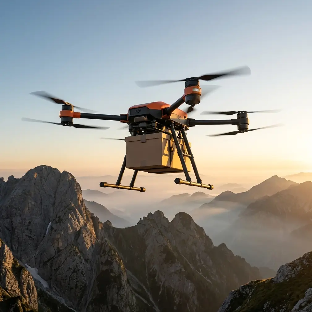
Winch system use in dense coastal vegetation
The FlyCart 30’s winch system can be the difference between a productive day and a damaged aircraft. Coastal forests are full of deceptive landing surfaces. Mudflats crust over. Root networks sit just below loose debris. Open patches are often narrower than they appear from altitude.
A winch delivery profile solves part of that problem, but only if teams understand the tradeoff. Hovering while lowering payload adds time, and time converts directly into energy use and exposure to lateral drift. That means winch missions should be designed around stable release zones, not improvised ones.
A few practical standards help:
Use the winch when the landing zone is uncertain, obstructed, or likely to contaminate the airframe with salt spray and mud. Do not use it simply because it feels more advanced.
Keep suspended loads simple. In coastal woods, swinging payloads are harder to manage because crosswinds wrap around trunks and break clean airflow. Compact packaging matters.
Train ground teams on retrieval posture. A bad handoff below the aircraft adds seconds, and those seconds matter more than people think when the drone is holding position over uneven canopy edges.
In monitoring missions, the winch system is especially useful for placing trail cameras, environmental sensors, or collection bags into clearings that are reachable from above but unpleasant from the ground. It is not just about convenience. It reduces unnecessary foot traffic in sensitive areas.
BVLOS planning is a route problem, not a paperwork problem
People often discuss BVLOS as a regulatory box to check. In coastal forest work, it is better understood as a route architecture challenge.
If you are monitoring a large coastal tract, visibility can disappear quickly behind tree mass, dunes, or low marine haze. A BVLOS-capable operation only becomes reliable when the route itself respects the environment. That means avoiding path designs that look elegant on a screen but force the aircraft through the most turbulent or least recoverable sections of the landscape.
My preference is to build routes around recovery logic first:
Where can the aircraft safely pause or reverse? Which legs expose it to the strongest crosswind? Which waypoint clusters are near the highest canopy or most reflective water? Which segments have the weakest communication confidence?
Once those are mapped, optimization becomes meaningful. Otherwise, route optimization is just cosmetic efficiency.
For FlyCart 30 coastal monitoring, a strong BVLOS route usually has fewer ambitious legs and more deliberate transitions. It may look slower. In real operations, it tends to produce better completion rates and fewer battery surprises.
Image capture is not secondary to the logistics mission
One of the most useful reminders from the photography source is that a photograph freezes a moment that would otherwise disappear, and that successful capture demands total focus. Strip away the poetic language and you are left with something highly practical for drone crews: if the operator treats imaging as an afterthought, the mission record becomes weaker than the mission itself.
That matters in coastal forests because conditions change fast. Tidal intrusion, storm damage, erosion, disease markers, and canopy thinning can present as brief visual cues. If the pilot or observer is careless with light angle, framing, or timing, those cues can be lost.
Good field documentation is not about taking many images. It is about knowing which image will still matter when someone reviews it 72 hours later.
Three habits improve results:
First, work the light, not just the route. Side light often reveals canopy texture and terrain relief better than flat overhead brightness. The photography principle about light shaping space is directly relevant here.
Second, slow the capture moment. During a complex delivery mission, teams tend to snap imagery while already transitioning to the next task. That is when motion blur, awkward composition, and poor orientation creep in.
Third, decide what “evidence” means before launch. Are you documenting shoreline encroachment, tree health, access conditions, or the placement of field equipment? Each requires a different framing priority.
A lot of operators spend heavily on airframes and then collect imagery that no analyst wants to use. That is avoidable.
Payload ratio: what efficient actually looks like
Payload ratio is one of those terms that gets discussed as a technical metric but should really be treated as a mission quality variable.
For coastal forest monitoring, an efficient payload ratio is not the highest one the aircraft can tolerate. It is the one that preserves enough flight behavior consistency that the crew can still execute precise routing, stable hover, and clean delivery.
Here is the practical version:
If your payload causes the aircraft to feel noticeably less settled at release altitude, you are probably too close to the wrong edge.
If your route requires multiple stop points, sensor drops, or image passes, prioritize controllability over theoretical carrying efficiency.
If ground teams are asking for one extra item “since the aircraft is already going there,” make them justify the operational value. Incremental payload creep ruins more missions than headline overloads do.
The FlyCart 30 is most useful in monitoring work when it protects the rhythm of the mission. Reliable outbound transport, stable task execution, and comfortable return margins usually produce more usable work across a full day than a handful of aggressive sorties.
Emergency parachute thinking should start before takeoff
Emergency parachute systems are often mentally filed under last-resort safety features. For coastal operations, they should also shape preflight planning.
Why? Because terrain affects what “emergency” means. In a coastal forest, an uncontrolled descent into shallow water, tangled branches, or unstable mud can complicate recovery, damage payloads, and create secondary risks for the field crew.
So when planning a FlyCart 30 mission, I recommend identifying not just where the aircraft will go, but where you would least want a forced descent to happen. That affects altitude decisions, transit line choices, and how aggressively you cut across mixed terrain.
A parachute feature is most valuable when the rest of the mission is designed to give it the best possible outcome window.
Building a better coastal workflow
If I were setting up a repeatable FlyCart 30 coastal forest monitoring program from scratch, I would build it like this:
Define the monitoring objective first. Not every route needs cargo, and not every cargo route needs imagery.
Segment payloads by urgency and handling method. Some items should be winched, others hand-delivered after landing only in proven zones.
Protect the battery reserve as environmental insurance. This one habit improves decision quality across the whole crew.
Design BVLOS paths around recovery logic and signal confidence, then refine for efficiency.
Standardize the image brief before launch. A good photo set is not luck. It is a planned output.
Review every mission for time lost in hover, handoff confusion, or unnecessary route extensions. Those are the silent drains on coastal performance.
If your team is comparing notes on route planning or payload setups for similar conditions, you can share field questions here: message the operations desk.
The bigger takeaway for FlyCart 30 operators
The interesting part of this story is not just the aircraft. It is the direction of the field around it.
When a propulsion supplier expands toward million-scale annual production capacity, it signals an industry preparing for wider deployment and more specialized missions. When a photography lesson reminds us that strong images combine technique with judgment, it highlights a blind spot in many drone workflows. Together, those signals point to a maturing UAV environment where success depends less on raw platform capability and more on how well teams integrate support systems, flight discipline, and data quality.
For FlyCart 30 users monitoring coastal forests, that is the real standard to aim for.
Not maximum load. Not longest route. Not the most dramatic mission profile.
The standard is repeatable usefulness under difficult conditions.
If the aircraft can move gear into awkward terrain, support a sensible BVLOS plan, maintain disciplined dual-battery margins, use the winch system where landing would be reckless, and return with imagery that actually helps the forestry team, then the mission is doing what it should.
That is what good UAV logistics looks like in the field. Quietly efficient. Deliberate. And built around the realities of the landscape rather than the promises of a brochure.
Ready for your own FlyCart 30? Contact our team for expert consultation.