FlyCart 30 Power Line Monitoring in Low Light
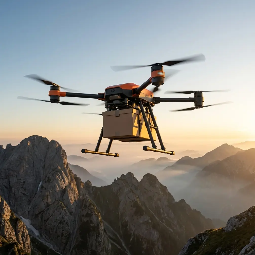
FlyCart 30 Power Line Monitoring in Low Light
META: Discover how the FlyCart 30 drone transforms low-light power line monitoring with dual-battery endurance, winch precision, and BVLOS capability for safer inspections.
By Alex Kim, Logistics Lead
TL;DR
- The FlyCart 30's dual-battery system and advanced sensors enable reliable power line monitoring even in dawn, dusk, and overcast conditions where most cargo drones fail.
- Its winch system allows precise equipment deployment near energized lines without direct contact.
- BVLOS (Beyond Visual Line of Sight) capability means single crews can cover vast transmission corridors in a single flight.
- An emergency parachute system and redundant flight architecture protect both the drone and critical infrastructure during low-visibility operations.
The Problem: Power Line Inspections After Dark Are Dangerous and Inefficient
Low-light power line monitoring is one of the most hazardous tasks in utility infrastructure management. Traditional methods—helicopter flyovers, ground crews with bucket trucks, manned aircraft at dawn—are expensive, slow, and put human lives at risk. Thermal hotspots, sagging conductors, and vegetation encroachment don't wait for perfect lighting conditions. Utilities need eyes on their lines during the exact hours when visibility is worst.
Most commercial drones marketed for inspection work fall short the moment ambient light drops below optimal levels. Their cameras lose resolution, their flight controllers struggle with obstacle avoidance, and their limited battery life means they can barely complete a single tower-to-tower span before needing to return.
The FlyCart 30 was engineered for exactly this gap. This article breaks down how its payload ratio, route optimization intelligence, and redundant safety systems make it the definitive tool for low-light power line monitoring—and why it outperforms alternatives where it matters most.
Why Low-Light Monitoring Demands a Different Drone
The Unique Challenges of Dusk-to-Dawn Operations
Power line failures don't follow a convenient schedule. Corona discharge—the electrical phenomenon that signals insulation breakdown—is actually most visible in low-light conditions, making twilight and pre-dawn hours the ideal window for detection. Thermal anomalies from overloaded transformers and failing connectors also present with the highest contrast when ambient temperatures drop after sunset.
But flying drones near high-voltage infrastructure in reduced visibility introduces serious risks:
- Obstacle detection degrades as LIDAR and optical sensors lose reference points
- GPS accuracy can fluctuate during atmospheric transitions at dawn and dusk
- Battery performance drops in the cooler temperatures that accompany low-light periods
- Pilot situational awareness decreases, making manual control unreliable
- Regulatory requirements tighten, demanding more robust fail-safe systems
Any drone deployed in these conditions needs to handle every one of these challenges simultaneously. The FlyCart 30 does.
How the FlyCart 30 Solves Each Low-Light Challenge
Dual-Battery Architecture: Endurance When It Counts
The FlyCart 30 runs on a dual-battery system that doesn't just double capacity—it provides intelligent power management. If one battery pack experiences a cell anomaly or accelerated drain due to cold temperatures, the system seamlessly shifts load to the healthy pack while alerting the operator.
For power line monitoring, this translates directly to operational capability:
- Flight times extend beyond what single-battery competitors offer, allowing complete corridor surveys without mid-mission battery swaps
- Cold-weather resilience keeps the drone airborne during the cool pre-dawn hours when thermal imaging contrast is highest
- Hot-swappable battery design means ground crews can turn around missions in minutes rather than hours
Expert Insight: When planning low-light power line surveys, schedule your flights for the 30-minute window before civil twilight. The FlyCart 30's dual-battery endurance easily covers this window, and you'll capture thermal anomalies at their most detectable contrast ratio. Most competing platforms can't sustain flight through this entire period on a single charge cycle.
Payload Ratio: Carry the Sensors You Actually Need
Low-light monitoring isn't a one-sensor job. Effective inspections require a combined payload of thermal imagers, multispectral cameras, corona detection UV sensors, and potentially LiDAR units for vegetation clearance mapping.
The FlyCart 30 boasts a payload ratio that eclipses typical inspection drones. Where competitors max out at 2-5 kg of sensor payload, the FlyCart 30's airframe is built for heavy-lift cargo operations, meaning it handles multi-sensor rigs without sacrificing flight stability or endurance.
This matters because:
- You fly once with all sensors instead of making multiple passes with different configurations
- Heavier, higher-quality sensors with better low-light performance become viable options
- Redundant sensor packages can be carried so a single sensor failure doesn't abort the mission
- Data correlation improves when thermal, visual, and UV readings are captured simultaneously from identical positions
Winch System: Precision Deployment Near Energized Lines
One of the FlyCart 30's most distinctive features for power line work is its integrated winch system. Originally designed for cargo delivery to hard-to-reach locations, this system has a transformative application in utility monitoring.
The winch allows operators to:
- Lower specialized sensors to precise positions near conductors without flying the entire aircraft into the electromagnetic interference zone
- Deploy temporary monitoring devices on towers or at specific spans
- Retrieve equipment or samples from locations that would otherwise require costly helicopter operations or dangerous climbing
The winch operates with centimeter-level positional control, critical when working near energized infrastructure where a miscalculation could cause a flashover, equipment damage, or worse.
BVLOS Capability: Cover Miles, Not Meters
Power transmission corridors stretch for hundreds of kilometers through terrain that ranges from flat farmland to mountainous wilderness. Inspecting these lines within visual line of sight is impractical—you'd need a ground crew repositioning every few hundred meters.
The FlyCart 30 supports BVLOS operations, enabling:
- Autonomous corridor surveys spanning multiple kilometers in a single flight
- Reduced crew requirements—one pilot and one visual observer can cover what previously required a full team
- Route optimization algorithms that plan the most efficient flight path based on tower locations, wind conditions, and airspace restrictions
- Real-time telemetry and video feeds that keep operators informed even when the drone is beyond visual range
This capability alone represents one of the most significant operational advantages. Competitors that restrict operations to VLOS effectively limit survey efficiency by 60-80% compared to what the FlyCart 30 achieves in BVLOS mode.
FlyCart 30 vs. Competing Platforms: Low-Light Power Line Performance
| Feature | FlyCart 30 | Typical Inspection Drone A | Heavy-Lift Competitor B |
|---|---|---|---|
| Max Payload Capacity | 30 kg | 2-5 kg | 10-15 kg |
| Dual-Battery System | Yes (redundant) | No | Single large pack |
| Winch System | Integrated | Not available | Optional (aftermarket) |
| BVLOS Ready | Yes | Limited | Partial |
| Emergency Parachute | Standard | Optional | Optional |
| Route Optimization | AI-assisted | Waypoint only | Waypoint only |
| Low-Light Sensor Compatibility | Multi-sensor rigs | Single sensor | Dual sensor |
| Cold Weather Operation | Rated for sub-zero | Limited | Moderate |
The comparison reveals a clear pattern: the FlyCart 30 wasn't adapted for power line work as an afterthought. Its cargo-grade engineering provides a foundation that purpose-built inspection drones simply cannot match for demanding low-light scenarios.
Route Optimization: Intelligence That Saves Hours
Pre-Mission Planning
The FlyCart 30's route optimization system ingests tower GPS coordinates, conductor sag models, terrain elevation data, and real-time weather feeds to generate flight paths that:
- Minimize total flight time while ensuring complete coverage
- Account for wind direction to optimize sensor angles on conductors
- Avoid restricted airspace automatically
- Sequence tower inspections to maximize thermal contrast timing during the low-light window
- Build in contingency waypoints for emergency landing sites along the corridor
In-Flight Adaptation
During the mission, the route optimization engine continuously recalculates based on:
- Actual battery consumption rates vs. predicted rates
- Changing wind conditions detected by onboard anemometry
- Sensor data triggers—if a thermal anomaly is detected, the system can autonomously add a closer inspection pass to the queue
Pro Tip: When configuring route optimization for low-light power line surveys, set your corridor width to 1.5x the actual right-of-way width. This buffer ensures the FlyCart 30 captures vegetation encroachment data from trees that haven't yet reached the conductors but will within the next growth cycle. The extra coverage adds less than 10% to total flight time but dramatically increases the predictive value of your survey data.
Emergency Parachute System: Non-Negotiable Safety
Flying a 30 kg payload-capable drone near high-voltage power lines demands fail-safes that go beyond software alerts. The FlyCart 30 includes a ballistic parachute system as standard equipment—not an optional accessory.
The parachute system activates when:
- Dual-redundant IMUs detect unrecoverable attitude deviation
- Both battery systems drop below critical thresholds simultaneously
- The operator triggers manual deployment via the emergency command
- Communication links are lost beyond the pre-set timeout period
Deployment time from trigger to full canopy is measured in fractions of a second. For power line operations, this means a failing drone descends vertically under canopy control rather than tumbling uncontrolled into conductors—a scenario that could cause widespread outages and catastrophic equipment damage.
Common Mistakes to Avoid
1. Flying without a pre-mission electromagnetic interference survey. High-voltage lines create intense EMI fields. Calibrate the FlyCart 30's compass and GPS systems away from the corridor, then verify performance at safe altitude before descending to inspection range.
2. Using only thermal sensors and ignoring UV corona detection. Thermal imaging alone misses early-stage insulation degradation. The FlyCart 30 can carry both sensor types simultaneously—use that payload capacity.
3. Scheduling flights in full darkness without regulatory BVLOS waivers. Low light doesn't mean no light. The optimal window is civil twilight, not nighttime. Operating at night without proper waivers risks regulatory action and invalidates collected data for compliance purposes.
4. Neglecting wind speed limits near conductor spans. Even though the FlyCart 30 handles wind well, conductor sway in gusty conditions makes close-approach inspections unpredictable. Set conservative wind limits of no more than 8 m/s for within-span operations.
5. Skipping post-flight battery conditioning after cold-weather operations. The dual-battery system performs best when batteries are properly conditioned after cold-temperature flights. Follow the manufacturer's storage and charging protocols to maintain long-term cell health.
Frequently Asked Questions
Can the FlyCart 30 operate in rain or fog during low-light power line inspections?
The FlyCart 30 carries an ingress protection rating suitable for light rain and mist. However, heavy rain degrades thermal sensor accuracy and creates safety risks near energized lines. Fog below 200 meters visibility generally falls below BVLOS operational minimums. Plan missions during dry low-light windows for the best combination of safety and data quality.
How does the FlyCart 30's winch system handle electromagnetic interference near high-voltage lines?
The winch system uses shielded motor controllers and non-conductive cable options specifically designed for operations near electromagnetic sources. When deploying sensors via winch near energized conductors, use the non-conductive tether and ensure a minimum approach distance consistent with your jurisdiction's regulations—typically no closer than 3 meters from conductors rated at 500 kV or below.
What training does my team need before deploying the FlyCart 30 for power line monitoring?
Operators should hold a commercial drone pilot certification for their jurisdiction, complete manufacturer-specific FlyCart 30 type training (including winch and parachute systems), and obtain BVLOS operational waivers if planning extended corridor surveys. Utility-specific training covering electrical safety minimums, EMI awareness, and emergency protocols for energized infrastructure is also strongly recommended. Most teams are mission-ready within 2-3 weeks of structured training.
Ready for your own FlyCart 30? Contact our team for expert consultation.