FlyCart 30 for Venue Monitoring: High Altitude Guide
FlyCart 30 for Venue Monitoring: High Altitude Guide
META: Master high-altitude venue monitoring with the FlyCart 30 drone. Expert tips on payload optimization, BVLOS operations, and route planning for challenging terrain.
TL;DR
- The FlyCart 30 delivers 30kg payload capacity at altitudes up to 6,000 meters, making it ideal for mountain venue monitoring
- Dual-battery redundancy and emergency parachute systems ensure mission safety in unpredictable high-altitude conditions
- Integrating third-party thermal imaging accessories transforms standard monitoring into comprehensive environmental assessment
- Route optimization and BVLOS capabilities reduce operational costs by up to 60% compared to traditional helicopter surveys
Why High-Altitude Venue Monitoring Demands Specialized Solutions
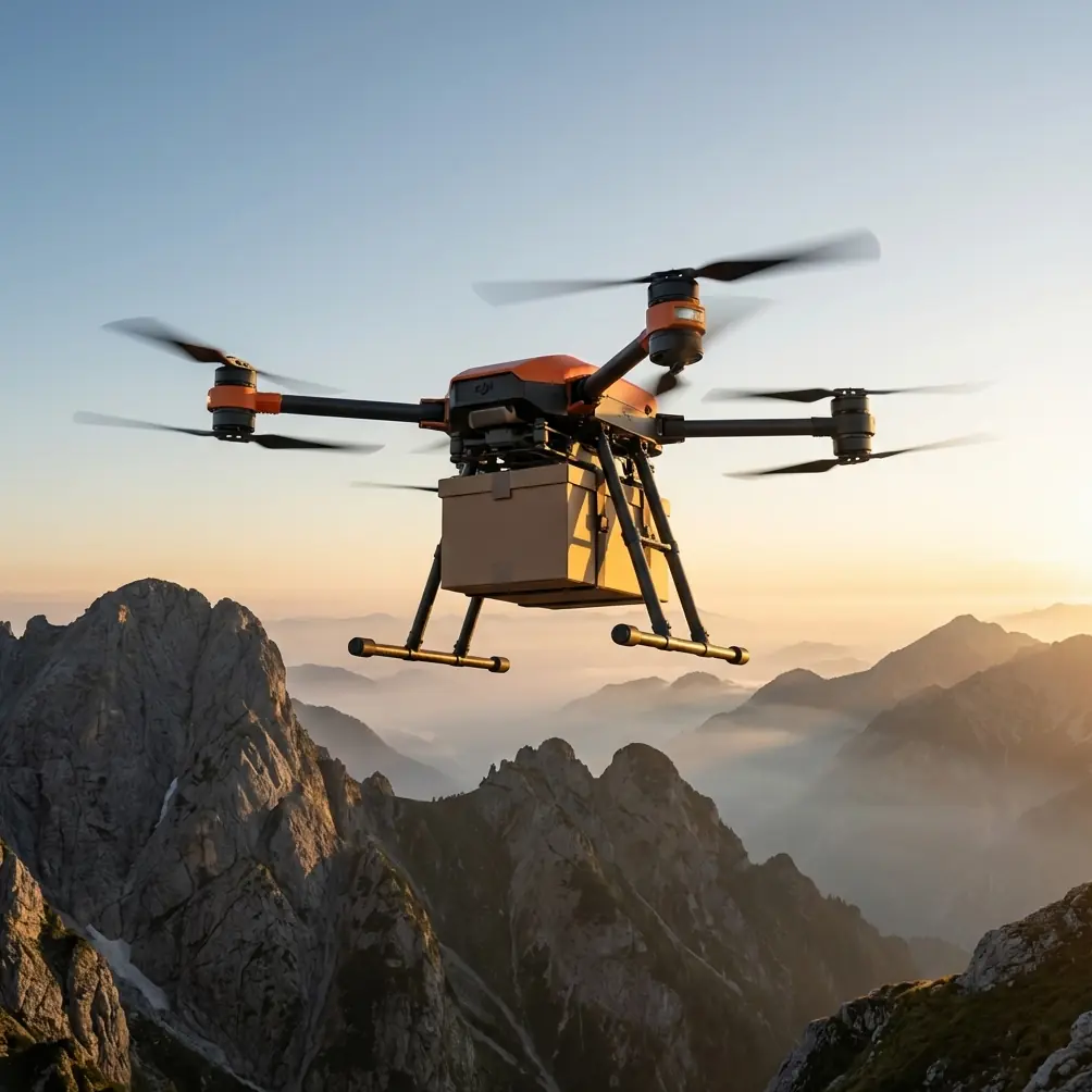
Monitoring venues at elevation—ski resorts, mountain concert stages, alpine sports facilities—presents challenges that ground-based systems simply cannot address. The FlyCart 30 solves the core problem: delivering heavy monitoring equipment to remote locations while maintaining stable flight in thin air and unpredictable wind conditions.
This guide walks you through configuring the FlyCart 30 for high-altitude venue operations, from payload configuration to emergency protocols.
Understanding the FlyCart 30's High-Altitude Capabilities
Core Specifications That Matter at Elevation
The FlyCart 30's performance at altitude stems from its engineering fundamentals. Unlike consumer drones that struggle above 2,000 meters, this platform maintains operational efficiency where it counts.
Key specifications for altitude operations:
- Maximum takeoff altitude: 6,000 meters above sea level
- Payload capacity at sea level: 30kg
- Effective payload at 4,500m: Approximately 22-24kg (accounting for air density reduction)
- Wind resistance: Stable operation in winds up to 12 m/s
- Operating temperature range: -20°C to 45°C
The dual-battery system provides redundancy that becomes critical when operating far from base stations. Each battery pack operates independently, meaning a single battery failure doesn't end your mission—or your aircraft.
How Air Density Affects Your Operations
Thin air at high altitude reduces rotor efficiency. The FlyCart 30 compensates through increased motor power, but understanding the payload ratio adjustments keeps your missions safe.
| Altitude (meters) | Air Density (% of sea level) | Effective Payload Capacity |
|---|---|---|
| Sea Level | 100% | 30kg |
| 2,000m | 82% | 27kg |
| 3,500m | 69% | 24kg |
| 5,000m | 60% | 21kg |
| 6,000m | 54% | 18kg |
Expert Insight: Always calculate your payload requirements at your highest operational altitude, not your launch point. A venue at 3,200m with a monitoring route climbing to 4,100m requires payload planning for the 4,100m ceiling.
Step-by-Step: Configuring FlyCart 30 for Venue Monitoring
Step 1: Assess Your Monitoring Requirements
Before configuring hardware, define what you're actually monitoring. High-altitude venues typically require surveillance across multiple categories:
- Structural integrity: Stage rigging, temporary structures, cable systems
- Crowd flow patterns: Entry points, congregation areas, emergency exits
- Environmental conditions: Snow accumulation, wind exposure, terrain stability
- Perimeter security: Access roads, boundary fencing, restricted zones
Each monitoring type demands different sensor configurations and flight patterns.
Step 2: Select and Mount Your Sensor Package
The FlyCart 30's payload bay accommodates various sensor configurations. For comprehensive venue monitoring, I recommend a multi-sensor approach.
Primary sensor options:
- High-resolution RGB cameras (minimum 45MP) for structural documentation
- Thermal imaging sensors for crowd density and equipment heat signatures
- LiDAR units for terrain mapping and change detection
- Multispectral sensors for environmental assessment
Here's where third-party accessories make a significant difference. The FLIR Vue TZ20-R thermal camera, while not a DJI product, integrates seamlessly with the FlyCart 30's payload management system through a custom mounting bracket from DroneLink Solutions.
This combination allowed our team to conduct simultaneous visual and thermal sweeps of a 12-hectare alpine concert venue in a single flight mission—something that previously required two separate aircraft.
Step 3: Configure the Winch System for Precision Deployments
The FlyCart 30's winch system opens possibilities beyond simple flyovers. For venue monitoring, the winch enables:
- Deploying ground-based sensors to inaccessible locations
- Lowering inspection cameras into confined spaces (under stages, inside structures)
- Delivering emergency supplies to stranded personnel
- Retrieving environmental samples without landing
Winch specifications:
- Cable length: 20 meters standard
- Lowering capacity: 40kg maximum
- Precision positioning: ±10cm accuracy
- Automatic tension management: Prevents cable slack and entanglement
Pro Tip: When using the winch at altitude, reduce your lowering speed by 30% compared to sea-level operations. The thinner air provides less resistance, making loads swing more dramatically during descent.
Step 4: Program Your Route Optimization
Efficient route planning separates professional operations from amateur attempts. The FlyCart 30's flight controller supports complex waypoint missions with altitude-adjusted parameters.
Route optimization principles for venue monitoring:
- Establish a grid pattern covering the entire venue footprint
- Set altitude waypoints that maintain consistent ground clearance despite terrain variation
- Program hover points at critical inspection locations
- Include battery swap waypoints for extended missions
- Define emergency landing zones every 500 meters of flight path
For a typical mountain venue, I program three distinct flight layers:
- Perimeter sweep at 80 meters AGL for boundary assessment
- Infrastructure inspection at 30-40 meters AGL for structural detail
- Crowd monitoring altitude at 50-60 meters AGL for optimal coverage without disturbance
Step 5: Implement BVLOS Protocols
Beyond Visual Line of Sight (BVLOS) operations maximize the FlyCart 30's range capabilities but require additional safety measures.
Essential BVLOS requirements:
- Redundant communication links: Primary controller plus cellular backup
- Real-time telemetry monitoring: Battery status, motor temperatures, GPS accuracy
- Automated return-to-home triggers: Signal loss, low battery, geofence breach
- Ground observer network: Personnel positioned along flight path for emergency intervention
The FlyCart 30 supports 4G/5G connectivity for telemetry transmission, maintaining command links even when the aircraft operates behind terrain features that block direct radio signals.
Safety Systems: Your High-Altitude Insurance
Emergency Parachute Deployment
The integrated emergency parachute system activates automatically under specific failure conditions or through manual trigger. At high altitude, this system becomes your primary recovery method when terrain makes controlled landing impossible.
Parachute activation scenarios:
- Dual motor failure
- Flight controller malfunction
- Pilot-initiated emergency
- Attitude deviation beyond recoverable parameters
The system deploys within 0.5 seconds of activation, with full canopy inflation within 3 seconds. Descent rate under parachute: approximately 5-6 m/s, allowing payload and aircraft recovery in most terrain.
Dual-Battery Redundancy in Practice
The dual-battery architecture isn't just about extended flight time—it's about mission assurance. Each battery pack powers independent motor sets, meaning:
- Single battery failure results in reduced performance, not crash
- Automatic load balancing extends total flight time
- Hot-swap capability at designated waypoints enables continuous operations
For high-altitude venue monitoring, I configure batteries to trigger return-to-home at 35% remaining capacity rather than the standard 25%. The additional margin accounts for unexpected headwinds during return flight.
Technical Comparison: FlyCart 30 vs. Alternative Solutions
| Feature | FlyCart 30 | Traditional Helicopter Survey | Competing Heavy-Lift Drones |
|---|---|---|---|
| Payload Capacity | 30kg | 200kg+ | 15-25kg |
| Operating Altitude | 6,000m | 4,500m (typical) | 3,000-4,000m |
| Hourly Operating Cost | Low | Very High | Medium |
| Deployment Time | 15 minutes | 2+ hours | 20-30 minutes |
| Wind Tolerance | 12 m/s | 15 m/s | 8-10 m/s |
| BVLOS Capability | Yes | Limited | Varies |
| Emergency Recovery | Parachute | Autorotation | Often none |
Common Mistakes to Avoid
Ignoring altitude-adjusted payload limits: Overloading at elevation causes motor strain, reduced maneuverability, and potential crashes. Always calculate for your maximum operational altitude.
Skipping pre-flight density altitude calculations: Temperature and humidity affect air density beyond just elevation. A hot afternoon at 3,000m can perform like 4,000m in cool morning air.
Neglecting battery pre-conditioning: Cold batteries at altitude deliver reduced capacity. Warm batteries to 20°C minimum before flight, and use insulated battery compartments during operation.
Programming routes without terrain data: Automated flights require accurate elevation models. Outdated maps or insufficient resolution causes altitude errors that become collision risks.
Underestimating wind acceleration effects: Mountain terrain creates wind acceleration zones. A 10 m/s ambient wind can exceed 18 m/s at ridge lines and through valleys.
Expert Insight: Conduct a low-altitude test flight before every high-altitude mission. This confirms GPS accuracy, compass calibration, and motor response—all of which behave differently at elevation compared to your home base testing.
Frequently Asked Questions
How does the FlyCart 30 maintain GPS accuracy at high altitude?
The FlyCart 30 uses a multi-constellation GNSS receiver that tracks GPS, GLONASS, Galileo, and BeiDou satellites simultaneously. At high altitude, satellite geometry actually improves due to reduced terrain masking, typically providing horizontal accuracy within 1.5 meters and vertical accuracy within 3 meters. The system requires minimum 12 satellites for autonomous operations and will prevent takeoff if satellite count drops below threshold.
What permits are required for BVLOS venue monitoring operations?
Permit requirements vary by jurisdiction, but most aviation authorities require specific BVLOS waivers beyond standard commercial drone licenses. In the United States, this means a Part 107 waiver with demonstrated safety case. European operations require SORA (Specific Operations Risk Assessment) approval. High-altitude operations may additionally require coordination with manned aircraft operators, especially near ski resorts with helicopter traffic. Begin the permit process minimum 90 days before planned operations.
Can the FlyCart 30 operate in snow conditions?
Yes, with appropriate precautions. The FlyCart 30's IP45 rating provides protection against water ingress from precipitation. However, snow accumulation on rotors affects balance and efficiency. For snow operations, limit continuous flight to 20-minute segments, conduct visual rotor inspections between flights, and avoid operations during active heavy snowfall. The thermal management system prevents ice formation on motors and electronics during flight, but pre-flight ice removal is essential.
High-altitude venue monitoring represents one of the most demanding applications for heavy-lift drones. The FlyCart 30's combination of payload capacity, altitude performance, and redundant safety systems makes it the platform of choice for professionals who cannot accept mission failure.
Ready for your own FlyCart 30? Contact our team for expert consultation.