How to Monitor Venues in Complex Terrain with FC30
How to Monitor Venues in Complex Terrain with FC30
META: Learn how the FlyCart 30 drone monitors venues across complex terrain using BVLOS routes, winch delivery, and dual-battery endurance for reliable logistics.
By Alex Kim, Logistics Lead
TL;DR
- The FlyCart 30 excels at venue monitoring across rugged, hard-to-reach terrain where ground logistics fall short.
- Flying at an optimal altitude of 120–150 meters AGL balances obstacle clearance, signal stability, and sensor accuracy for complex terrain operations.
- Its dual-battery architecture and emergency parachute system make it one of the safest heavy-lift platforms for sustained monitoring missions.
- This tutorial walks you through route planning, altitude optimization, payload configuration, and real-world deployment steps for venue monitoring.
Why Venue Monitoring in Complex Terrain Demands a Different Approach
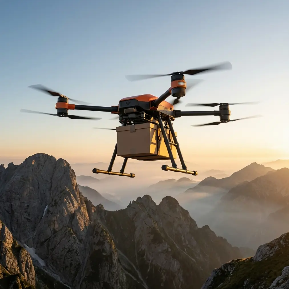
Standard monitoring drones struggle with mountainous stadiums, canyon-adjacent festival sites, and remote wilderness venues. The FlyCart 30 was built for exactly these scenarios—delivering payloads up to 30 kg while navigating elevation changes, unpredictable wind corridors, and extended distances that push beyond visual line of sight.
This guide breaks down the complete workflow for deploying the FC30 as a venue monitoring platform. You'll learn how to configure its systems, plan BVLOS routes through challenging topography, and avoid the costly mistakes that ground most operators.
Whether you're monitoring a multi-stage music festival spread across a mountain valley or surveilling a construction expo in a canyon setting, the principles here apply directly.
Step 1: Assess Your Venue and Terrain Profile
Before the FC30 leaves the ground, you need a detailed terrain profile of the entire venue and its surrounding airspace.
Gather Elevation Data
- Use SRTM or LiDAR-derived Digital Elevation Models (DEMs) at a minimum 1-meter resolution for the venue footprint.
- Identify the highest obstruction within a 2 km radius—this sets your minimum safe altitude baseline.
- Map all electromagnetic interference sources (broadcast towers, large LED screens, power infrastructure) that could disrupt communication links.
Classify Terrain Complexity
Not all "complex terrain" is equal. Categorize your venue using this framework:
| Terrain Class | Description | FC30 Altitude Recommendation |
|---|---|---|
| Class A – Moderate Hills | Rolling terrain, elevation changes under 50 m | 80–120 m AGL |
| Class B – Steep Valleys | Canyon walls, ridgelines, elevation changes 50–200 m | 120–150 m AGL |
| Class C – Extreme Alpine | Peaks, sheer cliffs, elevation changes exceeding 200 m | 150–200 m AGL |
Expert Insight: For most multi-venue monitoring operations in Class B terrain, flying at 130 meters AGL hits the sweet spot. This altitude keeps you above rotor wash turbulence reflected off canyon walls while maintaining strong downlink signal quality for real-time sensor feeds. Going higher than 150 m in these conditions often degrades camera resolution without meaningful safety gains.
Step 2: Configure the FC30 Payload for Monitoring
The FlyCart 30's payload ratio is what sets it apart from inspection-class drones. With a maximum takeoff weight of 95 kg and a maximum payload of 30 kg, you have substantial capacity to carry multi-sensor monitoring packages.
Recommended Monitoring Payload Stack
- Thermal imaging camera (e.g., radiometric thermal with 640×512 resolution) — approximately 1.2 kg
- Zoom optical camera with 40x hybrid zoom — approximately 0.8 kg
- Air quality sensor array (PM2.5, CO, NO₂) — approximately 2.5 kg
- PA speaker module for crowd communication — approximately 3 kg
- LED spotlight for night operations — approximately 1.5 kg
Total integrated payload: approximately 9 kg, leaving 21 kg of margin for supplementary equipment or emergency supply delivery via the winch system.
Using the Winch System for On-Demand Delivery
The FC30's winch system allows you to lower equipment, medical supplies, or communication devices to ground teams without landing. This is critical when:
- The venue has no safe landing zones nearby.
- You need to deliver supplies to a medical tent on a hillside mid-event.
- Ground access roads are congested or impassable.
The winch cable extends up to 20 meters, enabling precise drops into confined areas while the FC30 maintains a stable hover overhead.
Step 3: Plan BVLOS Routes Through Complex Airspace
Venue monitoring across complex terrain almost always requires Beyond Visual Line of Sight (BVLOS) operations. The FC30 supports this through its integrated ADS-B receiver, 4G/5G communication module, and redundant flight control systems.
Route Optimization Principles
Efficient route optimization for venue monitoring follows five rules:
- Minimize altitude transitions. Every climb and descent costs battery. Plan routes that follow terrain contours at a consistent AGL rather than a fixed AMSL.
- Use waypoint-based corridors. Define ingress and egress corridors with waypoints spaced no more than 500 meters apart in Class B terrain to maintain precise navigation.
- Build in loiter points. At critical venue zones (main stage, entry gates, VIP areas), program 60-second loiter holds so sensors can collect comprehensive data.
- Account for wind funneling. Valleys and ridgelines accelerate wind. Plan routes that approach ridgelines at 45-degree angles rather than perpendicular, reducing turbulence exposure.
- Set contingency waypoints. Pre-program at least 3 emergency landing zones along every route, verified for surface suitability and accessibility.
Technical Comparison: FC30 vs. Competing Platforms for Venue Monitoring
| Feature | FlyCart 30 | Competitor A (Heavy-lift Hex) | Competitor B (Fixed-wing VTOL) |
|---|---|---|---|
| Max Payload | 30 kg | 18 kg | 5 kg |
| Max Flight Time (loaded) | Up to 28 min at 15 kg | 22 min at 10 kg | 45 min at 3 kg |
| BVLOS Capability | Integrated ADS-B + 4G | Requires add-on module | Integrated |
| Winch System | Built-in, 20 m cable | Optional aftermarket | Not available |
| Emergency Parachute | Integrated dual-chute | Single chute optional | Whole-airframe chute |
| Dual-Battery Redundancy | Yes, hot-swappable | Single battery only | Dual battery |
| Wind Resistance | Up to 12 m/s | Up to 10 m/s | Up to 15 m/s |
| IP Rating | IP55 | IP43 | IP54 |
The FC30's combination of heavy payload capacity, integrated safety systems, and BVLOS readiness makes it the strongest option for complex terrain venue monitoring where fixed-wing platforms can't hover and lighter multirotors can't carry the necessary sensor payload.
Step 4: Deploy the Dual-Battery System Strategically
The FC30's dual-battery architecture isn't just a safety feature—it's a mission planning tool. Each battery pack operates independently, providing true redundancy. If one pack fails mid-flight, the remaining pack powers a controlled return to the nearest safe landing zone.
Battery Planning for Extended Monitoring
- Always plan missions to use no more than 70% of total battery capacity. The remaining 30% is your safety buffer for unexpected wind, rerouting, or extended hovers.
- In cold-weather venue monitoring (below 5°C), pre-heat batteries and reduce planned flight time by 15–20%.
- Use the FC30's telemetry to monitor individual cell voltages in real time. A voltage differential exceeding 0.1V between cells warrants an immediate return to base.
Pro Tip: For all-day venue monitoring events, set up two ground stations at opposite ends of the venue perimeter. Fly the FC30 in alternating legs—Station A to Station B and back—swapping batteries at each stop. This approach can deliver continuous aerial coverage for 8+ hours with just 4 battery sets and minimal downtime between swaps.
Step 5: Activate Safety Systems Before Every Flight
The FC30's emergency parachute system deploys automatically when onboard sensors detect a critical failure such as multi-motor loss or catastrophic IMU error. But relying solely on automatic activation is insufficient.
Pre-Flight Safety Checklist
- Verify parachute deployment altitude is set to at least 15 meters above the highest terrain feature on your route.
- Confirm ADS-B transponder is broadcasting correctly and receiving nearby traffic data.
- Test the Return-to-Home (RTH) function at low altitude before committing to the full route.
- Ensure the geofence is programmed to match your approved flight area—especially critical at public venues where airspace violations carry severe penalties.
- Validate communication link integrity at the maximum planned range before departure.
Common Mistakes to Avoid
1. Flying at a fixed AMSL altitude over variable terrain. This is the most dangerous error in complex terrain operations. A fixed altitude of 200 m AMSL might give you 150 m clearance at the valley floor but only 10 m clearance over a ridgeline. Always plan in AGL relative to terrain models.
2. Ignoring thermal updrafts near cliff faces. Rock faces heated by afternoon sun generate powerful updrafts that can push the FC30 off course. Schedule cliff-adjacent monitoring legs for morning hours before 10 AM when thermal activity is minimal.
3. Overloading the payload without recalculating flight time. Every additional kilogram reduces endurance. A 30 kg payload cuts flight time significantly compared to a 15 kg load. Always run updated endurance calculations with your actual payload weight before departure.
4. Skipping the winch system calibration. An uncalibrated winch can drop loads unevenly, creating swinging that destabilizes the aircraft in hover. Calibrate the winch with your actual delivery payload weight on the ground before every mission.
5. Neglecting backup communication links. In canyon environments, 4G signals can drop unexpectedly. Pre-configure the FC30 to fall back to its direct radio link if cellular connectivity drops below threshold, and program RTH activation if both links fail for more than 15 seconds.
Frequently Asked Questions
Can the FlyCart 30 operate in rain during venue monitoring missions?
Yes. The FC30 carries an IP55 rating, meaning it handles sustained rain and dust exposure. That said, heavy downpour with wind gusts exceeding 12 m/s should trigger a mission pause. Thermal cameras also lose effectiveness in heavy rain due to water droplet interference on the lens.
How far can the FC30 fly on a single BVLOS monitoring route?
The maximum operational range depends on payload weight and wind conditions. With a 15 kg monitoring payload in moderate wind (under 8 m/s), expect a practical round-trip range of approximately 16 km. Route optimization that minimizes altitude changes can extend this by 10–15%.
What regulatory approvals are needed for BVLOS venue monitoring?
Requirements vary by jurisdiction. In most regions, you need a specific BVLOS waiver or authorization from the national aviation authority, an operations manual detailing your contingency procedures, and proof of detect-and-avoid capability—which the FC30's ADS-B system partially satisfies. Work with a certified aviation consultant to secure approvals well before your event date, as processing times can exceed 90 days.
Ready for your own FlyCart 30? Contact our team for expert consultation.