FlyCart 30 for Urban Venue Monitoring: A Practical Guide
FlyCart 30 for Urban Venue Monitoring: A Practical Guide Built Around Direction, Not Gadget Chasing
META: Learn how to frame FlyCart 30 use in urban venue monitoring with a direction-first workflow, from route planning and payload logic to dual-battery resilience, winch operations, and emergency safety systems.
Most articles about the FlyCart 30 start with hardware. That is usually the wrong place to begin.
If you are responsible for monitoring an urban venue—stadiums, exhibition grounds, festival corridors, mixed-use plazas, waterfront event zones—the first decision is not the aircraft. It is the mission direction. What exactly are you trying to observe, verify, or move through the air? That distinction changes everything: route design, payload choice, battery strategy, launch position, and even whether the drone should hover, orbit, or simply pass through once and keep moving.
That idea may sound obvious, but it is often missed. One recent photography commentary made a sharp point that applies surprisingly well to drone operations: people tend to focus on improving technique while overlooking direction. It also noted that beginners usually gravitate toward an “all-in-one” setup with a very broad zoom range because they do not yet know what they are best at shooting or what they truly need to capture. For FlyCart 30 planning, the same trap appears in a different form. Teams chase a do-everything workflow, then wonder why the aircraft feels underused or oversized for the task.
Urban venue monitoring rewards the opposite approach. Start narrow. Define the operational direction first. Then let the FlyCart 30’s strengths support that mission.
Why “direction” matters more than raw capability
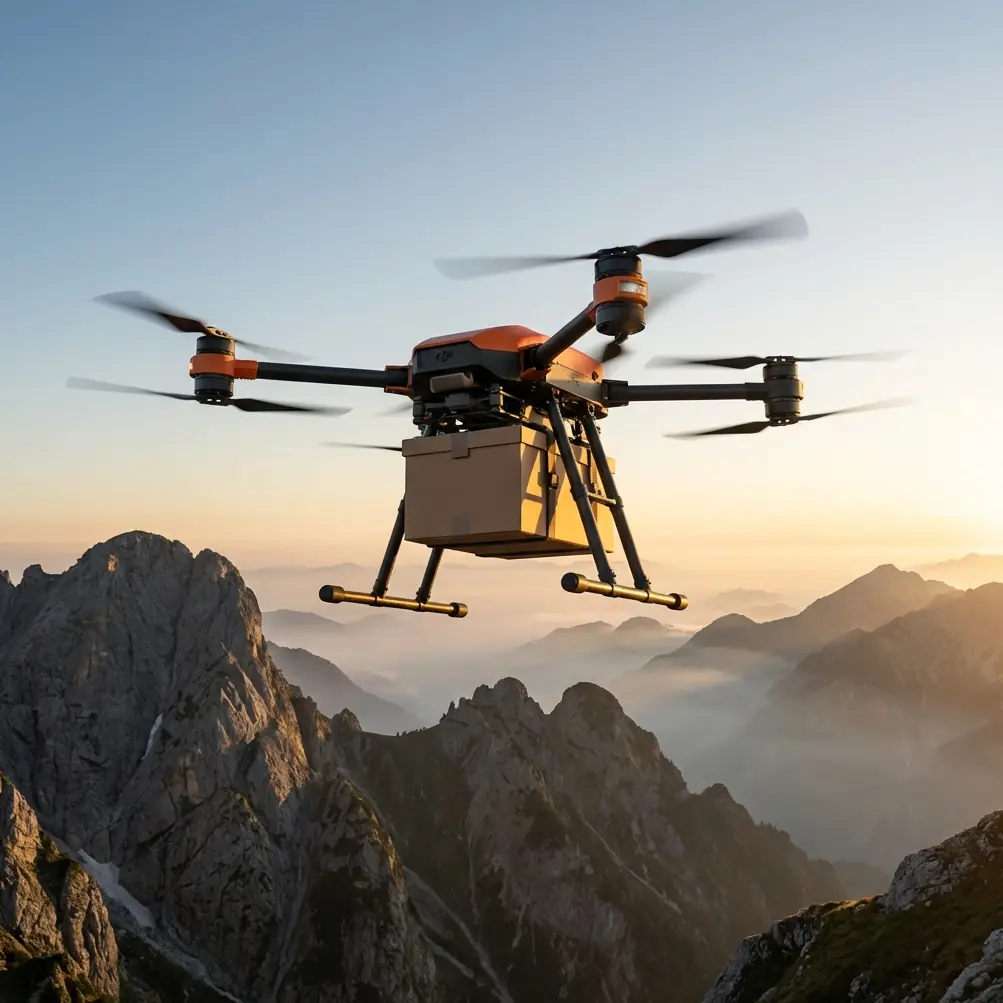
The FlyCart 30 has the kind of feature set that tempts operators into vague planning. It can carry meaningful loads, support different delivery or suspended-load workflows, and operate with systems such as a winch, dual-battery architecture, and emergency parachute safeguards. On paper, that flexibility looks like freedom. In practice, flexibility without mission clarity creates waste.
Consider three venue monitoring scenarios:
- Routine perimeter verification before opening
- Live-event overhead support for temporary equipment movement
- Rapid aerial inspection after a weather interruption
All three involve the same venue. All three may involve the same drone platform. Yet they are not the same mission.
A routine perimeter pass prioritizes repeatability, route optimization, and clean visual checkpoints. A live-event support flight may rely more on the winch system for moving small items into a constrained zone without landing. A post-weather inspection shifts attention to obstacle awareness, redundancy, and safe flight continuation in an environment where debris, birds, banners, and temporary structures may have changed since the last sortie.
The lesson is simple: the FlyCart 30 should not be treated as a flying Swiss Army knife just because it can adapt. That “one lens for everything” instinct is familiar in imaging, and it is just as common in drone deployment. The smarter path is to identify what the venue actually needs this week, this event cycle, and this hour.
A direction-first FlyCart 30 workflow for urban venues
Below is the framework I would use as a logistics lead when shaping a FlyCart 30 program for urban venue monitoring.
1) Define the monitoring outcome before the flight path
Do you need broad situational awareness, high-frequency spot checks, or aerial support tied to a ground crew? These are different jobs.
For example, a stadium operations team may say they need “monitoring.” That word is too loose. What they may actually need is:
- verification that rooftop assets remain secure,
- checks on loading-zone congestion,
- inspection of temporary fencing,
- observation of pedestrian buildup near secondary entrances,
- movement of lightweight equipment to a restricted upper deck.
Once that list exists, route optimization becomes meaningful. You are no longer flying to “look around.” You are flying to answer operational questions.
That is the operational significance of a direction-first mindset. It reduces unnecessary air time, avoids random hovering, and helps justify whether BVLOS procedures are relevant or whether line-of-sight staging is sufficient for the site.
2) Match payload logic to the mission, not to curiosity
Payload ratio matters in venue work because urban operations often force tradeoffs. If the aircraft is supporting monitoring while also carrying an accessory or small operational load, the team must understand what percentage of available lift is being consumed and how that affects endurance, route design, and reserve margins.
This is where many teams overbuild. They assume every flight should carry the most capable setup possible. That resembles the beginner photographer who chooses the widest possible zoom range for every outing. It works, technically. But it often sacrifices efficiency.
For FlyCart 30 operations, a better question is: what is the minimum airborne configuration required to complete this specific venue task safely and reliably?
That might mean:
- lighter mission planning for recurring visual checks,
- a winch-based load transfer when landing access is poor,
- separation of inspection flights from logistics flights rather than combining them awkwardly.
The significance here is operational discipline. Payload choices directly influence battery consumption, handling margins, and turnaround time. In dense urban venues, those variables matter more than theoretical versatility.
3) Use the winch system where ground access is the real bottleneck
The winch system is not just a convenience feature. In venue environments, it can be the difference between a practical aerial workflow and a disruptive one.
Urban venues are full of no-landing zones: crowded concourses, rooftops with limited clearance, temporary stage areas, fenced media compounds, grandstands, and service decks. A winch allows the aircraft to remain in a safer hover position while lowering or retrieving an item. That reduces the need to bring the drone into tighter physical proximity with structures or people.
Operationally, this matters in two ways.
First, it preserves the separation buffer around the aircraft. Second, it can shrink the ground footprint of the mission. Fewer people need to move into constrained areas to receive or pass equipment if the handoff point is planned correctly.
For monitoring teams, this can support tasks such as transferring a radio battery, replacing a small sensor pack, or moving a compact emergency item to a rooftop checkpoint. It also helps keep event operations flowing instead of forcing a temporary shutdown around a landing zone.
4) Treat dual-battery redundancy as planning leverage, not just backup
Dual-battery design is often discussed as a safety feature, which it is. But in urban venue monitoring, it is also a planning asset.
Redundancy changes how confidently a team can schedule repeated flights across a busy site. It supports continuity when the mission must cover multiple checkpoints in one sortie and when return timing cannot be left to guesswork. This is especially relevant if the venue has time-sensitive windows between crew movement, audience arrival, and live programming.
The practical benefit is not “longer is always better.” It is that route optimization becomes more honest. You can create routes around actual inspection priorities and reserve logic rather than constantly compressing the mission out of fear of an overly fragile power plan.
That does not remove the need for conservative margins. It does mean the aircraft is better suited to structured venue programs where repeatability matters.
5) Build emergency parachute logic into the operating concept
An emergency parachute should never be treated as a marketing bullet. In urban settings, it belongs in the risk model from the beginning.
Venue monitoring places aircraft near structures, service roads, temporary installations, and sometimes crowds at the edges of controlled zones. Even if the operating area is carefully managed, the environment remains less forgiving than an open rural field. An emergency parachute system adds a layer of mitigation that can be significant when designing standard operating procedures.
Its real value is not abstract. It affects where you choose to stage from, how you set corridor boundaries, and how you brief non-flight staff. When teams know the aircraft includes this safeguard, they can integrate it into a broader safety case rather than pretending risk can be eliminated.
That distinction matters. Mature drone programs do not rely on a single feature. They stack protections: route discipline, altitude planning, exclusion zones, crew communications, battery management, and fail-safe systems.
A field example: when sensors mattered more than the schedule
One of the more memorable venue-adjacent operations I’ve seen involved a waterfront event district at dawn. The assignment was routine: inspect the roofline of temporary hospitality structures, verify cable runs, and check access lanes before vendors opened. The route had already been optimized the previous day.
Then a large grey heron appeared near a drainage channel beside the site and lifted unexpectedly across the planned path.
That sounds minor until you consider the environment. Urban venues can still attract wildlife—especially near parks, rivers, marinas, or landscaped retention areas. The problem is not only animal safety. A bird encounter can disrupt a tightly timed route and create avoidable close-proximity corrections around structures.
In that case, the aircraft’s sensing and obstacle awareness behavior helped the operator break the sequence cleanly, hold position, and reroute around the movement rather than forcing the timeline. That is exactly why route optimization should never become route rigidity. Sensors are there to support real-world variability. And the real world includes wildlife, not just scaffolding and concrete.
The lesson for FlyCart 30 operators is practical: venue maps are static; venue environments are not.
When BVLOS enters the conversation
For some urban venue owners, BVLOS sounds attractive because it suggests broader coverage with fewer repositioning stops. Sometimes that is true. Sometimes it is unnecessary.
The right question is whether BVLOS actually improves the monitoring outcome for the site. If the venue has long, segmented corridors between operational zones, remote service areas, or linked campuses, a BVLOS-capable framework may support more efficient oversight. If the venue is compact and airspace complexity is high, a tightly controlled visual-line workflow may be cleaner and easier to manage.
That is another reason the direction-first model works. It prevents regulatory ambition from outrunning operational need.
If your venue program is still being scoped, a quick mission-planning discussion often resolves this faster than a hardware debate. If you need a second set of eyes on route logic or operating assumptions, you can message the team here.
A practical tutorial: how I would set up an FC30 venue monitoring program
Here is the sequence I recommend.
Step 1: Split missions into categories
Do not mix everything into one flight plan. Separate:
- visual inspection,
- logistics support,
- urgent response checks,
- recurring perimeter verification.
Step 2: Assign a payload envelope to each category
Estimate the load requirement, then assess payload ratio against expected route length and reserve. Avoid carrying capacity you do not need.
Step 3: Identify no-landing zones early
If the venue has roofs, terraces, stage decks, or dense service corridors, decide where the winch system creates a safer handoff than a landing attempt.
Step 4: Build battery and recovery thresholds into SOPs
Dual-battery architecture helps, but it should lead to disciplined thresholds, not complacency.
Step 5: Map dynamic hazards, not just permanent ones
Bird activity, temporary signage, cranes, inflatables, and seasonal structures deserve a place in the route review.
Step 6: Decide whether monitoring is periodic or event-triggered
A daily pre-opening sweep is different from a post-storm inspection or a live operations support flight.
Step 7: Review emergency actions in plain language
Every ground stakeholder should understand what happens if the aircraft aborts, reroutes, or activates a safety response.
The bigger takeaway for FlyCart 30 users
The most useful insight from the source material is not even about drones. It is about decision quality.
People often overemphasize technical improvement and underemphasize direction. In photography, that leads beginners toward broad, general-purpose gear before they know what they actually want to shoot. In venue drone operations, it leads teams to build generalized workflows before they know what outcomes they are measuring.
The FlyCart 30 is at its best when used with intent.
If your venue needs structured urban monitoring, the aircraft’s value comes from how its systems align with real tasks: payload ratio discipline, winch-enabled access where landing is impractical, dual-battery resilience for repeatable operations, and emergency parachute planning for dense environments. Add route optimization and sensible decisions around BVLOS, and you have something far more useful than a spec sheet. You have a working program.
That is what separates a capable drone from a capable operation.
Ready for your own FlyCart 30? Contact our team for expert consultation.