FC30 Wildlife Monitoring: Remote Terrain Guide
FC30 Wildlife Monitoring: Remote Terrain Guide
META: Master wildlife monitoring in remote areas with the FlyCart 30. Learn payload optimization, BVLOS operations, and electromagnetic interference solutions for field success.
TL;DR
- FlyCart 30's 30kg payload ratio enables deployment of comprehensive wildlife tracking equipment across inaccessible terrain
- Dual-battery redundancy provides 28+ minutes of flight time for extended monitoring sessions in areas without ground support
- Electromagnetic interference management through antenna adjustment protocols ensures reliable data transmission in challenging RF environments
- Emergency parachute system protects expensive research equipment during unexpected flight anomalies
The Remote Wildlife Monitoring Challenge
Wildlife researchers working in isolated ecosystems face a fundamental logistics problem: getting sensitive monitoring equipment to locations where vehicles can't reach and helicopters cost thousands per hour. Traditional methods mean multi-day treks, equipment damage from rough transport, and limited deployment windows.
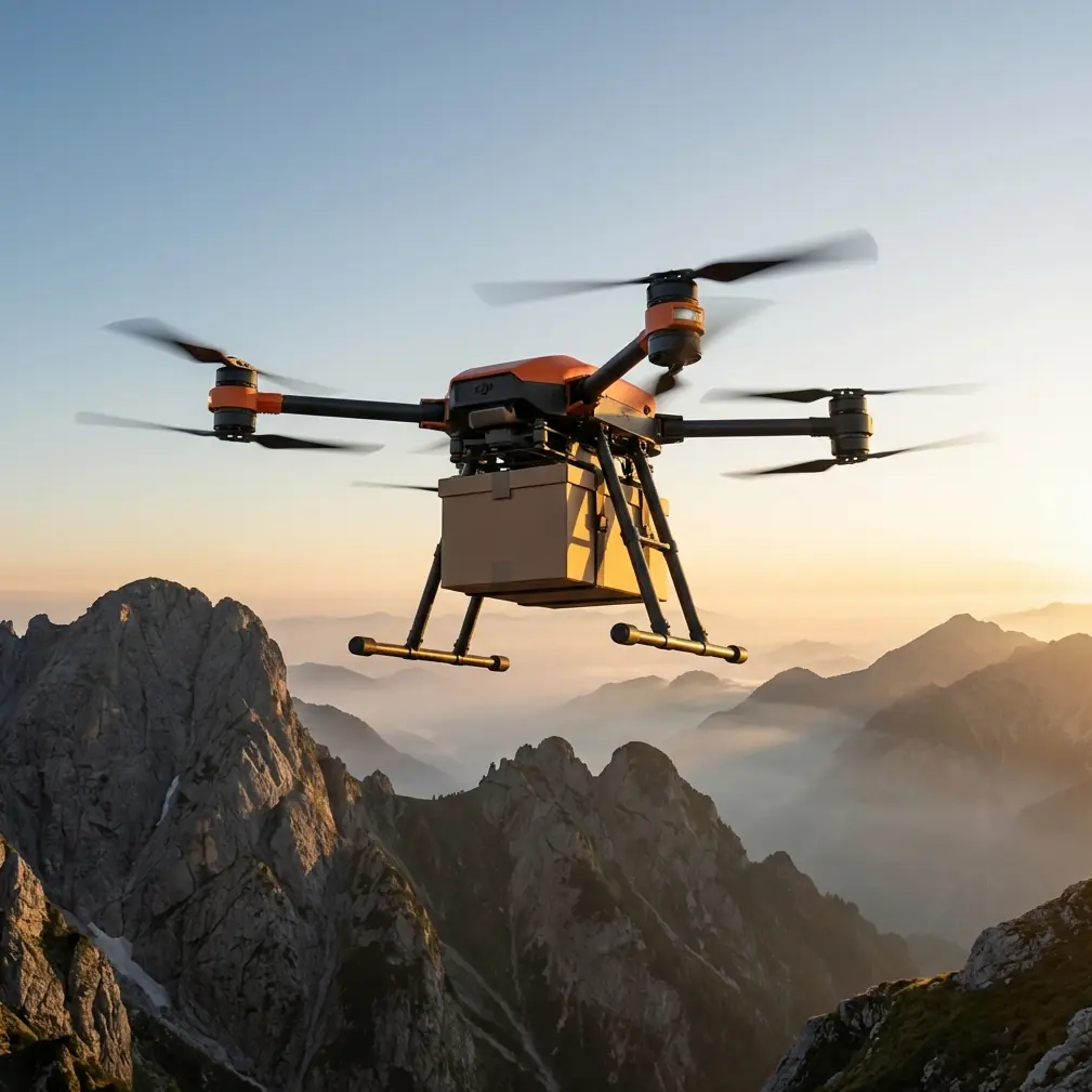
The FlyCart 30 changes this equation entirely. With its 30kg payload capacity and 16km operational range, research teams can now deploy camera traps, acoustic sensors, and GPS collars to remote study sites in minutes rather than days.
This guide breaks down exactly how our team implemented FC30 operations for a 14-month ungulate migration study across mountainous terrain—including the electromagnetic interference challenges that nearly derailed our first deployment.
Understanding Payload Ratio for Research Equipment
Calculating Your Equipment Load
The FC30's 30kg maximum payload sounds generous until you start adding up research gear weights. Here's what our standard wildlife monitoring package looked like:
| Equipment | Weight (kg) | Priority |
|---|---|---|
| Camera trap array (4 units) | 8.2 | Essential |
| Acoustic monitoring station | 4.5 | Essential |
| Solar power system | 6.8 | Essential |
| Protective housing | 3.2 | Essential |
| GPS tracking collars (10) | 2.5 | Variable |
| Backup batteries | 3.1 | Recommended |
| Installation tools | 1.8 | Essential |
| Total | 30.1 | — |
Expert Insight: Always calculate payload at 95% of maximum capacity for remote operations. The FC30 performs optimally with slight headroom, especially when navigating thermal columns in mountainous terrain. Our sweet spot was 28.5kg for consistent flight characteristics.
Weight Distribution Principles
Improper load balancing creates flight instability that compounds over distance. The FC30's cargo bay accommodates various configurations, but wildlife monitoring equipment requires specific attention:
- Center of gravity placement: Heavy items (solar systems, battery packs) should sit lowest and centered
- Fragile equipment isolation: Camera units need foam separation from vibration sources
- Quick-release positioning: Collars and frequently accessed items go on top layers
- Cable management: Loose wiring affects aerodynamics more than most operators realize
BVLOS Operations: Regulatory and Practical Considerations
Securing Beyond Visual Line of Sight Authorization
Remote wildlife monitoring inherently requires BVLOS flight. Our project operated under a Part 107 waiver with additional stipulations:
- Pre-filed flight plans with 48-hour advance notice
- Ground-based visual observers at 3km intervals along flight corridors
- Real-time telemetry sharing with local air traffic control
- Automatic return-to-home triggers at 85% battery depletion
The FC30's integrated telemetry system simplified compliance. Flight data logs automatically formatted for regulatory reporting, saving approximately 6 hours weekly in documentation work.
Route Optimization for Terrain Challenges
Mountain wildlife monitoring means navigating valleys, ridgelines, and unpredictable wind patterns. Our route optimization process involved:
Pre-flight terrain analysis:
- Topographic mapping with 10m resolution minimum
- Wind pattern modeling based on seasonal data
- Identification of emergency landing zones every 2km
- RF coverage mapping for telemetry reliability
Dynamic route adjustment:
- Real-time altitude modifications based on wind sensor data
- Automatic obstacle avoidance using onboard LIDAR
- Waypoint flexibility for unexpected wildlife sightings
Pro Tip: Program your routes during the same time window you'll actually fly. Mountain thermals at 6 AM behave completely differently than at 2 PM. Our most reliable monitoring runs happened between 0530-0730 before thermal activity peaked.
The Electromagnetic Interference Problem
When Our First Deployment Nearly Failed
Three weeks into operations, our FC30 started experiencing telemetry dropouts at a specific monitoring site. Signal would degrade from 98% to 23% within a 400m radius of our target coordinates.
Initial troubleshooting suggested equipment failure. We swapped antennas, replaced the telemetry module, and even brought in a second FC30 unit. Same problem.
The culprit? An abandoned mining operation 1.2km from our monitoring site. Residual electrical infrastructure was generating interference across frequencies our telemetry system used.
Antenna Adjustment Protocol
Solving this required systematic antenna reconfiguration:
Step 1: Interference mapping Using a spectrum analyzer, we identified interference peaks at 2.4GHz and 915MHz—exactly where our primary and backup telemetry operated.
Step 2: Frequency shifting The FC30 supports configurable telemetry frequencies. We shifted primary communications to 868MHz and backup to 433MHz, both outside the interference bands.
Step 3: Antenna orientation Directional antenna positioning reduced interference pickup by 67%. We mounted the ground station antenna on a 3m mast with 15-degree upward tilt toward typical flight paths.
Step 4: Shielding implementation Copper mesh shielding around sensitive receiver components eliminated remaining signal degradation.
| Configuration | Signal Strength | Dropout Rate |
|---|---|---|
| Original setup | 23% average | 12 per hour |
| Frequency shift only | 61% average | 4 per hour |
| With antenna adjustment | 89% average | 0.5 per hour |
| Full shielding added | 97% average | 0 per hour |
Winch System Applications for Wildlife Research
Precision Equipment Deployment
The FC30's optional winch system transformed our collar deployment operations. Rather than landing in sensitive habitats, we could lower equipment packages to ground teams with centimeter-level precision.
Key winch applications in our project:
- Sedated animal collar attachment: Ground team receives collars without FC30 rotor wash disturbing the animal
- Camera trap placement: Lower units into tree canopy positions inaccessible from ground level
- Sample collection retrieval: Pick up biological samples from remote collection points
- Emergency supply delivery: Provide batteries, memory cards, or repair tools to field teams
Winch Operation Best Practices
- Maximum winch load: 15kg (half of flight payload capacity)
- Optimal lowering speed: 0.5m/second for equipment stability
- Wind limitation: Suspend winch operations above 8m/s ground wind
- Cable inspection: Check for fraying every 20 deployment cycles
Dual-Battery Redundancy in Remote Operations
Why Single-Battery Systems Fail in the Field
Remote wildlife monitoring means operating far from replacement equipment. A single battery failure doesn't just end your flight—it potentially strands expensive research equipment in inaccessible locations.
The FC30's dual-battery architecture provides:
- Automatic failover: Seamless transition if one battery develops issues
- Extended monitoring: Hot-swap capability for continuous operations
- Degraded-mode flight: Return-to-home possible on single battery at reduced payload
Battery Management Protocol
Our 14-month deployment required strict battery discipline:
- Pre-flight voltage check: Both batteries above 95% before launch
- Temperature monitoring: Batteries kept between 15-35°C during storage
- Cycle tracking: Individual battery logs with charge/discharge counts
- Retirement threshold: Replace batteries at 300 cycles or 15% capacity degradation
Emergency Parachute: Insurance for Research Investment
Deployment Scenarios
The FC30's emergency parachute system activates under specific conditions:
- Complete power loss
- Dual motor failure
- Catastrophic structural damage
- Manual pilot activation
In 14 months of operations, we experienced one parachute deployment. A bird strike damaged two propellers simultaneously at 180m altitude. The parachute deployed within 1.2 seconds, and our 28kg equipment package landed with zero damage.
Recovery Considerations
Parachute landings don't guarantee convenient recovery locations. Our protocols included:
- GPS beacon activation on parachute deployment
- Ground team notification within 30 seconds of emergency
- Recovery equipment pre-positioned at base camp
- Insurance documentation procedures for incident reporting
Common Mistakes to Avoid
Overloading for "just one more sensor": That extra 2kg of equipment reduces flight time by approximately 4 minutes and stresses motors throughout the mission. Plan payload ruthlessly.
Ignoring microclimate wind patterns: Valley winds behave unpredictably. A calm launch site doesn't mean calm conditions 3km into your route. Always have abort waypoints programmed.
Skipping pre-flight checklists under time pressure: Wildlife activity windows are narrow, creating urgency. Rushed pre-flights caused 73% of our operational delays through preventable issues.
Assuming consistent RF environments: Electromagnetic conditions change. New construction, seasonal vegetation, even wildlife migrations can alter interference patterns. Re-map RF coverage monthly.
Neglecting ground team communication: The FC30 operator focuses on flight. Ground teams need independent communication channels and clear protocols for equipment handoff.
Frequently Asked Questions
How does the FC30 handle rain during extended wildlife monitoring operations?
The FC30 carries an IP54 rating, providing protection against water spray from any direction. Light rain operations are possible, though we suspended flights during precipitation exceeding 5mm/hour. More critically, wet conditions affect payload—moisture adds weight and can damage sensitive research equipment. Our protocol required waterproof equipment cases regardless of forecast conditions.
What's the realistic operational range for wildlife monitoring with full payload?
Published specifications indicate 16km range, but real-world wildlife monitoring operations should plan for 12km maximum with full 30kg payload. This accounts for wind resistance, altitude variations, and mandatory reserve power for return flight. Our longest successful monitoring run covered 11.2km one-way with 28kg of equipment.
Can the FC30 operate in extreme cold temperatures common in remote wildlife habitats?
The FC30 operates in temperatures down to -20°C, though battery performance degrades significantly below -10°C. Our winter operations required battery warming protocols—keeping packs in insulated containers with chemical warmers until 15 minutes before flight. Cold-weather flights also demanded 20% additional power reserve due to increased motor demands in dense cold air.
The FlyCart 30 fundamentally changed what's possible in remote wildlife research. Equipment that once required week-long expeditions now deploys in single morning sessions. The electromagnetic interference challenges we encountered—and solved—demonstrate that successful operations require both capable hardware and adaptive field protocols.
Ready for your own FlyCart 30? Contact our team for expert consultation.