Scouting Autumn Lake Venues With the FlyCart 30
Scouting Autumn Lake Venues With the FlyCart 30: Practical Tips for Feiran Lake Conditions
META: A field-driven guide to using the DJI FlyCart 30 for venue scouting in changing temperatures, inspired by Chongqing’s Feiran Lake pink muhly grass bloom and real commercial drone planning needs.
When people think about scouting a venue, they usually picture a camera drone, a few orbit shots, and a tidy folder of images for the client. That works until the site gets crowded, the weather swings between warm sun and cool wind, and the terrain starts imposing its own rules.
Feiran Lake in Chongqing’s Shapingba District is a good example of a location that looks simple from the road and becomes more complex once you plan an actual commercial operation. During the peak bloom of pink muhly grass, the area shifts into a dense seasonal attraction. The pink fields, the green lake, and the surrounding hills create exactly the kind of layered visual environment that draws visitors with phones, photographers with tripods, and venue teams trying to understand how to manage access, logistics, and timing. That combination matters if you are considering the FlyCart 30 as more than a cargo aircraft and using it as a serious site-scouting platform for operational planning.
I’m approaching this from a logistics lead perspective, not from a tourism angle. The question is not whether the site is beautiful. It clearly is. The useful question is what a platform like the FlyCart 30 can tell you about a place like this when temperatures vary, foot traffic rises, and access routes become less reliable than they looked on a map.
Why a flower-lake venue is a real test case
The news detail that Feiran Lake’s pink muhly grass is in full bloom sounds aesthetic on the surface. Operationally, it signals three things.
First, seasonal density. A venue that attracts “many residents and tourists” for viewing, photos, and leisure is not an empty landscape. It is a dynamic public environment. Your scouting plan has to account for temporary human flow patterns, parked vehicles, informal footpaths, and ad hoc activity clusters.
Second, visual complexity. Large pink floral zones beside green water and backed by hills create strong color contrast and shifting light conditions. That is useful for mapping sightlines and identifying presentation angles, but it also exposes where glare, shadow bands, and wind-exposed sections can complicate route planning.
Third, environmental variation. Warm autumn sun over open grassland near water often produces local micro-changes in air movement and temperature feel, especially between exposed shoreline edges and sheltered areas near slopes. For drone teams scouting venues in extreme temperatures—or even just in strong day-night swings—this matters more than the postcard view.
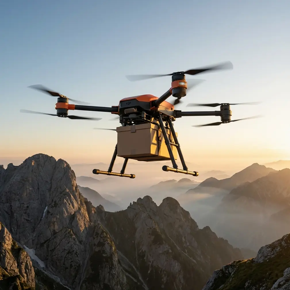
That’s where the FlyCart 30 enters the discussion in a different way. It is not a conventional lightweight scout aircraft. Its value comes from how its transport-oriented architecture can support field evaluation for sites where access, payload movement, and operational continuity are part of the project.
Start with the real mission, not the drone
If you are scouting a venue like Feiran Lake, define the task in layers.
A tourism operator may want to identify the safest and least disruptive equipment staging points during peak bloom. An event services team may need to know whether décor, signage, power units, or temporary shelters can be moved into position without damaging sensitive landscape areas. A land manager may want to study how public congregation shifts throughout the day. A content team may simply need to understand which hill-facing or lake-facing zones hold up best under changing light.
The FlyCart 30 becomes relevant when your scouting mission includes logistics intelligence, not just imagery.
Its payload ratio matters here because venue reconnaissance often turns into a mixed mission. You are not only observing. You may be testing delivery feasibility for sensors, markers, lightweight support equipment, or communications relays. A drone that can carry meaningful loads changes how quickly a team can validate whether a lakeside site is practical under field conditions.
That sounds abstract until you apply it to Feiran Lake. During the bloom, areas of pink grass become visually compelling but physically sensitive. Ground teams walking repeatedly through or around those zones can disturb the visitor experience and put pressure on fragile areas. Using a platform with serious lift capacity allows a team to move selected gear in and out while minimizing repeated foot access through crowded or delicate sections.
How to scout in temperature swings without losing the mission
The “extreme temps” scenario is often misunderstood. It does not always mean desert heat or snowfield operations. In venue scouting, it often means a location where conditions shift enough across the day to affect batteries, route timing, and landing discipline.
At a hill-and-lake site, you can see a warm midday surface environment and a much cooler late afternoon profile, especially when autumn wind moves across open water. For FlyCart 30 teams, the dual-battery setup becomes operationally significant because it helps stabilize planning for longer field windows and repeated short-hop tasks. When the site is busy and timing matters, battery resilience is not just a spec-sheet talking point. It affects whether you can complete a mapping loop, reposition to a backup route, and still keep reserve margin for a safe return.
That reserve matters even more in scenic public spaces, where you don’t want to improvise around pedestrian movement.
My recommendation is to break venue scouting into three thermal periods:
1. Early light assessment
Use the first pass to identify dew-prone surfaces, cool-air pooling areas near the lake edge, and any slope shadows that may influence visual clarity or landing options.
2. Midday route verification
This is the best time to test route optimization around crowd concentration. The pink bloom at Feiran Lake is precisely the kind of attraction that compresses visitors into a few “must-shoot” zones. Plan around those choke points rather than through them.
3. Late-day risk review
As the light softens and wind character changes, reassess whether your original paths still make sense. Sites framed by water and hills rarely behave the same way at 4 p.m. as they did at 11 a.m.
Using the winch system for smarter site validation
One of the most underrated advantages in a venue-scouting workflow is the winch system. Most people associate it with delivery, but for scouting it can function as a precision placement tool.
At a flower-lake venue, you may need to place lightweight survey markers, test communication nodes, or drop small environmental sensors in spots where frequent foot traffic would be intrusive. A winch allows that without forcing a landing in every zone you need to evaluate.
That becomes useful at Feiran Lake because the attraction is the landscape itself. The pink muhly grass is the visual asset. You do not want repeated ground disturbance in or around the most photogenic sections if your goal is to preserve conditions while still collecting planning data.
The operational significance is simple: a winch-equipped workflow can reduce surface contact, shorten setup time, and lower the disruption footprint in visitor-heavy areas.
BVLOS planning is a discipline, not a shortcut
BVLOS is often discussed as range freedom. That misses the point. For venue scouting, BVLOS only makes sense when it is tied to route discipline, airspace compliance, and strong situational awareness.
At a place like Feiran Lake, surrounded by hills and shaped by shoreline curves, route optimization is not just about the shortest line between two points. It is about maintaining stable link quality, preserving contingency options, and avoiding visual hotspots where public activity is concentrated.
If you are planning repeated operational support at a seasonal venue, a BVLOS-ready mindset helps you build a reliable corridor structure:
- one route for primary observation,
- one route for secondary access,
- one contingency corridor for recovery or mission interruption.
This is where the FlyCart 30’s logistics DNA becomes practical. You are not trying to squeeze cinematic spontaneity from the aircraft. You are building repeatable paths that support venue management, equipment movement, and low-disruption oversight.
The wildlife moment that changed our route logic
On one autumn scouting pass at a lakeside venue with similar hill-water conditions, the aircraft’s sensors flagged movement near a low transit line we had considered “clean.” It turned out to be a pair of waterbirds lifting suddenly from the shoreline reeds and crossing into our projected path. Not dramatic, but enough to force an immediate route adjustment.
That incident changed the way we build venue surveys around lakes and bloom fields. Seasonal attractions draw people, but they also concentrate quiet wildlife activity in edge habitats where water, grass, and shelter meet. The lesson was not simply “watch for birds.” The lesson was to stop assuming scenic margins are operational margins.
For FlyCart 30 teams, obstacle sensing and route discipline work together here. Sensor awareness is only useful if your route planning leaves room to respond without compressing safety margins. At a place like Feiran Lake, where pink grass, lakeside edges, and surrounding green hills create a layered habitat as well as a scenic one, that flexibility should be built into every survey segment.
Emergency systems matter more in public leisure spaces
Public-facing scenic venues are the wrong place for optimism-based flight planning.
That is why an emergency parachute system deserves to be treated as part of the venue-scouting equation, not as an afterthought. In a commercial context, especially around visitors gathering for photos and leisure, redundancy is part of responsible planning. If your route crosses near pathways, viewing points, or temporary activity zones, emergency mitigation directly affects whether the site is suitable for repeat drone-supported logistics.
This matters at Feiran Lake because the bloom itself attracts people into visually dense clusters. The more attractive the scene, the more concentrated the public presence can become. Any platform used there must be assessed not only for capability, but for how well it supports conservative operating practices under crowd-adjacent conditions.
A practical FlyCart 30 checklist for a venue like Feiran Lake
If I were preparing a FlyCart 30 team to scout a seasonal venue with flower fields, lake edges, and mixed temperatures, I would focus on six things:
1. Define the logistics question
Are you scouting views, equipment access, temporary staging, or recurring supply movement? The answer determines the route.
2. Map the crowd magnets first
At Feiran Lake, the pink bloom itself is the traffic engine. Build your no-interference logic around the photo hotspots.
3. Use payload capability with intent
Do not treat lift capacity as excess. Use it to move the specific gear that reduces repeated foot intrusion into sensitive or crowded spaces.
4. Use the winch where landing would be disruptive
This is often the cleanest way to place or retrieve lightweight field tools near landscape attractions.
5. Segment operations by temperature window
Dual-battery planning works best when matched to the site’s actual thermal rhythm, not generic assumptions.
6. Keep a wildlife buffer in the route model
Lakeside grass and low vegetation edges are active spaces, even when they look empty.
If you want to compare route ideas or field setups for a public scenic venue, this FlyCart 30 planning chat is a straightforward place to discuss it.
What Feiran Lake really teaches FlyCart 30 operators
The most useful takeaway from the Feiran Lake bloom story is not that the site is visually impressive, though it clearly is. It is that attractive seasonal venues are operationally layered. The pink muhly grass in full bloom draws visitors. The lake and hills shape movement, light, and air behavior. The public presence changes what “safe and efficient” means. And the landscape’s sensitivity changes how you should think about access.
That is why the FlyCart 30 belongs in this conversation. Not as a sightseeing tool, but as a platform for serious venue intelligence where cargo logic, route optimization, battery resilience, and controlled placement all matter.
Scouting a site in changing temperatures is really about reducing uncertainty. On a venue like Feiran Lake, uncertainty comes from crowd flow, terrain, microclimate, habitat edges, and access limitations all happening at once. The right aircraft does not remove that complexity. It gives you a structured way to measure it before the actual operation begins.
Ready for your own FlyCart 30? Contact our team for expert consultation.