How to Use the FlyCart 30 for Windy Power Line Surveys Witho
How to Use the FlyCart 30 for Windy Power Line Surveys Without Letting Wide-Angle Footage Work Against You
META: Practical FlyCart 30 guidance for windy power line surveys, with wide-angle camera technique, EMI antenna setup, route planning, and safer data capture workflows.
Power line surveying in wind is rarely limited by airframe stability alone. The real bottleneck is often image discipline. Crews come home with hours of footage, only to find the useful frames buried under edge distortion, cluttered compositions, or perspective that makes conductor spacing harder to judge than it was in the field.
That is why one recent photography note about ultra-wide shooting matters more to FlyCart 30 operators than it may seem at first glance. The core lesson is simple: an ultra-wide lens can create dramatic visual impact, but if the operator does not control the field of view, the frame becomes chaotic, the edges deform, and a full day of flying can yield little operational value. The same source also grounds the definition: ultra-wide generally means a focal length under 24 mm. That detail is not trivia. For utility inspection teams, it is the dividing line between “I captured the corridor” and “I captured a broad scene that tells me less than I think.”
If you are surveying power lines with the FlyCart 30 in windy conditions, this is the practical takeaway: the aircraft can carry the mission, but your camera choices determine whether the data is useful.
Why this matters specifically for the FlyCart 30
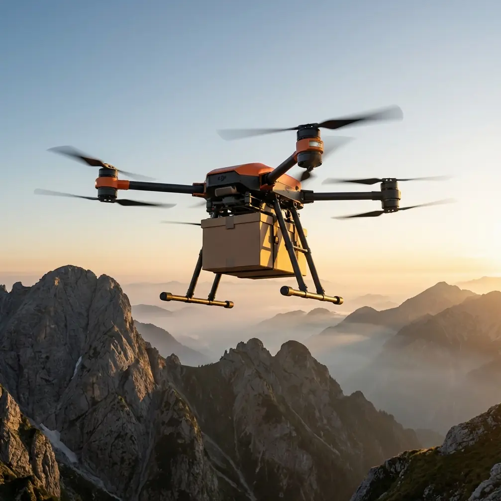
The FlyCart 30 is usually discussed through transport language: payload ratio, winch system behavior, dual-battery endurance logic, and its suitability for demanding field operations. All of that matters. But on power line work, especially in wind, the aircraft becomes part hauler and part sensor platform. That changes the standard workflow.
On a windy route, line crews are often balancing three pressures at once:
- Maintain safe offset from energized infrastructure
- Hold a stable enough viewing angle to inspect hardware and conductor clearance
- Cover enough corridor length to keep the mission efficient
An ultra-wide setup sounds like the answer because it captures more in a single pass. In reality, it can reduce inspection confidence if the image geometry gets sloppy. The recent photography guidance warns that wider is not automatically better, and that principle applies directly here. When a lens falls below 24 mm, its broad field of view and stronger perspective exaggeration can stretch space in ways that look impressive but distort spatial judgment.
For a social clip, that is fine. For a utility survey, it can mislead your eye around insulator alignment, pole-top hardware spacing, vegetation encroachment, or the relative position of conductors in crosswind conditions.
Start with the mission, not the lens
I approach windy power line surveys as a logistics problem first. That mindset keeps crews from overflying a corridor just because the image feed feels cinematic.
Before launch, define which of these jobs you are actually doing:
- Corridor awareness over a long segment
- Defect identification on structures and hardware
- Clearance review near vegetation or terrain
- Access planning for downstream repair crews
- Material placement support using the winch system
Each of those calls for a different camera behavior.
If the goal is corridor awareness, a wide view helps. If the goal is hardware review, too much width can bury the actual point of interest in a noisy frame. The photography source puts this well in practical terms: many first-time ultra-wide users end up with cluttered images, severe edge deformation, or a wide field they never truly controlled. That exact failure mode shows up in drone inspection all the time.
With the FlyCart 30, you should not ask, “How much can I fit in the frame?” Ask, “What decision will this image support?”
That one shift improves route optimization immediately.
The right way to use ultra-wide during windy inspections
Ultra-wide imagery is still valuable. You just need to use it in a disciplined way.
The referenced photography note highlights the strengths of sub-24 mm shooting: broad view, strong perspective, expanded sense of space, and more dramatic visual separation. In power line surveying, those strengths become operationally useful in four situations.
1. Corridor entry and context passes
At the start of a route, an ultra-wide view helps establish terrain, tower sequence, access roads, and nearby structures in one glance. In wind, this matters because drift and gust patterns often correlate with terrain features such as ridgelines, cut corridors, and open agricultural sections.
A short context pass gives the team a better map of how wind will likely behave across the route. You are not trying to inspect every component here. You are building spatial awareness.
2. Tight right-of-way environments
Where lines run near buildings, tree walls, or uneven ground, a wider field can help maintain standoff distance while still showing the full interaction between the asset and its surroundings. That is useful for safety, and it is one of the few times the “stretching space” effect becomes an asset rather than a problem.
Still, keep critical components away from the extreme frame edges. That is where shape distortion becomes most misleading.
3. Interior-like structure views
The source specifically lists architecture and indoor spaces among strong ultra-wide use cases. In utility work, the parallel is substation-adjacent areas, under-structure positioning, or close corridor segments where visual space feels compressed. The wider perspective can help reveal relationships between conductors, support elements, and obstacles that are hard to read with a narrower lens.
4. Access and delivery planning
If the FlyCart 30 is supporting field teams with tools, replacement hardware, or rope kits via its winch system, a wide perspective helps confirm drop-zone geometry. In wind, that extra context matters because pendulum behavior and obstacle proximity become more critical than the package itself.
When ultra-wide hurts your survey
This is where experienced operators separate usable inspection data from pretty but weak documentation.
Avoid relying on ultra-wide footage when:
- You need accurate visual assessment of component condition
- The subject sits near frame corners
- The line corridor already has strong visual clutter
- You are flying oblique angles in gusty crosswinds
- You need to compare repeated shots across multiple structures
A wide field of view can make a conductor look farther from vegetation than it really is. It can make tower geometry feel exaggerated. It can also make minor tilt errors appear acceptable because the image looks expansive, even while important references are bending at the edges.
That is why “wider is not better” is not just a photography tip. It is a survey integrity rule.
Handling electromagnetic interference with antenna adjustment
Power line work adds another complication: electromagnetic interference. Wind makes it worse because the aircraft is already spending more energy stabilizing, and any interruption in signal confidence increases pilot workload.
For the FlyCart 30, antenna adjustment is not a ceremonial preflight step. It directly affects command reliability and video consistency near energized lines.
My field method is straightforward:
- Keep the aircraft body orientation predictable during inspection legs
- Adjust the controller antenna angle so the strongest pattern faces the expected flight path, not the ground
- Avoid standing where steel structures, vehicles, or temporary site equipment reflect or block signal
- Reassess antenna orientation when shifting from longitudinal corridor flight to side-on structure review
- Increase lateral separation first if signal behavior becomes inconsistent near heavy interference zones
The common mistake is leaving the antenna setup static while the mission geometry changes. A corridor run and a side-offset pole inspection do not present the same signal environment. Near power infrastructure, a small adjustment can clean up link quality enough to reduce hesitation in control inputs and stabilize your video review later.
If your crew is building a repeatable FC30 field procedure, add antenna orientation checks to every position change, not just initial takeoff.
For teams refining that checklist in the field, I usually recommend sharing a live ops note through this quick crew chat link so the pilot, visual observer, and ground lead are working from the same antenna and route plan.
Wind changes how you use the winch system
The FlyCart 30’s winch system is usually discussed for transport operations, but it also affects survey planning. In utility corridors, the aircraft may not only inspect but also support crews by staging tools or lightweight materials where vehicle access is poor.
In wind, the operational significance is twofold.
First, the winch lets you avoid landing in unstable or obstructed ground zones. That reduces rotor risk around brush, uneven slope, or muddy access points.
Second, a suspended load changes aircraft behavior. Even if the primary mission is surveying, any mixed-use sortie involving delivery should separate image capture passes from active winch deployment whenever possible. A swinging payload corrupts the consistency you need for visual inspection, especially with ultra-wide optics where motion at the edges feels amplified.
This is where payload ratio thinking matters. Just because the aircraft can carry mission gear does not mean it should carry everything at once. If survey quality is the priority, preserve margin for wind compensation and stable path control.
Dual-battery planning in real field conditions
Windy power line surveys are endurance traps. Operators often plan around nominal flight time and then burn extra reserve on re-approaches, hover corrections, and repositioning around towers.
The FlyCart 30’s dual-battery configuration is useful here not because it makes wind irrelevant, but because it gives you more predictable energy management for segmented route work. Break the corridor into short, decision-based sectors:
- Context capture sector
- Detailed hardware sector
- Clearance verification sector
- Delivery support sector if needed
That structure matters more than a single long route. It protects your reserve and improves data quality because each sector has a clear visual objective. It also simplifies BVLOS planning where applicable and where regulations and approvals allow it. BVLOS is not just about extending distance; it only works well when the route logic is clean, communication roles are defined, and image priorities are pre-decided.
Route optimization for crosswind corridors
Most inefficient utility flights happen because the team chases the image instead of designing the line.
For windy surveys, route optimization should follow three rules:
Rule one: fly the safer side first
Choose the inspection side with cleaner escape space and lower visual clutter. This helps both pilot control and later image review.
Rule two: separate overview from evidence capture
Do one pass for corridor context. Do another for the details that require repeatability. Mixing both goals in one pass usually weakens both.
Rule three: use wind to stabilize, not just endure
A headwind leg may give cleaner controlled inspection on certain structures, while a tailwind transit can speed repositioning. Build the route around that logic. Do not wait until you are airborne to decide.
When teams ignore this, they return with broad footage that looks complete but lacks the exact angles needed to support maintenance decisions.
Emergency parachute thinking changes pilot behavior
Even when an aircraft has an emergency parachute capability or related mitigation system, the presence of that safeguard should not tempt crews into tighter margins around energized assets.
Its real value is procedural confidence. It supports conservative planning, especially in variable wind or terrain-driven gusts, because the crew knows there is a final protective layer if a severe failure occurs. That does not justify aggressive line proximity. It supports disciplined offset, better route segmentation, and smarter decision points for aborting a leg.
In practical terms, the safest crews are usually the ones who plan as if they will never need that system.
A better FlyCart 30 workflow for windy line surveys
If I were briefing a crew tomorrow, this is the sequence I would use:
- Define whether the sortie is for context, defect review, clearance, or delivery support.
- Select lens behavior based on that purpose instead of defaulting to the widest view.
- Treat any focal length under 24 mm as a special tool, not the baseline.
- Keep critical inspection targets away from image edges.
- Recheck controller antenna direction whenever flight geometry changes near power infrastructure.
- Segment the route around battery reserve and wind exposure, not just distance.
- Keep winch tasks separate from detail capture unless the mission truly requires both.
- Maintain conservative standoff even if the aircraft has advanced safety systems.
That workflow sounds basic. It is not. It is what prevents wasted flight days.
The recent photography advice is aimed at beginners, but the lesson scales all the way up to utility operations: a broad view only helps if the operator knows how to control it. On the FlyCart 30, that means using wide perspective intentionally, planning for wind rather than reacting to it, and respecting the signal environment around energized lines.
If your survey images feel dramatic but do not help your maintenance team make decisions, the problem may not be the aircraft. It may be that the lens is showing too much and telling you too little.
Ready for your own FlyCart 30? Contact our team for expert consultation.