FlyCart 30 for Remote Venue Surveys: What Community
FlyCart 30 for Remote Venue Surveys: What Community Pushback on Drone Delivery Really Means for Flight Planning
META: A technical review of FlyCart 30 best practices for surveying remote venues, with practical insight on flight altitude, route design, community acceptance, and why local uncertainty around drone operations matters.
When people talk about cargo drones, the conversation usually drifts toward payload, range, and automation. Those are real factors. They are not the whole story.
If you are assessing remote venues with the DJI FlyCart 30, the harder variable is often social airspace, not physical airspace. A useful reminder came from Georgia, where county officials denied Walmart’s application to install a fenced drone delivery area at a suburban Atlanta store. That decision, reported by DRONELIFE on April 24, 2026, was tied to Walmart’s attempt to expand its UAV delivery service into the Atlanta region. The larger signal was clear: communities are still uncertain about expanded drone operations, even when the aircraft and the business case are ready.
For FlyCart 30 operators, especially those surveying venues in remote areas, that matters more than it first appears.
This is not a piece about retail delivery strategy. It is about what that kind of local resistance teaches us when we evaluate sites, choose flight profiles, and build workable operating plans around the FlyCart 30. If your job is to inspect access routes, move light equipment between staging points, or validate logistics for isolated venues, the aircraft’s capabilities only become valuable when the surrounding operation is acceptable, predictable, and quiet enough to be tolerated.
The first lesson: a fenced pad is not the same thing as operational approval
The Georgia case centered on a fenced drone delivery area at a Walmart location. On paper, that sounds modest: a defined footprint, known launch area, limited scope. Yet it was still denied by county officials. The practical implication for FlyCart 30 teams is simple. A clear launch-and-recovery zone does not automatically solve stakeholder concerns.
That is especially relevant for remote venue surveys. Teams often assume that distance from dense neighborhoods removes friction. Sometimes it does. Sometimes it merely shifts it. You may be operating near a resort under development, a rural event site, a remote utility-adjacent venue, or a mountainous hospitality property where residents, landowners, and site managers each view drone traffic differently.
So when planning a FlyCart 30 survey mission, I do not treat the landing zone as the primary problem. I treat it as one component in a broader acceptability model:
- Who can hear the aircraft during climb, cruise, and descent?
- Which parts of the route are visible from roads, homes, or gathering areas?
- Will repeated passes feel like testing, delivery service, or industrial work?
- Does the operation look controlled from the ground, or improvised?
The Walmart example is a reminder that local uncertainty can block expansion even before service begins. For FlyCart 30 users, that means reconnaissance is not just about terrain and obstacles. It also includes perception mapping.
Why this matters specifically for FlyCart 30
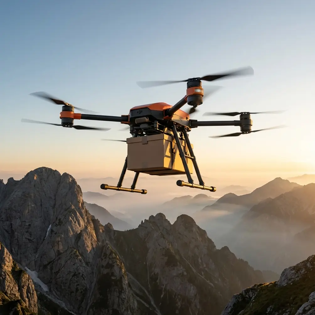
FlyCart 30 sits in an interesting category. It is not a lightweight camera drone that disappears into the background. It is a serious logistics platform. That creates opportunities for remote venue surveys because the same aircraft you use to evaluate a site can later support it operationally, carrying tools, sensors, or staged materials into hard-to-reach areas.
But the characteristics that make the aircraft useful also make mission planning more sensitive.
A stronger payload ratio changes risk management. The integrated winch system changes how you can deliver or retrieve items without landing on uneven ground. Dual-battery architecture improves operational continuity and redundancy. Safety systems such as an emergency parachute affect contingency planning. If your route concept could eventually support BVLOS workflows, route optimization becomes central from day one.
Each of those details has operational significance:
Payload ratio affects survey realism
A remote venue survey is often too abstract if performed only with a mapping drone. The FlyCart 30 lets you assess the route under a logistics-relevant load profile. That matters because the path that works for a visual scout aircraft may not be the path you want for a cargo platform. Climb performance, energy use, and margin over obstacles all change once weight enters the equation.
In plain terms, a venue that looks accessible on a map can become inefficient if the route demands repeated altitude changes while carrying useful payload. Good survey work should model the likely mission, not just the easiest one.
The winch system changes site suitability
Many remote venues have poor or temporary landing surfaces: gravel clearings, sloped pads, vegetation edges, incomplete service roads. The FlyCart 30’s winch system can turn a marginal landing location into a workable delivery point because the aircraft can remain above the ground while transferring equipment.
For venue surveys, this means you should not evaluate every destination as a conventional touchdown zone. Instead, classify nodes into:
- Full landing capable,
- Winch-delivery capable,
- Transit only.
That distinction saves time later. It also reduces the need for earthworks or pad construction at sites where ground access is limited.
Optimal flight altitude for remote venue surveys
Here is the altitude insight I give teams most often: for remote venue surveying with FlyCart 30, the best working altitude is usually not the lowest legal one and not the highest available one. It is the lowest altitude that clears terrain and vegetation consistently while minimizing visual and acoustic footprint near occupied areas.
In many remote survey missions, that sweet spot is established by segment, not by one mission-wide number.
Why segment-based altitude planning works better:
- Over open approach corridors, a moderate altitude can reduce terrain conflict and preserve line quality.
- Near residences, access roads, or active venue zones, climbing too high can increase visibility over a larger area even if obstacle clearance is excellent.
- Flying too low near tree lines or broken terrain can create abrupt power changes, unstable routing, and noisier perception from the ground because the aircraft is closer.
For FlyCart 30, I generally advise planners to build altitude around three route layers:
1. Departure and recovery layer
Keep this high enough to clear local obstacles cleanly and establish a stable climb profile early. The main goal is consistency. Wavering, low-altitude departures attract attention and increase pilot workload.
2. Transit layer
This is where route optimization matters most. For remote venue work, choose an altitude that avoids repeated climb-descent cycles caused by terrain undulation. A smoother energy profile usually matters more than shaving a small amount of linear distance.
3. Terminal layer
If the destination is a survey point or winch drop area, descend only when you are committed to that segment and have verified the ground environment. This reduces low-level exposure over nonessential areas.
That approach is operationally stronger than setting one blanket altitude for the whole mission. It also addresses the same kind of local uncertainty seen in the Georgia news item. People react to what they see and hear. Segment-based altitude planning reduces unnecessary exposure.
Community uncertainty is an operational variable, not a PR issue
The DRONELIFE report framed the Georgia decision as an example of community uncertainty about expanding drone delivery operations. That phrase deserves attention. Uncertainty is not outright opposition. It is a condition created when people do not know what the drone is doing, how often it will fly, what safeguards exist, or how the activity affects their environment.
That is highly relevant for FlyCart 30 venue surveys because survey flights often happen before the permanent use case is visible. A resident may hear repeated flights long before they understand whether the site will support agriculture, hospitality, infrastructure maintenance, or event logistics.
For a logistics lead, uncertainty changes the mission design checklist:
- Limit unnecessary repetition during site qualification.
- Avoid routes that cross visible public touchpoints unless they are essential.
- Use predictable time windows for flights.
- Document safety systems and emergency procedures in plain language for stakeholders.
- Distinguish between test operations and future routine operations.
The emergency parachute is one of those details that should never be treated as brochure filler. In stakeholder conversations, it translates advanced engineering into a concrete answer to a simple question: what happens if the aircraft has a serious problem? The same is true for dual-battery design. Redundancy is not just a technical spec. It is part of operational credibility.
Route optimization for remote venues: think infrastructure first, not straight line first
A common mistake in venue surveying is drawing the shortest route between launch point and destination. That can be mathematically clean and operationally poor.
With FlyCart 30, route optimization should align with existing infrastructure corridors when practical: service roads, utility access paths, ridgelines with predictable clearance, or open land buffers. There are three reasons.
First, these corridors are easier to inspect and maintain over time. Second, they simplify emergency response and visual reference. Third, they often reduce community concern because the flight path follows an already industrial or service-oriented pattern rather than appearing arbitrary.
This is where the Walmart case becomes surprisingly relevant. A suburban launch site may be technically feasible yet still unwelcome because it inserts drone movement into a daily consumer environment. Remote venues can trigger a milder version of the same response if routes pass over recreational space, guest-facing areas, or neighboring properties when a service corridor alternative exists.
The best FlyCart 30 route is usually the one that looks intentional from the ground.
BVLOS readiness starts during the first survey phase
Not every venue survey will mature into a BVLOS operation. But if the site may eventually support recurring logistics, you should assess BVLOS readiness from the start.
That means documenting:
- Terrain masking zones
- Communications weak points
- Safe contingency areas
- Alternate routing around seasonal activity
- Ground risk concentration near roads or occupied structures
If you wait until later, you end up re-surveying the site under pressure.
FlyCart 30 is often introduced as a payload platform, but long-term value comes from repeatable route architecture. A venue that can support safe, efficient, low-friction corridor design has more strategic value than one that merely permits occasional ad hoc flights.
A practical workflow for FlyCart 30 remote venue assessments
When I review candidate venues, I use a five-part sequence:
1. Terrain and access read
Identify elevation changes, wind exposure, vegetation density, and likely obstacle bands.
2. Operational node classification
Mark launch, recovery, hover-transfer, and winch-capable points.
3. Visibility and sensitivity map
Note roads, residences, guest zones, trail systems, and gathering spaces. This step is where many technically valid routes get rejected for good reason.
4. Segment altitude plan
Assign departure, transit, and terminal altitude logic rather than one universal profile.
5. Future-state suitability
Ask whether the route still works once flight frequency increases. The Georgia example shows why this matters. Initial acceptance is not the same as long-term permission.
If you are trying to structure this assessment for a live project, it helps to compare route concepts against actual venue operations rather than generic drone metrics. For teams that need a quick technical discussion around site planning, altitude logic, or winch-based delivery nodes, this FlyCart 30 operations chat is a practical starting point.
The real takeaway
The most useful thing about the Georgia denial is not the headline. It is the reminder that drone operations succeed or fail in layers. Airframe capability is one layer. Site geometry is another. Community comfort is another. Regulatory and local approval sit on top of all of it.
FlyCart 30 is strong when the mission is designed with those layers in mind. For remote venue surveys, that means using the aircraft’s strengths deliberately: payload-relevant route testing, winch-enabled access where landing is poor, dual-battery redundancy for continuity, emergency parachute planning for contingencies, and route optimization that respects how the operation is perceived from the ground.
The aircraft can solve difficult logistics problems. It cannot solve a poorly framed operation.
That is why altitude choice matters. That is why route shape matters. And that is why a local decision in suburban Atlanta should influence how you survey a remote venue with FlyCart 30. Not because the environments are identical, but because the operating principle is. Drone logistics is never just about whether the aircraft can fly the route. It is about whether the route can live in the real world.
Ready for your own FlyCart 30? Contact our team for expert consultation.