FlyCart 30 Guide for Coastal Vineyard Surveying
FlyCart 30 Guide for Coastal Vineyard Surveying: What Actually Matters When Conditions Shift
META: A practical FlyCart 30 guide for coastal vineyard surveying, covering route planning, weather shifts, payload thinking, winch use, BVLOS workflow, and risk controls for real field operations.
Coastal vineyard work looks easy from the road. Long rows. Open sky. Predictable geometry. Then you step onto the site and the real constraints show up fast: wind rolling in off the water, broken terrain, patchy access roads, salt-heavy air, and narrow operational windows between crews, irrigation cycles, and changing light.
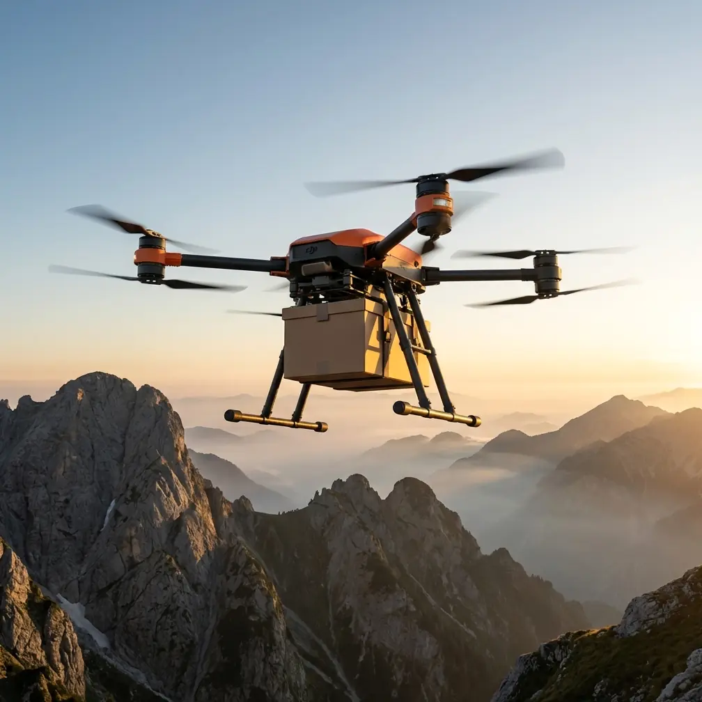
That is where the FlyCart 30 starts to become more interesting than its name suggests.
I’m approaching this from the perspective of a logistics lead, not a brochure writer. If you are evaluating the FlyCart 30 for surveying vineyards in coastal regions, the question is not whether it can fly. The question is whether it can keep a mission organized when the environment stops cooperating. That includes route discipline, payload decisions, communications planning, and how the aircraft responds when weather changes halfway through the job.
There’s also a useful parallel from an unlikely place: spring flower photography. A recent 2026-04-29 piece published by 御空逐影 in a technology news section focused on why people fail to capture flower fields well. The article pointed to three recurring problems: cluttered composition, flowers that look dull, and flat color. It also argued that you do not need expensive gear if you understand eight core techniques. That principle applies surprisingly well to vineyard drone work. Better results usually come less from throwing hardware at the problem and more from disciplined execution. In survey operations, the equivalent failures are cluttered flight plans, weak data collection logic, and lifeless outputs that don’t answer an operational question.
So instead of treating the FlyCart 30 as a generic heavy-lift platform, let’s talk about how to use its architecture intelligently for coastal vineyard surveying.
Start with the real objective, not the aircraft
Vineyard operators rarely want “drone data” in the abstract. They want answers.
Usually that means one or more of the following:
- row-by-row visual condition review
- drainage or erosion tracking near coastal slopes
- transport of small field kits to inaccessible sections
- targeted sensor placement and retrieval
- time-sensitive checks after weather events
- infrastructure review around pumps, trellis lines, tanks, and access tracks
The FlyCart 30 can support these workflows, but only if the mission is designed around the vineyard’s operational bottleneck.
This is where the flower-field comparison matters. That reference article mentioned locations like Linzhi peach blossoms, Jiangnan rapeseed fields, tulip displays, and lavender expanses. Those scenes look simple until you realize the frame can quickly become visually messy. Vineyards behave the same way from an aerial operations standpoint. Rows create order, but coastal terrain introduces interruptions: tree lines, service roads, contour changes, retaining structures, fog pockets, and wind corridors. If your route isn’t built to simplify the mission, you end up with the aviation equivalent of a cluttered composition.
The first job, then, is reduction. Strip the mission down to the minimum path that produces a useful result.
Why FlyCart 30 fits more than transport tasks
People often pigeonhole aircraft like the FlyCart 30 as pure delivery platforms. That misses the point in an agricultural setting.
For coastal vineyards, the value is not just moving weight. It is the combination of payload ratio, route control, and field adaptability. A stronger payload ratio matters because survey work is rarely just “camera up, fly around.” Teams end up carrying spare power, compact inspection tools, marker kits, weather sensors, small sample containers, or tethered retrieval accessories depending on the day’s problem. An aircraft that can absorb those workflow variations without forcing a complete mission redesign is operationally useful.
That’s especially true when the weather shifts mid-flight.
A lightweight survey setup may leave the pad under stable conditions, only to face stronger coastal gusts twenty minutes later. In that moment, the mission is no longer about ideal data capture. It becomes a test of aircraft stability, power reserve, return logic, and whether your team planned for deterioration instead of hoping against it.
This is where dual-battery thinking matters. Not as a spec-sheet talking point, but as a planning discipline. With a dual-battery system, you can structure your reserve assumptions more conservatively for coastal work. You are not simply trying to complete the route. You are protecting enough margin for rerouting, loiter adjustments, or an earlier-than-planned return when wind conditions worsen along exposed row edges.
Build routes around row logic and wind exposure
The best vineyard survey routes are rarely the most elegant-looking on a map. They are the ones that respect terrain, crop geometry, and marine weather behavior.
For a coastal site, I recommend dividing the property into operational bands:
- Exposed perimeter rows closest to open wind influence
- Interior blocks with more stable air
- Slope transition zones where airflow can become erratic
- Infrastructure pockets around sheds, tanks, pumps, and loading points
That segmentation helps with route optimization. Instead of one long sweep, the FlyCart 30 can work through zones with clear decision points between them. If weather remains stable, continue. If it starts to shift, stop after the current zone and reassess. This sounds basic, but it prevents the classic mistake of being operationally “committed” too deep into the property just because the mission was designed as one uninterrupted run.
And yes, BVLOS enters the conversation here. On larger vineyards or fragmented estates, BVLOS can improve efficiency dramatically, but only if you have the operational maturity to manage it properly. Coastal sites are not forgiving. Visibility can change quickly. Wind behavior can differ across a relatively short distance. Communication discipline, route pre-approval, alternate landing logic, and live weather interpretation all need to be tighter than they would be on a flat inland block.
BVLOS without route discipline is just longer-distance uncertainty.
The winch system is more useful in vineyards than many teams expect
A lot of people hear “winch system” and think only of cargo drop-offs. In vineyards, the winch can become a practical tool for reducing ground disruption and avoiding repeated landings in poor terrain.
Here’s where it matters operationally:
- lowering lightweight sensors or test kits into hard-to-reach sections
- placing field supplies near steep or muddy rows without landing the aircraft
- retrieving small items from isolated service areas
- reducing rotor wash impact near sensitive ground conditions
In a coastal vineyard, that last point matters more than many teams realize. Some access points become soft or uneven after moisture shifts. A full landing may be technically possible but operationally sloppy. The winch system gives the crew another option: deliver or retrieve what is needed while keeping the aircraft clear of unstable ground.
That can save time, but more importantly, it protects mission continuity. Every unnecessary landing introduces another cycle of dust, moisture exposure, setup time, and relaunch risk.
What happened when the weather changed mid-flight
Let’s talk about a scenario that is common enough to deserve its own planning section.
You launch in stable morning conditions. The vineyard is running along a coastal slope, with marine air expected later but not immediately. The first survey band goes cleanly. During the second band, surface movement in the vine canopy begins to show a stronger crosswind than forecast. Nothing dramatic. But enough to alter the aircraft’s attitude and increase power demand along the most exposed rows.
This is where experienced crews stop trying to “finish the plan.”
A well-run FlyCart 30 mission should shift into a shortened decision loop:
- compare live behavior against the preflight weather threshold
- evaluate battery draw trend under the new load
- reduce route depth into exposed areas
- prioritize any remaining high-value survey objective
- prepare return before conditions force the decision for you
If the aircraft is equipped with an emergency parachute, that adds another layer of risk control in a degraded scenario. Not because it excuses bad judgment. It doesn’t. But in coastal agricultural operations, where slopes, trellis structures, and scattered infrastructure complicate forced-landing outcomes, an emergency parachute has real significance as a final mitigation layer.
That matters most when weather moves from inconvenient to unstable quickly. In those moments, resilient systems matter. So do conservative humans.
Don’t confuse image volume with survey quality
This is where the flower-photography reference comes back again. That article’s premise was that expensive equipment is not the deciding factor; technique is. It highlighted common visual failures like dull subjects and flat color. For vineyard surveying, the equivalent mistake is collecting lots of aerial material that says very little.
A coastal vineyard survey should produce contrast, not just coverage. You want data that separates healthy from stressed rows, stable drainage from runoff pathways, easy access from logistics bottlenecks. If everything in the final output looks visually complete but operationally vague, the mission failed.
That is why route optimization has to be linked to decision-making.
For example:
- If the purpose is erosion review, prioritize slope edges and water paths.
- If the purpose is row health triage, structure passes for comparability block by block.
- If the purpose is field support, integrate the survey with targeted payload movement instead of splitting them into disconnected missions.
The FlyCart 30 becomes more valuable when one sortie can do more than one thing well.
Payload ratio affects flexibility more than headline capacity
Payload ratio tends to get discussed as a simplistic “how much can it carry” metric. In the field, it is better understood as a flexibility multiplier.
On a coastal vineyard mission, a stronger payload ratio gives your team more room to adapt without resetting the whole operation. You can carry inspection support gear, swap task priorities, or combine survey and transport functions in one coordinated workflow. That reduces downtime between flights and lowers the number of separate launches needed to finish the day’s objectives.
This matters when the weather window is narrow. A vineyard near the coast may give you one calm period in the morning, then deteriorate. If you need three different aircraft setups to complete one job, you may lose the day. If the FlyCart 30 lets you consolidate tasks sensibly, your usable weather window effectively expands.
Not because the weather improves. Because your workflow gets sharper.
A practical planning framework for FlyCart 30 vineyard missions
If I were setting up a repeatable program for coastal vineyard surveying, I would use this sequence:
1. Define the operational question
Be specific. “Survey the vineyard” is not a mission brief. “Identify post-rain access issues and inspect western slope rows” is.
2. Segment the property by exposure
Separate sheltered blocks from wind-prone edges. Route them differently.
3. Assign payloads only to the actual mission need
Do not overbuild the aircraft for a simple data pass. But do not underbuild it if the route may require support items or winch-based delivery.
4. Set conservative battery thresholds
With dual-battery capability, use the margin intelligently. Coastal conditions are too variable for optimistic return calculations.
5. Build BVLOS logic only where the process supports it
Distance is easy. Safe distance management is the real skill.
6. Create a weather-triggered cutback plan
Decide before launch what conditions end the mission, reduce the mission, or switch priority zones.
7. Use the winch where landing adds unnecessary risk
This is one of the most underused efficiencies in agricultural drone operations.
8. Review outputs against vineyard decisions
If the result does not change a field decision, the route probably needs redesign.
Training matters more than hardware vanity
The flower-field article made one point that deserves repeating: better results often come from mastering core techniques rather than chasing expensive gear. In its case, it claimed that even smartphone users could improve their photos by learning eight fundamentals. The same mentality should guide FlyCart 30 adoption.
A capable aircraft in an undertrained workflow creates expensive confusion.
The strongest teams train around:
- changing weather recognition
- route adjustment discipline
- battery reserve judgment
- winch deployment procedures
- emergency response logic
- payload handling consistency
- communication clarity under BVLOS conditions
That is where the real performance gap shows up between average and excellent field operations.
If your team is still deciding whether the FlyCart 30 fits your vineyard survey workflow, it helps to talk through route structure and site conditions with someone who understands both aircraft capability and agricultural logistics. If that would be useful, you can message a coastal vineyard drone specialist here.
The bottom line for coastal vineyard operators
The FlyCart 30 makes sense in vineyard surveying when you stop thinking of it as a single-purpose aircraft. Its value comes from how it connects transport flexibility, route optimization, weather resilience, and safer field interaction through tools like a winch system, dual-battery architecture, BVLOS-ready planning, and emergency parachute protection.
But none of those features work in isolation.
Coastal vineyards punish loose planning. Wind shifts expose bad assumptions. Long rows can trick teams into oversized routes. Uneven access tempts unnecessary landings. The aircraft can handle a lot, but the operation has to deserve the hardware.
If you remember one idea, make it this: the best survey missions are not the ones that collect the most. They are the ones that stay coherent when conditions change. That is the standard coastal vineyard work should be judged against, and it is the lens through which the FlyCart 30 should be evaluated.
Ready for your own FlyCart 30? Contact our team for expert consultation.