FlyCart 30 Wildlife Survey Tips for High Altitude
FlyCart 30 Wildlife Survey Tips for High Altitude
META: Discover how the FlyCart 30 transforms high-altitude wildlife surveying with its dual-battery system, heavy payload capacity, and BVLOS flight capabilities.
Author: Alex Kim, Logistics Lead Last Updated: July 2025 Reading Time: 8 minutes
TL;DR
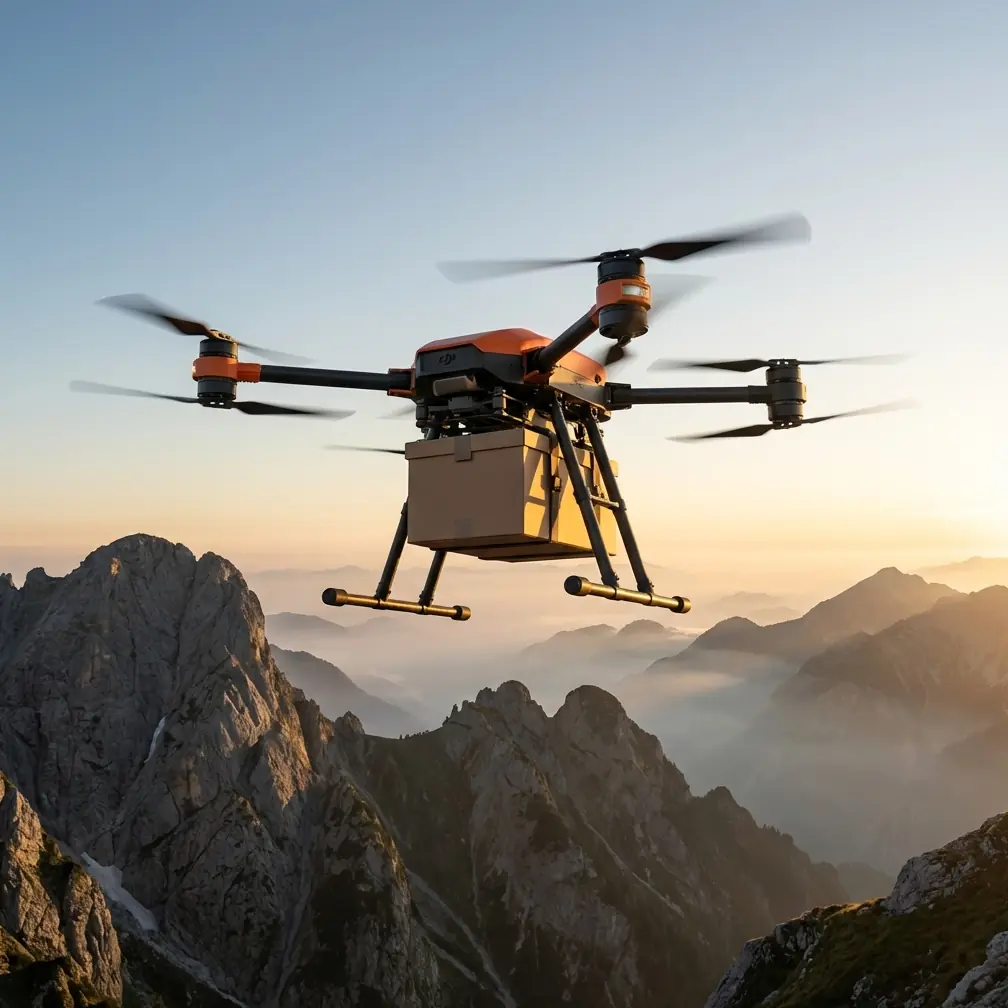
- The FlyCart 30 supports payloads up to 30 kg, making it ideal for deploying thermal cameras, tracking sensors, and sample-collection gear across remote wildlife habitats.
- Its dual-battery redundancy and emergency parachute system ensure mission-critical safety at altitudes exceeding 5,000 meters.
- BVLOS (Beyond Visual Line of Sight) route optimization allows autonomous survey flights covering up to 28 km in a single mission.
- Pairing the FlyCart 30 with a third-party winch system like the Hoodman Winch Deploy Kit unlocks precision supply drops and trap-deployment capabilities without landing.
Why High-Altitude Wildlife Surveying Demands a Heavy-Lift Drone
Surveying wildlife at high altitude is punishing work. Thin air reduces rotor efficiency, extreme cold drains batteries faster, and remote terrain makes equipment recovery nearly impossible if something goes wrong. Traditional survey methods—manned helicopters, ground teams on foot—are expensive, disruptive to animal behavior, and often logistically impractical above 4,000 meters.
The DJI FlyCart 30 was engineered for exactly these conditions. This guide breaks down the specific configurations, flight strategies, and third-party accessories that make the FC30 the most capable platform for high-altitude wildlife research missions today.
Understanding the FlyCart 30's Core Specifications
Before diving into wildlife-specific applications, it helps to understand what separates the FC30 from standard enterprise drones. This is not a photography platform retrofitted for cargo. It is a purpose-built delivery and logistics drone with capabilities that translate directly to field research.
Key Specifications at a Glance
| Specification | FlyCart 30 Detail |
|---|---|
| Max Payload (Cargo Mode) | 30 kg |
| Max Payload (Winch Mode) | 40 kg |
| Max Flight Range | 28 km (no payload) |
| Max Service Ceiling | 6,000 meters |
| Battery Configuration | Dual-battery redundant system |
| Wind Resistance | Up to 12 m/s |
| Safety Systems | Emergency parachute, ADS-B, redundant IMU |
| IP Rating | IP55 |
| Operating Temp Range | -20°C to 45°C |
The payload ratio is what matters most for wildlife surveying. At altitude, you lose roughly 10-15% of effective lift capacity per 1,000 meters of elevation gain. That means a drone with a marginal payload at sea level becomes useless above the treeline. The FC30's 30 kg cargo capacity provides enough headroom that even at 5,000 meters, you can reliably carry 18-22 kg of survey equipment.
Configuring the FC30 for Wildlife Survey Missions
Sensor Payload Selection
High-altitude wildlife surveys typically require multiple sensor types deployed simultaneously. The FC30's cargo bay accommodates modular setups. Here is a proven loadout for alpine and montane wildlife monitoring:
- FLIR Vue TZ20-R dual thermal/visible camera — for detecting animal heat signatures through vegetation and snow cover
- GPS wildlife tracking relay unit — receives and retransmits collar signals from tagged animals across valleys
- Atmospheric data logger — records temperature, humidity, and barometric pressure at survey altitude
- LiDAR terrain mapper (lightweight unit) — generates habitat topography models on each pass
- Sample drop container — for deploying bait, medication, or tracking tags at remote sites
A total loadout weight of 15-19 kg is typical for a comprehensive survey configuration. This keeps you well within the FC30's operational envelope at high altitude.
Expert Insight: Always weigh your full payload assembly—including mounting hardware, cables, and protective casings—before programming your flight plan. Field teams routinely underestimate accessory weight by 2-3 kg, which can critically reduce flight time at altitude.
Route Optimization for BVLOS Operations
The FC30's flight controller supports BVLOS route programming through DJI DeliveryHub, which is essential for wildlife surveying. Animals do not concentrate near your launch site. You need autonomous flight paths that cover ridgelines, valleys, and water sources kilometers away from your ground station.
Best practices for route optimization include:
- Segment your survey area into grid cells no larger than 2 km × 2 km per flight
- Set altitude holds relative to terrain, not sea level—the FC30's terrain-follow radar handles elevation changes automatically
- Program loiter points over known animal congregation areas like salt licks, watering holes, and nesting cliffs
- Build in a 20% battery reserve beyond what DJI's software recommends—cold air at altitude accelerates discharge
- Overlap flight paths by at least 15% to eliminate blind spots in thermal imaging coverage
The combination of route optimization and BVLOS capability means a single operator can survey 40-60 square kilometers per day with multiple battery swaps—work that would take a ground team weeks.
The Hoodman Winch Deploy Kit: A Game-Changing Accessory
This is where the FlyCart 30 transitions from an aerial survey platform to a true field research tool. The Hoodman Winch Deploy Kit, a third-party winch system designed for heavy-lift drones, attaches to the FC30's cargo bay and adds precision lowering and retrieval capability with up to 40 meters of cable.
Wildlife researchers use it to:
- Lower camera traps into dense canopy or cliff faces without disturbing the habitat
- Deploy GPS collars and bait stations at exact coordinates inaccessible on foot
- Retrieve biological samples (scat, feathers, water) from sensitive areas without human presence
- Place acoustic monitoring devices in remote valleys for nocturnal species tracking
The winch system adds approximately 3.2 kg to your payload weight. When operating in winch mode, the FC30's maximum capacity increases to 40 kg because the aircraft hovers rather than flies at speed, reducing aerodynamic load requirements.
Pro Tip: When using the Hoodman winch at altitude, reduce your lowering speed to 0.5 m/s or slower. The FC30 compensates for the shifting center of gravity as payload descends, but rapid deployment in thin air can cause oscillation that triggers the stability warning system.
Dual-Battery Redundancy and Emergency Parachute: Non-Negotiable Safety
High-altitude wildlife survey zones are typically national parks, protected wilderness areas, or UNESCO heritage sites. Losing a drone in these environments is not just expensive—it is an environmental contamination event that can jeopardize your research permits.
The FC30's dual-battery system operates in active redundancy. If one battery fails, the second maintains full flight control and provides enough power to complete a return-to-home sequence. At 5,000 meters, where battery performance degrades by an estimated 25-30% compared to sea level, this redundancy is not a luxury. It is the reason this drone is insurable for remote operations when others are not.
The integrated emergency parachute deploys automatically if the flight controller detects:
- Dual motor failure
- Complete loss of GPS and visual positioning
- Unrecoverable attitude deviation beyond 70 degrees
- Manual trigger by the operator
Parachute deployment slows descent to approximately 5-7 m/s, which protects both the drone and the survey payload. For wildlife work, it also prevents a high-speed crash that could injure animals in the survey zone.
Technical Comparison: FlyCart 30 vs. Alternative Survey Platforms
| Feature | FlyCart 30 | Manned Helicopter | Standard Enterprise Drone |
|---|---|---|---|
| Max Payload | 30 kg | 500+ kg | 2-5 kg |
| Operating Ceiling | 6,000 m | 6,000 m+ | 3,000-5,000 m |
| Noise at 100 m | ~65 dB | ~95 dB | ~60 dB |
| Wildlife Disturbance | Low | Very High | Low |
| BVLOS Capability | Yes | N/A | Limited |
| Emergency Safety System | Parachute + dual battery | Autorotation | Varies |
| Daily Survey Coverage | 40-60 km² | 100+ km² | 5-15 km² |
| Operator Certification | Remote pilot license | Commercial pilot license | Remote pilot license |
| Deployment Time | ~15 minutes | Hours (logistics) | ~10 minutes |
The FC30 occupies a unique position. It carries 6-15x more payload than standard enterprise drones while generating a fraction of the noise and disturbance of a helicopter. For endangered species research—where behavioral disruption can invalidate an entire season of data—this balance is decisive.
Common Mistakes to Avoid
1. Ignoring Density Altitude Calculations Density altitude combines elevation, temperature, and humidity into an effective performance altitude. A 4,500-meter launch site on a warm afternoon can have a density altitude of 5,500 meters or higher. Always calculate density altitude before confirming your payload configuration.
2. Skipping Pre-Flight Thermal Calibration Thermal cameras need recalibration when ambient temperatures shift dramatically. Flying from a sun-warmed valley floor to a shaded alpine ridge can introduce 5-8°C sensor drift, making animal detection unreliable.
3. Programming Identical Outbound and Return Routes Flying the same path twice doubles your disturbance footprint. Program separate outbound and return corridors with at least 200 meters of lateral separation to minimize repeated noise exposure to wildlife.
4. Neglecting Wind Shear at Ridgelines The FC30 handles 12 m/s sustained winds, but mountain ridgelines produce turbulent gusts that exceed steady-state ratings. Set waypoint altitudes at least 50 meters above ridgelines rather than crossing at the crest.
5. Overloading the Winch Beyond Recommended Limits The Hoodman Winch Deploy Kit is rated for specific loads. Exceeding its capacity—even if the FC30's airframe can handle the weight—risks cable failure and dropped equipment in protected habitats.
Frequently Asked Questions
Can the FlyCart 30 operate in sub-zero temperatures common at high altitude?
Yes. The FC30 is rated for operation down to -20°C. Its dual-battery system includes internal heating elements that maintain cell temperature during flight. For extended operations below -10°C, pre-warm batteries in insulated cases for at least 30 minutes before takeoff. Expect a 15-20% reduction in total flight time at extreme cold.
What permits are required for BVLOS wildlife survey flights?
Permit requirements vary by jurisdiction, but most countries require a specific BVLOS waiver or exemption beyond the standard remote pilot certificate. You will typically need to demonstrate redundant communication links, a detect-and-avoid strategy, and an emergency recovery plan. The FC30's ADS-B receiver, dual-battery failsafe, and emergency parachute system satisfy many of the technical requirements regulators look for in BVLOS applications.
How does the FlyCart 30's noise profile affect wildlife behavior during surveys?
At a 100-meter survey altitude, the FC30 produces approximately 65 dB of noise—comparable to a normal conversation. Peer-reviewed studies on ungulates and large raptors suggest behavioral responses diminish significantly when drone noise falls below 70 dB at the animal's position. Flying at 120 meters or higher reduces the noise footprint further and is recommended for sensitive species like snow leopards, ibex, or nesting eagles. The FC30's heavy payload capacity means you can carry higher-resolution sensors that compensate for the increased altitude.
Start Your High-Altitude Wildlife Survey Program
The FlyCart 30 bridges the gap between lightweight camera drones and full-scale aviation in ways that directly serve wildlife researchers working in Earth's most demanding environments. Its payload capacity, safety redundancy, and BVLOS autonomy make it the most practical tool available for systematic, low-disturbance surveying above the treeline.
Ready for your own FlyCart 30? Contact our team for expert consultation.