FlyCart 30 in Mountain Wildlife Surveying
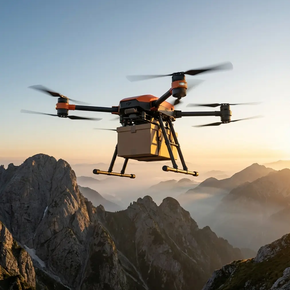
FlyCart 30 in Mountain Wildlife Surveying: What Actually Matters in the Field
META: A field-focused FlyCart 30 tutorial for mountain wildlife surveying, covering payload ratio, dual-battery management, winch use, BVLOS planning, route optimization, and emergency safety decisions.
Mountain wildlife surveying has a habit of exposing weak assumptions. A route that looks simple on a desktop map turns into a wind tunnel above a ridgeline. A battery estimate that felt conservative at base camp gets eaten alive by cold air, repeated altitude changes, and a few extra hover seconds over a nesting zone. And the moment you add logistics to the mission—sensor drops, sample retrieval, or resupply to a remote observation team—the aircraft stops being just a camera platform. It becomes part of the operation.
That is where the FlyCart 30 deserves a more practical discussion.
Most coverage of this aircraft leans on transport capability alone. Useful, but incomplete. For mountain wildlife work, the more interesting question is not whether the platform can carry something. It is whether it can carry the right thing, along the right route, with enough reserve to stay predictable when the environment starts stripping away your margins.
I approach this from a logistics perspective, not a brochure perspective. In wildlife surveying, especially in mountain terrain, predictability matters more than headline capability. A strong mission profile for the FlyCart 30 is not “maximum lift.” It is disciplined payload ratio, stable power management, and careful use of the winch system to avoid putting the aircraft where the terrain wants to trap it.
Why the FlyCart 30 fits mountain survey support
A wildlife team working in steep terrain usually faces three recurring problems.
First, access is slow. Reaching a ridge or basin on foot can take hours, which limits sensor placement windows and reduces observation time.
Second, terrain forces compromise. You may have a good sightline for animal movement but a poor landing zone, or a safe staging area but the wrong angle for line-of-sight flight.
Third, every extra kilogram has a consequence. Teams want to carry thermal payloads, acoustic devices, trail cameras, sample kits, weather instruments, and emergency supplies. But each added item shifts the payload ratio and changes how much operational flexibility remains for the flight home.
The FlyCart 30 stands out in this environment because it is not only about transport capacity. Its winch system changes how you work near uneven ground, and its dual-battery architecture gives field teams another layer of planning control when they are trying to balance lift, range, and contingency reserve. Those two details matter operationally far more than people often admit.
A mountain survey team rarely needs an aircraft to do one dramatic thing. It needs the aircraft to do the same demanding thing six times in a row without surprises.
Start with payload ratio, not payload ambition
The phrase “payload ratio” sounds technical, but in practice it is simple: how much of your aircraft’s useful capacity are you consuming on this mission, and what does that do to your safety and route options?
For wildlife surveying, the mistake is usually over-packing the first sortie. Teams want to send the camera trap, mounting hardware, a battery bank, a weather logger, and backup supplies in one run. The aircraft may lift it. That does not mean it should.
In mountain operations, a healthier rule is to preserve flexibility by treating payload as part of the terrain equation. A heavier load increases power draw during climbs, increases braking distance in gusts, and reduces your options if you need to divert or hold position. This becomes more pronounced when you are crossing saddles or climbing along a valley wall where wind can change direction fast.
A disciplined payload ratio gives you room for decisions. That room matters more than squeezing one more item into the sling.
My recommendation for survey teams is to define three load classes before deployment:
- Essential survey load
- Extended support load
- Recovery or contingency load
The essential survey load should be your default. Think one instrument package, one mounting or retrieval accessory, and a strict reserve policy. The extended support load is only for stable weather and proven routes. The contingency load is designed for urgent tasks such as battery resupply to a remote observer or retrieval of a critical memory card or sample container.
This kind of load planning sounds administrative until the weather shifts. Then it becomes the difference between a controlled mission and a rushed one.
The winch system changes the way you choose drop zones
The FlyCart 30’s winch system is one of its most operationally significant features for mountain wildlife work. Not because it looks advanced, but because it lets you stop forcing the aircraft into poor landing geometry.
In steep terrain, landing is often the highest-risk phase. Loose rock, scrub, slope angle, rotor wash, and uncertain footing all work against you. If your mission requires dropping a passive acoustic monitor into a small clearing near a ridgeline, trying to land close to the target can create more risk than value.
A winch-based drop changes that calculus.
Instead of flying low and searching for a perfect touchdown point, you can keep the aircraft in cleaner air above the slope and lower the payload into a controlled target area. That reduces terrain interaction, limits dust and debris disturbance, and can be better for wildlife-sensitive zones where you want to minimize aircraft proximity.
For animal observation missions, this matters in two ways.
One, it reduces the pressure to overfly habitat features at very low altitude. That is not just safer for the aircraft; it is often less disruptive to wildlife behavior.
Two, it allows better route optimization. Your route can be built around stable hover positions rather than improvised landing points. Stable hover planning is much easier to model and rehearse than landing on rough mountain ground.
Used properly, the winch system is not just a convenience. It is a risk-reduction tool.
BVLOS thinking starts long before takeoff
Mountain missions tempt teams into casual assumptions about line-of-sight. The aircraft is visible at launch, visible over the first ridge, then suddenly masked by terrain. That is how crews end up treating a complex route like a routine one.
If your survey program involves BVLOS or BVLOS-like operating conditions, route design has to account for terrain shielding, not just straight-line distance. A route that is short on the map may create more communication and situational awareness issues than a longer path that follows an open valley contour.
This is where route optimization becomes more than efficiency language. It becomes a safety discipline.
For the FlyCart 30 in wildlife support missions, I prefer routes that prioritize the following in order:
- Predictable wind exposure
- Stable altitude transitions
- Reliable command and observation geometry
- Clean contingency turn points
- Minimal low-altitude loiter near habitat targets
That sometimes means rejecting the most direct route.
A good mountain route should include at least one preplanned exit path that assumes degraded conditions. If the aircraft encounters unexpected gust loading or the power reserve falls faster than modeled, the crew should already know whether the safer option is descent into a valley corridor, return along the inbound path, or abort to a secondary delivery point.
This is not theoretical planning. It is what keeps logistics aircraft useful in survey work instead of becoming an operational burden.
A field battery tip that saves missions
The context provided here mentions one detail from outside the UAV world that is surprisingly relevant: a recent piece on smartphone pro mode photography argued that automatic settings often blow out the sky, crush ground detail, and leave users with poor results, while manually tuned settings produce cleaner, more layered images. It also stressed that the advice was tested across major phone brands and meant to be directly usable by beginners.
That same operational mindset applies to the FlyCart 30 in the mountains.
Do not trust “automatic” judgment when conditions are punishing your margins.
In phone photography, auto mode can leave the sky washed out and the foreground too dark because it averages a scene badly. In mountain UAV work, a simplistic battery assumption does something similar. It averages the mission. It pretends the climb, hover, descent, cold temperature, and payload behavior all blend into one easy estimate. They do not.
My field tip is straightforward: with a dual-battery aircraft, manage batteries as a matched working pair, but think about them as two separate stories during preflight and postflight.
Here is what I mean.
Before launch, do not just confirm that both batteries are charged. Check whether they reached charge balance under similar temperature conditions. In mountain camps, one pack may have sat in colder air or an uninsulated case while the other stayed warmer in a vehicle or tent. They can show acceptable numbers and still behave differently under load.
After landing, do not log the sortie as one generic battery event. Note how the pair responded during the climb segment, the hover or winch segment, and the return segment. If one mission profile consistently burns reserve faster during hover than transit, that is your clue to redesign the route or reduce load on future runs.
The practical tip I give crews is this: keep spare packs warm, but never hot, and rotate them with a written sequence rather than memory. In mountain work, memory gets sloppy when teams are cold, busy, and trying to move quickly. A simple battery rotation card avoids uneven cycling and helps catch a weak pack before it becomes the reason a return leg feels tighter than expected.
That is the dual-battery advantage in real use. Not just endurance on paper, but more disciplined energy management when the environment is actively working against you.
Emergency parachute thinking should be mission-driven
A lot of teams mention emergency systems only to satisfy a checklist. That misses the point.
If your FlyCart 30 operation includes an emergency parachute strategy, the question is not whether the feature exists in the abstract. The real question is whether your route and altitude profile create moments where deployment would actually reduce harm.
In mountain wildlife surveying, terrain can make any emergency descent scenario more complicated. Trees, rock faces, and narrow clearings limit what “safe” looks like. So your planning should identify route segments where the aircraft has enough vertical and lateral margin for emergency recovery measures to matter. If a leg passes through a constricted section with little separation from terrain, the mitigation there is not wishful thinking about equipment. It is route redesign.
This is another reason to favor hover-and-lower workflows with the winch over aggressive terrain-following approaches. The more you keep the aircraft out of terrain traps, the more meaningful your emergency options remain.
How I would structure a FlyCart 30 mountain survey mission
If I were briefing a team for wildlife surveying in mountain terrain, I would structure the mission like this:
First, classify the payload. Decide what truly needs to move on this sortie and what can wait. Protect the payload ratio.
Second, map the route by wind and terrain behavior, not just distance. If the shortest path crosses a rotor-prone saddle, it is probably not the best path.
Third, design the task around the winch system whenever the ground zone is marginal. Hover in the stable air. Lower the package. Get out cleanly.
Fourth, treat the dual-battery setup as an active planning variable. Build reserve thresholds around the actual mission shape: climb, hover, lower, retrieve, return.
Fifth, define your abort logic before takeoff. Not after a warning appears.
Sixth, keep wildlife disturbance in mind as an operational parameter, not an afterthought. Altitude discipline, reduced low-hover exposure, and efficient task execution all matter.
If your team is refining that workflow for a new mountain site, it helps to compare notes with operators who have already worked through the same terrain and energy-management problems. I usually point crews to a direct field discussion channel like this operator contact link when they want to sanity-check route structure or payload planning before a deployment window closes.
What this means for FlyCart 30 users specifically
The most useful way to think about the FlyCart 30 in this scenario is not as a flying truck. It is a mountain logistics node that happens to fly.
That distinction changes how you use it.
You stop asking, “How much can it carry?” and start asking, “How much margin do I want left when the ridge wind shifts?”
You stop optimizing for dramatic single-sortie capability and start optimizing for repeatable survey support over a full field day.
You stop planning around ideal landing spots and start using the winch system to avoid needing them.
And you stop treating batteries as a passive resource and start treating them as a live operational constraint that deserves as much discipline as route design.
The reference news about smartphone pro mode might seem unrelated at first glance, but it offers a useful analogy. Auto settings often produce flat, compromised results because they fail to understand the scene. Better outcomes come from taking manual control of a few critical variables. The article specifically called out recurring image failures such as white skies, dark ground, weak detail, and dull color, then argued that tested settings across Huawei, Xiaomi, OPPO, and Honor phones could be applied directly by beginners. The underlying lesson is operationally sound: when the environment is complex, small manual adjustments beat lazy automation.
That lesson holds in mountain UAV work.
For FlyCart 30 crews supporting wildlife surveys, the winning formula is not complexity for its own sake. It is control over the variables that matter most: payload ratio, route optimization, battery handling, and terrain-safe delivery methods.
Get those right and the aircraft becomes genuinely useful in the mountains, not merely capable on a spec sheet.
Ready for your own FlyCart 30? Contact our team for expert consultation.